Google+ Mars Travel: November 2011

Mars Photo of the Day - Nov 30 2011

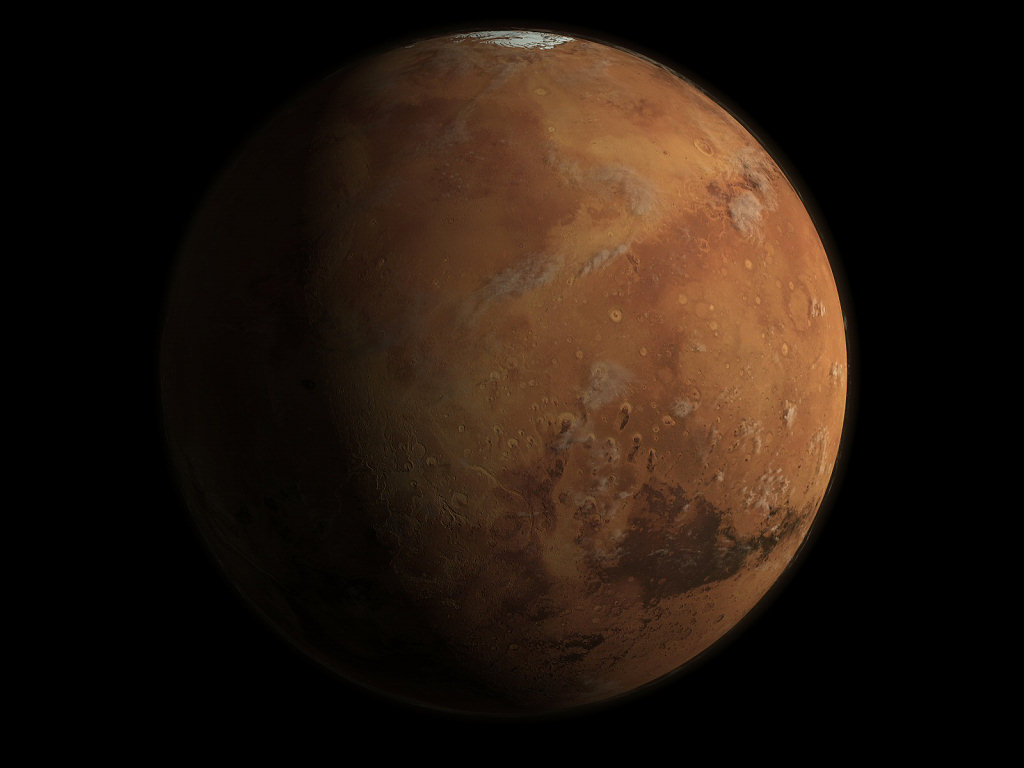
Today's Image of Mars is a Space4Case depiction of the Red Planet as it looks in modern times. This image is computer generated using data primarily from Mars Orbiter Laser Altimeter (MOLA), which helps to determine variations in elevation on Mars. This image was shown in the July 2005 edition of National Geographic. 

Clicking on this image will take you to the original, larger image.
Source: Space4Case

Response From NASA Regarding Assistance Provided to Roscosmos for Phobos-Grunt

As posted earlier, I called NASA to inquire about reports that they are prohibited from assisting Phobos-Grunt due to the Chinese orbiter being onboard. I just received a response from NASA.


-----


Mr. Geaney
Your query was passed to me.


NASA was working with Roscosmos to provide requested technical and communications assistance regarding the Phobos-Grunt spacecraft using NASA's Deep Space Network and other assets. These efforts were on-going prior to transitioning NASA Space Communications and Network and Jet Propulsion Laboratory personnel to support the launch and mission of the Mars Science Laboratory. For further information on the Phobos-Grunt mission, please contact Roscosmos.


Regards
Michael


Michael Braukus
Public Affairs Officer
NASA Headquarters
 Washington, DC 20546


-----


So reports from Russian Space Web that NASA is not assisting Roscosmos with Phobos-Grunt seem to be unsubstantiated.


UPDATE 17:45 EST


I sent a follow up email to see if assistance has resumed since the launch of Mars Science Laboratory. I got a response:
-----


I’m waiting on confirmation on that. But despite diverting some of the resources and personnel to support MSL’s launch and mission, we continued to work with Russia.


Michael Braukus
Public Affairs Officer
NASA Headquarters
 Washington, DC 20546


-----


So NASA continued to assist Phobos-Grunt as requested by Roscosmos, even during the buildup to Mars Science Laboratory's Launch.


I will post more details when I get a response about whether they are continuing to assist Roscosmos with Phobos-Grunt.


In the meantime my Twitter will probably get the update first so make sure to check that.


NASA Prohibited from Helping Phobos-Grunt?

EDIT: DEBUNKED! I got a response back from NASA. Check it out here

Disturbing reports have emerged that NASA has been forbidden from assisting Russia with Phobos-Grunt because of a US law that prohibits assistance to China's space program. Phobos-Grunt is carrying Yinghuo-1, China's first attempt at placing an orbiter around Mars.

Russian Space Web reports that there is a US law which is prohibiting NASA from assisting Russia and the ESA in the recovery of Phobos-Grunt. This law seems to state that because Yinghuo-1 is onboard they cannot provide assistance.


Mars Travel has contacted NASA and is waiting for them to substantiate or refute these claims.

If true this would contradict what Doug McCuistion, director of NASA's Mars Exploration Program, was quoted as saying during a news briefing three weeks ago:

We have offered assistance and if they need it we will provide it to the best of our ability. That's a different organization from ours. I am not sure if they have asked for such assistance, but we have offered it.

When Russian Space Web reported that the NASA was prohibited from helping Phobos-Grunt many people, including myself called NASA to determine the validity of these claims. We are still waiting on a response.

I'll have more as the story breaks!


Background on Yinghuo-1

Yinghuo-1 would be China's first foray to Mars. It would separate from the larger Russian probe in October 2012 (or maybe later now) and begin a year-long orbit of Mars. Its primary purpose is to collect data about the Martian atmosphere. On board it has a plasma package, a fluxgate magnetometer, a radio occultation sounder, and an optical imaging system. It also has two solar arrays to collect energy.

Mars Photo of the Day - Nov 29 2011

Today's Image of Mars shows part of El Dorado, located in Gusev Crater, the landing site for Mars Exploration Rover Spirit back in 2004. 

El Dorado is a field of dark, rippled sand that is visible from space as a dark spot on the side of Columbia Hills. The composition of El Dorado results in the low albedo feature seen from orbit. It was determined that El Dorado is a large deposit of dark windblown, "well rounded, well sorted, olivine rich" sand (Lunar Planetary Institure). While the sands of El Dorado are different than those in other parts of Gusev Crater, they are not as different as the image taken from orbit suggested. 

The disparity between the image taken from orbit and the ground image is a result of people interpreting the raw images sent from the orbiter incorrectly. For a full report on this phenomena, please see The Planetary Society's article about Spirit from 2006 where this image is also discussed.

Clicking on this image will take you to the High Resolution Image from NASA. 


Mars Photo of the Day - Nov 28 2011

Today's Image of Mars is a compilation of dust devil images from Mars Exploration Rover Spirit as taken in Gusev Crater. These images were taken on Sol 543 of Spirit's mission, which was on July 12 2005. 

Gusev Crater is approximately 166km in diameter and is thought to have formed between three and four billion years ago. The crater was likely home to a lake in the distant Martian past, as Ma'adim Valles drains into it and the ground is rich with sediments that are up to 3000 feet thick. 

Images of dust devil tracks in Gusev Crater were taken from orbit and investigated by Mars Rover Spirit. There is speculation that Spirit lasted so long on Mars because dust devils helped clean its solar panels. 

Clicking this image will take you to the original, slightly larger version of this from NASA.


Mars Photo of the Day - Nov 27 2011

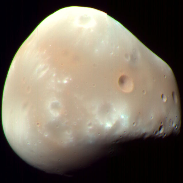
Today's Image of Mars is of Deimos, the smaller and furthest of Mars' two moons. As you can see Deimos is lopsided, but it has an average diameter of only 12.4km. Unlike Earth's moon, if you were looking up into the sky from Mars, Deimos would never appear brighter than Venus does from Earth. Deimos cannot be seen on Mars at latitudes greater than 82.7° because it orbits Mars almost exactly around its equator. 


This image was taken by Mars Reconnaissance Orbiter on Feb 12 2009. Clicking on it will take you to the very detailed Wikipedia page. 

Mars Photo of the Day - Nov 26 2011

Today's Image of Mars shows part of Mars at the boundary between night and day. You can see Gale Crater is beginning to feel the first rays of morning light. It is the crater in the center with the large central mound.

This will be the landing spot for Mars Science Laboratory Curiosity when it touches down in August 2012. [Learn More About Mars Science Laboratory's Mission]

This image was created using information from Mars Orbiter Laser Altimeter, which flew on NASA's Mars Global Surveyor orbiter.

Clicking on this image will take you to the original NASA Image of the Day. I highly recommend that you click on it because theirs is much larger.


Mars Science Laboratory Mission

Now that we have a successful launch of Mars Science Laboratory Curiosity, here is a repost about its mission!


MSL Curiosity will be the most complex and scientifically advanced robot to ever explore the surface of another planet. See below for a diagram of MSL Curiosity and all of its instruments.

For a description of everything on the payload click the image.
Source: NASA/JPL


For specifics on the launch and navigation I highly recommend you read Universe Today's How Will MSL Navigate to Mars? Very Precisely

But where on Mars with MSL Curiosity land?

Curiosity is set to land in Gale Crater on Mars between August 6 and August 20, 2012 and has an expected operation time of 668 Martian sols (686 Earth Days). Gale Crater is 150 kilometers (~93.21 miles) in diameter, so there is a lot of space for Curiosity to land, but fortunately NASA has given us a better idea! See below for approximately where in Gale Crater MSL Curiosity will land.

Gale Crater with Landing Site Outlined
Image Credit: NASA/JPL/HiRISE
What will Mars Science Laboratory Curiosity study in Gale Crater?

Gale Crater contains an enormous mound near the center that rises even higher than the southern rim of the crater. It rises 5.5 km above the northern crater floor and 4.5 km above the southern crater floor. The mound contains many layers; it is estimated that its foundation may be as old as 2 billion years old. Curiosity will be able to examine these different layers and determine at which point, if any, Mars was able to support life. It is speculated that the mound is what remains of sedimentary layers that once filled the entire crater and that these were initially deposited on a lake bed. 

A look at the lower portion of Gale Crater's central mound
Image Source: NASA
As you can see from the labels, the lowest portion of the mound is comprised of clays and sulfates, materials which are formed in the presence of water. The overlying layers contain sulfates, but very little clay, implying they were formed in an environment in which water was evaporating and Mars was becoming drier. 

What does the MSL Team hope to find?

Michael Meyer, lead scientist for NASA's Mars Exploration Program claims that Gale Crater was chosen from all candidate landing sites because "the site holds a diversity of features and layers for investigating changing environmental conditions, some of which could inform a broader understanding of habitability on ancient Mars." He also states that "Gale gives us attractive possibilities for finding organics," but points out that it is still unlikely we will find organic life still living on Mars.

Regardless of whether Curiosity discovers past or present life on Mars it is a great step toward manned exploration of Mars. The discoveries that Curiosity makes will at the very least give us a better understanding of the Martian past and its habitability. Knowing this will enable us to plan for future missions to Mars.

Live Stream: Mars Science Laboratory Launch

Watch the Mars Science Laboratory (MSL) Curiosity launch on its mission to Mars live! The live coverage and commentary begin at 7:30AM EST and launch commences at 10:02AM EST. [Read More About MSL Curiosity's Launch and Mission]


For live updates on Mars Science Laboratory Curiosity's Launch.
Watch live streaming video from spaceflightnow at livestream.com
This live stream is from Spaceflight Now


Not on Twitter? Follow the whole thing Live in this screen!


Mars Photo of the Day - Nov 25 2011

Today's Image of Mars is of crescent shaped depressions on the surface created by strong winds.  The Earth equivalent are called blowoutsbut occurrences on Mars are much larger than those on Earth. This image is from North Azimuth on Mars, but there are many similar features in other parts of Mars. 

On Mars, wind is the currently the primary cause of erosion. [How strong are the winds on Mars?] There is evidence that water helped shape much of the Martian surface, but over billions of years Mars is now devoid of the massive seas, rivers, and lakes that once played a part in shaping the planet.

This image links to the original image page from Mars Odyssey's THEMIS.


Mars Photo of the Day - Nov 24 2011

Today's Image of Mars is of part of Turkey Haven, the aptly named place that Mars Exploration Rover Opportunity will be spending the Thanksgiving weekend. Oppy will be studying the rocks in Turkey Haven for the weekend. I felt this was a fitting image for Thanksgiving Day, don'r you think?

There are a lot of interesting rocks and features in Turkey Haven and the microscopic imager is sure to return some great fascinating photos after the long weekend!

As with most images from Mars Exploration Rover Opportunity, this has been colored by Stuart Atkinson from The Road to Endeavour. Clicking on the image below will take you to the post on his blog where this image is from.


Mars Science Laboratory's Launch and Mission

NASA's Mars Science Laboratory (MSL) Curiosity will launch on Saturday morning at 10:02 EST aboard a United Launch Alliance's (ULA) Atlas V. Curiosity will launch from Cape Canaveral Air Force Station at Space Launch Complex 41.

MSL Curiosity will be the most complex and scientifically advanced robot to ever explore the surface of another planet. See below for a diagram of MSL Curiosity and all of its instruments.

For a description of everything on the payload click the image.
Source: NASA/JPL


For specifics on the launch and navigation I highly recommend you read Universe Today's How Will MSL Navigate to Mars? Very Precisely

But where on Mars with MSL Curiosity land?

Curiosity is set to land in Gale Crater on Mars between August 6 and August 20, 2012 and has an expected operation time of 668 Martian sols (686 Earth Days). Gale Crater is 150 kilometers (~93.21 miles) in diameter, so there is a lot of space for Curiosity to land, but fortunately NASA has given us a better idea! See below for approximately where in Gale Crater MSL Curiosity will land.

Gale Crater with Landing Site Outlined
Image Credit: NASA/JPL/HiRISE
What will Mars Science Laboratory Curiosity study in Gale Crater?

Gale Crater contains an enormous mound near the center that rises even higher than the southern rim of the crater. It rises 5.5 km above the northern crater floor and 4.5 km above the southern crater floor. The mound contains many layers; it is estimated that its foundation may be as old as 2 billion years old. Curiosity will be able to examine these different layers and determine at which point, if any, Mars was able to support life. It is speculated that the mound is what remains of sedimentary layers that once filled the entire crater and that these were initially deposited on a lake bed. 

A look at the lower portion of Gale Crater's central mound
Image Source: NASA
As you can see from the labels, the lowest portion of the mound is comprised of clays and sulfates, materials which are formed in the presence of water. The overlying layers contain sulfates, but very little clay, implying they were formed in an environment in which water was evaporating and Mars was becoming drier. 

What does the MSL Team hope to find?

Michael Meyer, lead scientist for NASA's Mars Exploration Program claims that Gale Crater was chosen from all candidate landing sites because "the site holds a diversity of features and layers for investigating changing environmental conditions, some of which could inform a broader understanding of habitability on ancient Mars." He also states that "Gale gives us attractive possibilities for finding organics," but points out that it is still unlikely we will find organic life still living on Mars.

Regardless of whether Curiosity discovers past or present life on Mars it is a great step toward manned exploration of Mars. The discoveries that Curiosity makes will at the very least give us a better understanding of the Martian past and its habitability. Knowing this will enable us to plan for future missions to Mars.

Watch MSL Curiosity Launch Live!

I'll make sure to post a live stream of Mars Science Laboratory Curiosity's launch, so check back for that on Saturday morning! Don't forget the launch is scheduled for 10:02 AM EST! This is one you won't want to miss.


Mars Photo of the Day - Nov 23 2011

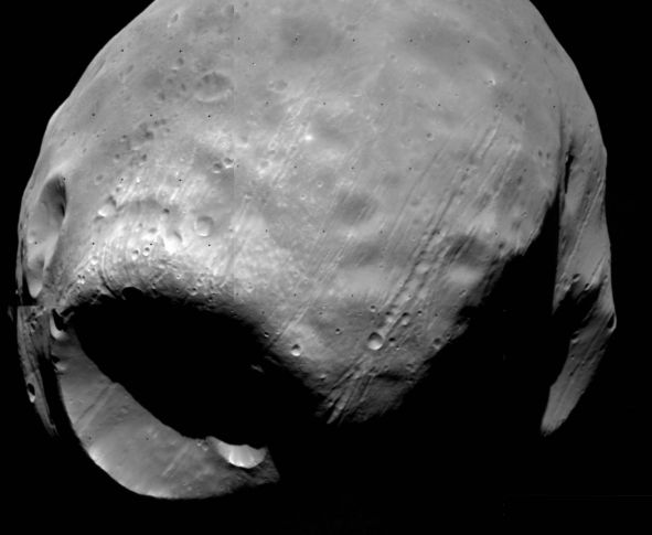
Today's Image of Mars is of Phobos, the larger of the two Martian moons and, if the mission can be saved, the destination for Roscosmos' Phobos-Grunt.

Phobos is 27 km at its longest point and orbits Mars at about 3000 miles above the surface in a little over 7 hours. Stickney Crater is on the bottom left of this image.

It's uncertain how Phobos became a moon of Mars, or even where it came from. It may be a main-belt asteroid that was captured by Mars' gravity, or have formed during the early stages of the solar system. Another theory suggests that the ejecta from a large impact on Mars resulted in many moons, but that over the course of millions of years, those moons fell back to the surface. One of the missions of Phobos-Grunt is to determine the origin of Phobos.

This image was taken by Viking 1 in 1977. Clicking on this image will take you to the Wikipedia page for Phobos where you can find a lot more information.

Contact Made with Phobos-Grunt - Mission May Proceed

ESA Tracking station in Perth, Australia
Image Credit: ESA
On Tuesday (Nov 22 2011) at 20:25 UT a tracking station based in Perth, Australia made contact with Phobos-Grunt. This was the first signal received on Earth from the spacecraft since it launched on November 8 2011. [Phobos-Grunt, Yinghuo-1, and LIFE Remain in Earth's Orbit]

Teams from the European Space Agency (ESA) that made the original contact are in discussions with Russian engineers to determine the best method for maintaining contact with Phobos-Grunt. According to Ria Novosti five attempts will be made to get telemetry from the spacecraft on Thursday. Each attempt will last for approximately 6-7 minutes.

If contact is made could the mission continue as planned?

While Ria Novosti and others report that the window to continue the mission passed on November 21 2011, some people like Dr. David Warmflash, lead investigator for the LIFE experiment on board the Phobos-Grunt spacecraft, says the mission could go on if Phobos-Grunt leaves Earth's orbit anytime well into December.

Why is this?

Current missions to Mars must fall within a specified launch window when travel between Earth and Mars is most optimal. Launch windows are calculated by determining a spacecrafts propulsion capabilities and the alignment of the concerned celestial bodies. Launch windows to get from Earth to Mars (or Mars to Earth) are around once every 26 months.

Phobos-Grunt could still make it to Mars within this launch window, but the issue is that by the time it collected samples from Phobos it would have missed the launch window for the trip back to Earth. That means that samples could not be returned until 2016, 26 months later than planned.

The two ride-along missions would still be fulfilled. 


Yinghuo-1 would be China's first foray to Mars. It would separate from the larger Russian probe in October 2012 (or maybe later now) and begin a year-long orbit of Mars. Its primary purpose is to collect data about the Martian atmosphere. On board it has a plasma package, a fluxgate magnetometer, a radio occultation sounder, and an optical imaging system. It also has two solar arrays to collect energy.

The Living Interplanetary Flight Experiment (LIFE), created by the Planetary Society is an astrobiological experiment containing ten types of organisms. It is an international venture, with cooperation from the Russian Space Research Institute, the Institute of Biomedical Problems of the Russian Academy of Sciences, the Moscow State University, the American Type Culture Collection, and the Institute of Aerospace Medicine, Germany. The mission is to see what types of organisms can survive the harsh conditions of space travel. Please see the LIFE page for more information on their missions.


The two ride along missions would essentially be unaffected by an extended stay on Mars. Yinghuo-1 is only set to remain in orbit for a year regardless and the purpose of the LIFE is to determine whether life can survive the harsh conditions of deep space for an extended period of time, so prolonging the time would likely only help to the experiment.

It remains to be seen whether commands can be sent to Phobos-Grunt, but for now there is renewed hope that the mission can go on.

For the latest information on the Phobos-Grunt mission I highly recommend following Dr. David Warmflash, (@CosmicEvolution) on Twitter.


Mars Photo of the Day - Nov 22 2011

Today's Image of Mars is of a crater filled in by lava flows from the volcano Arsia Mons, one of the northern most Tharsis volcanoes. 

What's amazing about this crater is the fact that the rim remains almost entirely intact.  Oftentimes all evidence of an impact will be erased by a lava flow, but not in this case. The lava flows surrounded this crater and eventually broke through the crater rim, filling it to the same level as the surrounding terrain, but the rim is still distinct.

Clicking this image will take you to the original captioned image from Mars Odyssey Orbiter's THEMIS.

Source: THEMIS

Mars Photo of the Day - Nov 21 2011

Today's Image of Mars is a color image of Gale Crater with Mars Science Laboratory (MSL) Curiosity's approximate landing spot outlined. You can see that MSL Curiosity will be landing close to the base of Gale Crater's central mound, which contains an abundance of sulfates and clays formed in a wet environment. Curiosity will land in a flat ares of the crater (as indicated in the image) and work its war up the mound, determining the conditions in which each layered deposit was formed. 

The MSL Curiosity team hopes to determine whether Mars was ever habitable. They believe examining clays formed in wet conditions provides them the best chance of determining whether there was ever life on Mars.

Clicking on this image will take you to all previous posts related to Gale Crater.
Image Credit: NASA/JPL


Mars Photo of the Day - Nov 20 2011

Today's Image of Mars is of the lower portion of the central mound in Gale Crater. The central mound rises 5.5km above the northern crater floor and 4.5km above the southern crater floor and will be a prime target for Mars Science Laboratory Curiosity. The bottom of this image is actually the floor of the crater. 

What's so special about Gale Crater's central mound? 

Well the central mound is larger than any observed by a Mars rover before, which means that it contains more layers of deposits and will be able to tell scientists more about the ancient Martian past than ever before.

As you can see from the labels, the lowest portion of the mound is comprised of clays and sulfates, materials which are formed in the presence of water. The overlying layers contain sulfates, but very little clay, indicative of an environment in which water was evaporating and Mars was becoming drier. 

Mars Science Laboratory Curiosity will examine these layers in an attempt to determine whether Mars was ever able to support life.

Clicking on this image will take you to the original image page from NASA
Image Credit: NASA/JPL-Caltech/University of Arizona/USGS

Mars Photo of the Day - Nov 19 2011

Today's Image of Mars is absolutely stunning. What you see below is Mars Exploration Rover Opportunity's view from the highest vantage point of Cape York. You need to click on this image and see the high resolution beauty of Mars. 

And who else could transform the black and white images sent from Opportunity into something so magnificent? Stuart Atkinson from The Road to Endeavour of course! He has some really awesome images, including a false color image of the one below. You really need to check out The Road to Endeavour post including this image and if you follow Opportunity at all you need to keep up with his blog.


Mars Photo of the Day - Nov 18 2011

Today's Image of Mars is of Gale Crater as taken by Mars Odyssey THEMIS. Between August 6 and August 20 2012 Mars Science Laboratory Curiosity is set to land at Gale Crater.

Gale Crater is 150 kilometers (around 93.21 miles) in diameter and contains an enormous mound near the center that rises even higher than the southern rim of the crater. It rises 5.5 km above the northern crater floor and 4.5 km above the southern crater floor. The mound contains many layers; it is estimated that its foundation may be as old as 2 billion years old. Curiosity will be able to examine these different layers and determine at which point, if any, Mars was able to support life. It is speculated that the mound is what remains of sedimentary layers that once filled the entire crater and that these were initially deposited on a lake bed. 

This image will link to the original full page, high resolution image from THEMIS. Be sure to check back soon because I'll have an article on the whole Mars Science Laboratory mission!


Mars Photo of the Day - Nov 17 2011

Today's Image of Mars is of Maunder Crater, which lies in the Noachis Terra region of Mars. Maunder Crater is 90km in diameter, but barely 900m deep because it has been filled in by surrounding sediments. The western side of the crater (bottom of this image) collapsed in on itself an and the resultant landslide transported loose material eastward into the crater. The landslide resulted in the formation of hummocky terrain, identifiable by irregularly-shaped hills and valleys.

But what are the eye-catching black marks at the center of the crater?

These 500 to 2500 meter long features are called Barchan dunes, which are among the most common dune forms in arid environments. In fact, similar dunes are found in dry areas on Earth, like in Western Africa's Namib Desert. 

This image was compiled from three images taken by the High Resolution Stereo Camera (HRSC) aboard the Mars Express. The image below links to the original, full page, high resolution image. The image is so detailed I highly recommend you click on it because it is stunning.


Mars Photo of the Day - Nov 16 2011

Today's Image of Mars is of Coprates Cantena, located in the Southern part of the Valles Marineris canyon system on Mars. Coprates Cantena is a chain of collapsed structures running parallel to the main valley, Coprates Chasma. It is not as deep as the main canyon, but you can still see layered deposits on the walls of the pits.

This image was taken on May 25 2004 by Mars Express Orbiter. Clicking on the image will take you to the original, full-screen, high resolution image from the ESA. 


Press Release: NASA Hosting Science Update About Jupiter's Icy Moon Europa


Dwayne Brown  Headquarters, Washington  
202-358-1726  
dwayne.c.brown@nasa.gov 
Nov. 15, 2011


MEDIA ADVISORY : M11-233
NASA Hosting Science Update About Jupiter's Icy Moon Europa
WASHINGTON -- NASA will host a Science Update at 1 p.m. EST on Wednesday, Nov. 16, to discuss new theories concerning Jupiter's icy moon Europa. The event will be in NASA's James E. Webb Auditorium at 300 E St. SW in Washington.  NASA Television and the agency's website will broadcast the event live. Reporters may attend the event or ask questions from participating NASA centers or by phone. For dial-in information, reporters must contact Dwayne Brown at: dwayne.c.brown@nasa.gov with their name, media affiliation and telephone number by noon Wednesday.  Europa, which is slightly smaller than Earth's moon, is thought to have an iron core, a rocky mantle and an ocean of salty water beneath its frozen surface.  Briefing participants are:  - Britney Schmidt, postdoctoral fellow, Institute for Geophysics, University of Texas at Austin  - Tori Hoehler, astrobiologist and senior research scientist, NASA's Ames Research Center, Moffett Field, Calif.  - Louise Prockter, planetary scientist, Johns Hopkins University Applied Physics Laboratory, Laurel, Md.  - Tom Wagner, program scientist, cryospheric sciences, Earth Science Division, NASA Headquarters  ---
END
View the News Conference on NASATV at 1PM EST on Nov 16
See Original Press Release

Live Stream: ISS Hatch Opening and Welcome Ceremony

After a flawless docking, The ISS and Soyuz hatch opening coverage will begin at 2:30AM EST on November 16. The actual opening is scheduled to be for 2:55AM EST, but the docking ran ahead of schedule, so the hatch opening may do the same. 

A welcome ceremony will air following the hatch opening. 

Two cosmonauts, Anton Shkaplerov and Anatoly Ivanishin, as well as one astronaut, Daniel Burbank will be joining the current crew of the ISS, Mike Fossum, Satoshi Furukawa, and Sergei Volkov. (See below the video for an image of the full 6 person Expedition 29 crew)

For live updates of hatch opening and welcome ceremony


Watch live streaming video from spaceflightnow at livestream.com


Expedition 29 crew members pictured from the left on the front row are Commander Mike Fossum and Flight Engineer Dan Burbank. Pictured from the left on the back row are Flight Engineers Satoshi Furukawa, Sergei Volkov, Anatoly Ivanishin and Anton Shkaplerov. Photo credit: NASA
Image links to original NASA page
Image and Caption Credit: NASA


Live Stream: Soyuz Docking to the International Space Station

You can watch the Soyuz docking to the International Space Station (ISS) here! The docking will begin at 12:33AM EST on November 16 2011. The automated rendezvous sequence aboard the Soyuz will begin at 10:11PM EST on November 15 2011.

Live coverage begins at 12:00AM EST.

This comes from SpaceFlight Now's live feed. The feed will begin automatically until the launch is over. 
Watch live streaming video from spaceflightnow at livestream.com

Two cosmonauts, Anton Shkaplerov and Anatoly Ivanishin, as well as one astronaut, Daniel Burbank will be docking to the ISS in what is the first manned docking since the last Shuttle (Atlantis) docked on July 10 2011.

For live updates of the Soyuz docking to the ISS

Mars Photo of the Day - Nov 15 2011

Today's Image of Mars is of a proposed future landing site in Ladon Valles on Mars. Ladon Valles is a 278km long outflow channel that connects with Ares Valles. It is part of a larger system that heads to Argyre Basin, which many scientists believe once contained a large ocean of water. 

This image was published by HiRISE on November 1 2011, but is not currently captioned.

There are many sites on Mars that have been proposed as landing sites for future missions. Clicking on the image will take you to all HiRISE images of candidate landing sites.


Mars Photo of the Day - Nov 14 2011

Today's Image of Mars is of the volcano Tharsis Tholis, as taken by Mars Express Orbiter's High Resolution Stereo Camera (HRSC). The volcano rises 8km above the surrounding terrain and is one of the many Tharsis Volcanoes. It stretches 155 x 125km at its base and its caldera (opening) is 32 x 34km. 

Tharsis Tholis is unique among Martian volcanoes due to the degree by which it has been modified by faulting. Large faults cut across the entire volcano. dividing it into several major sections. [View images of Tharsis Tholis as taken by other cameras aboard Mars Express]

Click on the image below to see the original high resolution image from Mars Express.


Live Stream of Launch to the ISS

Watch the first manned launch to the International Space Station (ISS) since the failed Soyuz launch in August. This video is a live feed from SpaceFlightNow! The launch begins at 11:14PM EST.

The feed should begin automatically. (EDIT: I disabled automatic playing since the launch ended - It was a complete success!)
Watch live streaming video from spaceflightnow at livestream.com
Two cosmonauts, Anton Shkaplerov and Anatoly Ivanishin, as well as one astronaut, Daniel Burbank will be ascending to the ISS in what is the first manned launch since the last Shuttle (Atlantis) docked on July 10 2011.

Vladimir Popovkin, the director of Roscosmos, the Russian Federal Space Agency is confident that the launch and docking will be carried out successfully. He was quoted as saying, "We have no doubt in our minds both the rocket and the vehicle are ready, all the activities have been done at the appropriate level of quality and reliability." Regardless, you can be sure that the world will watch with admiration as these three brave men ascend to the ISS.

If you view this after the launch the feed will just go to live NASA TV, if anything. I will make sure it doesn't start automatically following the Soyuz docking with the ISS.

Mars Photo of the Day - Nov 13 2011

Today's Image of Mars shows a portion of the dunes in Richardson Crater, a 55km diameter crater in the south polar region of Mars. This image was taken as the dunes began to thaw and the carbon dioxide ice started to sublimate. You can see this in the dark patches where the ice has already sublimated. 

This image was taken in 2009 by HiRISE aboard the Mars Reconnaissance Orbiter. Click image to see the original captioned image.


Mars Photo of the Day - Nov 12 2011

Today's Image of Mars is of Nili Fossae in perspective, as taken by Mars Express Orbiter on Feb 8 2008. Nili Fossae is a graben system on Mars. 'Graben' is the term used to identify the lowered terrain in the area between two parallel faults or fractures. The area collapses when tectonic forces pull the area apart. 

Nili Fossae contains many grabens and is located "northeast of the Syrtis Major volcanic province, on the northwestern edge of the giant Isidis impact basin." (ESA) Some of the fractures and faults in the Martian crust extend up to 500 meters deep.

One of the intriguing things about Nili Fossae lies above the surface. Earth-based telescopes have detected that the atmosphere around Nili Fossae contains an increased amount of methane. This leads scientists to believe that methane may be produced in the area, a theory which the ExoMars Trace Gas Orbiter will attempt to verify if/when it launches. The orbiter is currently expected to launch in 2016, but has suffered numerous setbacks, some of which I detailed in the October article, Russia Looks Set to Become Partner in ExoMars Mission.

Clicking on this image will take you to the full page high resolution image taken by Mars Express' High Resolution Stereo Camera (HRSC)
Credits: ESA/DLR/FU Berlin (G. Neukum)

Mars Photo of the Day - Nov 11 2011

Today's Image of Mars is a perspective of Oraibi Crater, as taken by Mars Express Orbiter. Oraibi Crater is 32 km in diameter and a prominent feature in Ares Valles, an outflow channel channel on Mars. 

The crater is filled with sediments and a large part of its southern rim has been eroded by the water that once flooded Ares Valles. On the right side of this image you can see a number of relatively recent craters.

Clicking on this image will take you to the original image taken by the High Resolution Stereo Camera (HRSC). I highly recommend checking it out because it's a lot bigger and you can zoom in on it. 

Credits: ESA/DLR/FU Berlin (G. Neukum)

Phobos-Grunt, Yinghuo-1 and LIFE Remain in Earth's Orbit

The engines aboard Phobos-Grunt, which is also carrying Yinghuo-1 and the Living Interplanetary Flight Experiment (LIFE), failed to fire after separation with the larger booster. The Zenit-2 launch vehicle detached from the Phobos-Grunt on time and correctly, but the engine for the spacecraft itself failed to start.

The Zenit-2 rocket launching Phobos-Grunt
CREDIT: German Aerospace Center (DLR) 
Russia has been unable to make contact with Phobos-Grunt, despite several attempts and opportunities to do so. According to Vladimir Popovkin, head of Russia’s space agency Roscosmos, engineers have until November 23 to restart the probe's booster before it runs out of batteries.

Popovkin claims that this scenario is one that was prepared for and that can be remedied from the ground. He goes on to say, “We will attempt to reboot the program. The spacecraft is currently on a support orbit, the fuel tanks have not been jettisoned, and the fuel has not been spent.” There is still hope for Phobos-Grunt, and thus hope for the other two missions riding along with it.

Mars Photo of the Day - Nov 10 2011

Today's Image of Mars is of gullies and lobate material in a crater in the Noreidum Montes. The area surrounding the impact site is devoid of ejecta and the crater is not as deep as one that size should be, meaning that the area was filled in.

The crater imaged below also has gullies on its northern side and extending toward the center. It also has an arc-shaped ridge inside the southern edge of the crater. This could be caused by wind erosion or accumulation of material filling the crater.

Clicking on this image will take you to the original captioned image from HiRISE.


Mars Photo of the Day - Nov 9 2011

Today's Image of Mars is from Kasei Valles, a 1780 km (1100 mi) long set of flood carved channels on Mars. This image focuses on a much narrower channel that was carved into Kasei Valles.

Many channels carved by water on Mars are covered by a more recent layer of lava. In many cases the fissures that released the water, later release the lava that covers the channels, but in the case of Kasei Valles, the lava came from a different location than the water. 

Kasei Valles was carved by floods from Echus Chasma, but the lava came from a source between the Tharsis Volcanoes and only covers the lowlands of the valleys. 

This image links to the original captioned image by HiRISE.


Live Stream of Phobos-Grunt and Yinghuo-1 Launch

See the live stream of the joint Phobos-Grunt and Yinghuo-1 launch to the Martian Moon Phobos and Mars, respectively.

Mars Photo of the Day - Nov 8 2011

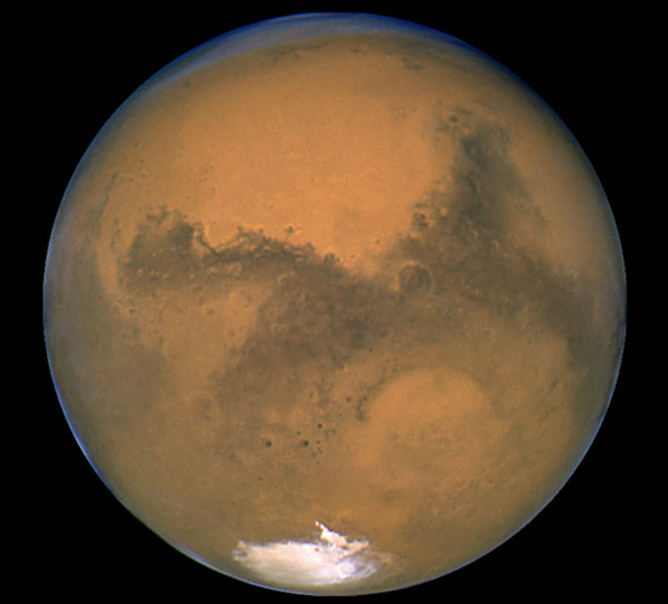
Today's Image of Mars is one of the most well known images of Mars. It was taken by the Hubble Telescope on August 27 2003. You can see the clearly defined south polar ice cap, as well as many other features. This is the most detailed view of Mars ever taken from Earth. 

I suggest that you click on the image because it links to the NASA page, which provides much more detail.

I would provide more detail here, but I am at NASA Langley for the #NASATweetup and don't really have time.


Mars Photo of the Day - Nov 7 2011

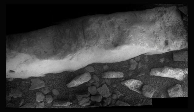
Today's Image of Mars is once again of Homestake, that mysterious vein Mars Exploration Rover Opportunity is currently inspecting. This was compiled by Stuart Atkinson from The Road to Endeavour from a collection of images taken by Opportunity's microscopic imager. 

The image shows that Homestead is weathered and covered with grooves. Homestead is denser than the surrounding material, making it more resistant to weathering. But just what is Homestead made of? 

While the MER team has not announced anything officially, Atkinson reports that many MER forums are abound with the theory that Homestead is made of the mineral magnesite. For more information on that particular mineral I suggest you highlight the the word "Magnesite" on my page; The Wikipedia page on Magnesite should pop up into a little window, telling you all you want to know about that mineral, and more! 

This image links to Atkinson's post with this image on The Road to Endeavour.