Google+ Mars Travel: Argyre Basin
Showing posts with label Argyre Basin. Show all posts

Frost in Argyre Basin on Mars

Just like on Earth, a frost can develop on Mars. What you see below is a swath of land within the 1800km wide, 5km deep Argyre Basin, which was created from an enormous impact in the early part of Mars' history. The prominent crater partially captured in this image from Mars Express' High Resolution Stereo Camera is the 138km wide Hooke Crater.

Click to see original high resolution image from Mars Express. [See their article]
The frost you see in this image is actually carbon dioxide ice, which scientists believe only forms at ground level when it freezes out of the atmosphere. The reason why only the frost is only abundant in the southern (left) lowlands of this image is because of the angle of the sun at the time this image was taken. This image was taken at 1630 local time on Mars, when the Sun was at a 20 degrees above the horizon. It only had enough time to melt the frost off the north facing crater walls, but wasn't yet able to melt any in the low lying area to the south.

Understanding when and for how long frost can cover the surface of Mars will save future explorers from facing potential surprises! Imagine waking up in your space capsule only to look out the window and see the ground covered in ice!


Mars Photo of the Day - Apr 9 2012

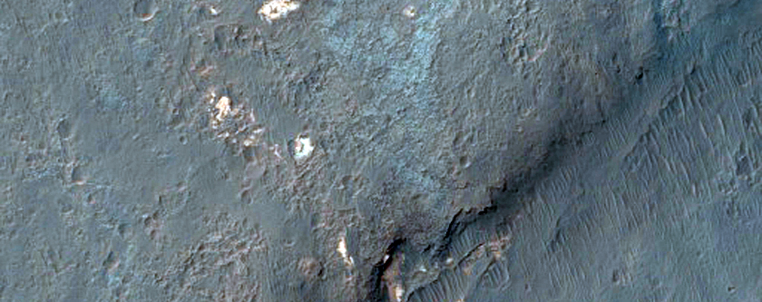
Today's Image of Mars shows layered deposits on the rim of a crater close to Argyre Basin, as imaged by HiRISE. The sun struck the crater at a low enough angle that it cast the interior into deep shadow, while illuminating the distinct layers on the crater rim. 

Layered deposits are important to scientists because they provide insight about the past environment on Mars. Transitioning layers imply that the environment on Mars was changing during that time period; how much and how often depends on the variance and size of the layers.

Clicking on this image will take you to the original high resolution image from HiRISE. [See their caption for the image]


Mars Photo of the Day - Dec 24 2011

Today's Image of Mars shows exposures of layered rocks in the Argyre Quadrangle on Mars. This bullseye looking feature is created as a result of erosion. Over millions or billions of years the wind on Mars chips away the outer and uppermost layers of these deposits, exposing the older material underneath. Scientists can then study the older, exposed layers and use their composition to determine the climate on Mars when the materials were deposited. Layered deposits like these are thought to be evidence that great lakes or seas once existed on Mars. 

The Argyre Quadrangle is home to the Argyre impact basin, which contains a lot of ancient eroded terrain and numerous impact craters, including Galle Crater (aka 'Smiley Face' Crater).

Clicking on this image will take you to the original, captioned HiRISE image.


If you like the HiRISE images showcased in the Mars Photo of the Day posts I encourage you to enter for a free 2012 HiRISE Calendar

Mars Photo of the Day - Nov 15 2011

Today's Image of Mars is of a proposed future landing site in Ladon Valles on Mars. Ladon Valles is a 278km long outflow channel that connects with Ares Valles. It is part of a larger system that heads to Argyre Basin, which many scientists believe once contained a large ocean of water. 

This image was published by HiRISE on November 1 2011, but is not currently captioned.

There are many sites on Mars that have been proposed as landing sites for future missions. Clicking on the image will take you to all HiRISE images of candidate landing sites.