Google+ Mars Travel: October 2011

Mars Photo of the Day - Oct 31 2011

Today's Image of Mars is of gullies on the wall of Dao Vallis, just upstream of its merge with Niger Vallis. The gullies that flow into Dao Vallis begin just below the top of the valley and erode through the upper rock layers. The material that once filled the valley was likely ice rich and melted through the upper layers of rock, much like slow moving glacial material on Earth. 

Dao Vallis is an outflow channel that was most likely created by massive flooding caused by the catastrophic release of ground water. This likely occurred because of a rupture in an underground source of water, either from tectonic shifts in Mars' ancient past, or meteorite impacts. 

Clicking on this image will take you to the captioned image by HiRISE.


The Airline Precedent for Space Funding

Popular airlines Spirit in the US and Ryanair in Europe have been gaining millions in ad revenue for years by renting empty spaces on and in their aircraft. How does that work? Simple, they set a price and say "Hey, if you pay us $14 million we'll put your logo on the outside of all of our aircraft for a year." They even sell space inside the cabin. According to USA Today they charge "$196,000 for three months of ads on the overhead bins in Spirit's planes, $119,000 for ads on the tray tables or $18,500 for ads on air-sickness bags." The airlines get extra money and the advertisers get more exposure. The problem is that all those ads annoy passengers who don't like being inundated with ads while inside of a plane: one of the last 'safe havens' from the outside world. So while airlines and ad companies are happy, the customers are not.

Selling ad space on and in aircraft may or may not work out because the customers don't like being inundated on planes, but what about on spacecraft? While NASA might have nearly insurmountable restrictions on spacecraft advertising, what about the private industry? What is to stop SpaceX, Virgin Galactic, or any other private space company from renting space on, or in their spacecraft?


How many people follow every space launch? How much exposure and publicity would a company get if they had their logo on the outside of a spacecraft? How much would a company pay for to advertise on one launch? In order to find out we can look back at past advertisements in space.

Mars Photo of the Day - Oct 30 2011

Today's Image of Mars is a panoramic of Victoria Crater as taken by Mars Exploration Rover Opportunity in 2006. This image is taken from the vantage point of Cape Verde and compiled from images taken over a period of three weeks, from Oct 16 2006 to Nov 2 2006. 

Click on the image to see the enlarged version (Trust me, you want to).
Source: NASA/JPL Mars Exploration Rover Opportunity

Mars Photo of the Day - Oct 29 2011

Today's Image of Mars is a close-up view of the layered deposits near Mawrth Vallis, a channel that was most likely carved by water at some point in the past. The varying tones of each layer is likely reflective of differences in mineral content. The dark patches that you see on the layers are sand dunes. 

CRISM has detected clays in the Mawrth Vallis region, so the layers may be rich in clays. Clays are another indication of past water on Mars because they are only known to form by interaction with water. Needless to say, Mawrth Vallis has consistently been a landing site candidate for proposed missions to Mars. 

This image is a subimage of a larger, captioned image by HiRISE, which you can view by clicking on this image. 

Mars Photo of the Day - Oct 28 2011

Today's Image of Mars is further evidence that great seas of water once covered the surface of Mars. What you see was once a flat surface that broke apart; the surface was most likely a freezing mudflow. The pieces of that flat surface began flowing apart on top of slushy material.

When the slushy material eventually froze it would have expanded and forced its way up between broken, drifting pieces. That is why you see the raised ridges that resemble channels.  

This image links to the captioned HiRISE image that is a subimage of this one. It's a lot more colored and  will let you see one of these ridges up close.


Mars Photo of the Day - Oct 27 2011

Today's Image of Mars once again comes from Stuart Atkinson at The Road to Endeavour. It shows a realistically colored image of a rock Mars Exploration Rover recently passed called "New Consort." I'm not sure where the MER team came up with that name, but I've long since given up trying to guess. The original black and white image were sent back today, but it was taken as Opportunity passed by the rock roughly two days ago. 

Clicking on this image will take you to the post from The Road to Endeavour where he discusses the image (and some others). I can't impress enough on all of you how amazing Atkinson is. He brings the raw images from Opportunity to life and his commentary makes you feel like you are right there alongside the Mars Rover. I highly recommend you click this image then subscribe to his blog.


Mars Photo of the Day - Oct 26 2011

Today's Image of Mars is of an avalanche, which has kicked up a large dust cloud. This image is looking down the scarp, or cliff and shows different layered deposits typical in these features. Scientists are still uncertain as to why these avalanches occur, but they believe they could be the result of temperature changes in the layers of ice or large gusts of wind passing over the rocks.

Clicking this image will take you to the original captioned image by HiRISE.


Mars Photo of the Day - Oct 25 2011

Today's Image of Mars shows a chain of pits along the northwestern flank of the volcano, Alba Patera. Those pits form a fracture at the volcano's southern most point. The fracture is part of a larger fracture system that is radial to the volcano and suggests that it is somehow related to the volcano's formation.

The fracture system could have formed when subsurface magma ceased flowing and the overlying ground collapsed. Another possibility is that water-ice could have formed along the fractures and the subsequent sublimation of the ice resulted in a partial collapse.

This image links to the original captioned image by HiRISE.

Mars Photo of the Day - Oct 24 2011

Today's Image of Mars shows lobate flow features in the Northwest Hellas Rim. Lobate features on Mars are generally located at mid-latitudes (30-60 degreees) and are indicative of viscous flow reminiscent of glaciers on Earth. These slow flowing features has long been thought to be evidence of subsurface ice on Mars. This assertion is supported by recent ground penetrating radar images, which indicate these lobate features have cores of ice.

Clicking this image will take you to the original captioned image by HiRISE.


Mars Travel will be @NASA_Langley #NASATweetup!

Mars Travel will be taking part in the NASA Tweetup at NASA Langley! You can be sure that we will be updating everyone on the days events! The best way to keep up to date with the days events is to

I'll be sure to update as much as I can with pictures and descriptions!

As I get more details about the days events I'll let everyone know what they can expect! Thanks!

Mars Photo of the Day - Oct 23 2011

Today's Image of Mars is a mosaic showing South Candor Chasma. Candor Chasma is one of the largest canyons in the Valles Marineris canyon system. 

This mosaic was created from images taken by both Viking orbiters. Clicking on the image will take you to the full-page image from NASA.


Mars Photo of the Day - Oct 22 2011

Today's Image of Mars is from the Mars Pathfinder mission and shows the Sojourner rover taking an Alpha X-ray spectrometer measurement of Yogi Rock. This image was taken on July 4, 1997.

Yogi Rock was the first basalt rock discovered on Mars. Basalt is an igneous rock, which implies previous volcanic activity in the region. But that is not all that makes Yogi Rock memorable; images of Sojourner driving up to Yogi Rock were aired in the opening credits of Star Trek: Enterprise. This was the first time that images from another planet were used in a science fiction television or film production.


Mars Photo of the Day - Oct 21 2011

Today's Image of Mars is of the boundary between Candor Chasma and Ophir Chasma, both of which are located in the Valles Marineris canyon system on Mars. The Valles Marineris is the largest canyon system in the solar system and would span almost the entire United States from East Coast to West.

Candor Chasma is one of the largest canyons in the Valles Marineris canyon system and it borders Ophir Chasma to the south. The photo below shows a small stretch of the border between Candor and Ophiir Chasma.

This image was taken by HiRISE, but they have not captioned it as of this posting, so clicking on the image will take you to all posts labeled with Valles Marineris.


Mars Photo of the Day - Oct 20 2011

Today we have a compilation of images from Mars taken by HiRISE. These images all show the same central structures in Horowitz Crater.  The images span over a period of close to two years and show changes in slope features. These changes are thought to be indicative of flowing water on Mars

The features that seem to extend down the slope are called Recurring Slope Linae (RSL). Repeated imaging has shown that these features appear and gradually grow during the warm season on Mars, only to fade during the cold season. It is thought that the best explanation for these recurring features is the existence of briny water just below the surface, but that is unconfirmed as of yet.

Mars Travel wrote an article about these findings the day they were released. [View This Article]

This series of photos was published with many others and an article in the journal Science on August 5 2011. This photo will link to the larger high resolution images, but if you want to see the HiRISE article and abstract from Science on these features, you can find them here.
Image credit: NASA/JPL-Caltech/Univ. of Arizona


Mars Photo of the Day - Oct 19 2011

Today's Image of Mars shows some stunning sand dunes. The ridges on these dunes resemble thousands of legs and create the illusion that we are seeing millipedes, thus the reason HiRISE labeled this image "The Millipedes of Mars?"
Unfortunately I haven't been able to find much information about these particular dunes, but the placement nnd quantity of ridges you see do make for a fascinating image don't they?

To see the captioned image from HiRISE simply click on this image.


Mars Photo of the Day - Oct 18 2011

Today's Image of Mars is of a rock dubbed Sheba by the Mars Exploration Rover Opportunity team. Sheba is in the area where the highest levels of phyllosilicates have been detected from orbit. 

This is just one of many intriguing science targets Opportunity has passed by in its search to find a north facing slope where the rover will wait out the oncoming Martian winter. 

This image was colored by Stuart Atkinson from The Road to Endeavour and it links to the article containing this image.


Russia Looks Set to Become Partner in ExoMars Mission

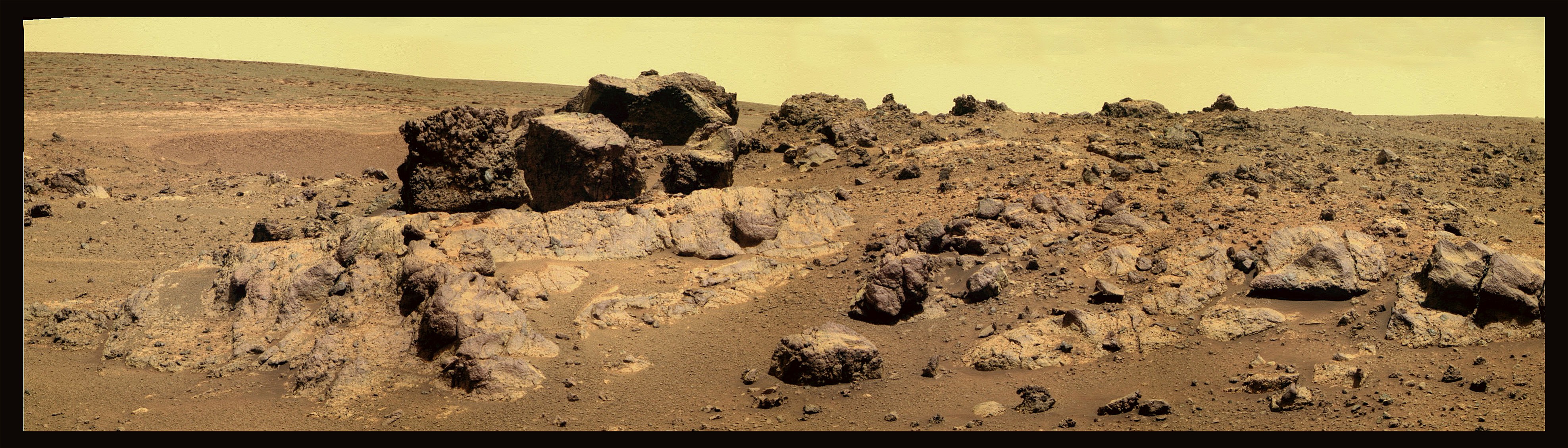
On October 13 2011 the European Space Agency (ESA) announced that it has officially invited Russia to become a full partner in the joint Euro-US ExoMars mission. The mission, which planned to launch an orbiter in 2016 and the rover in 2018, has suffered numerous setbacks primarily due to funding issues. 


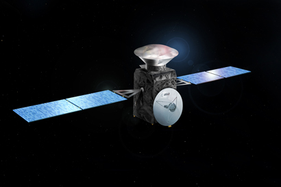
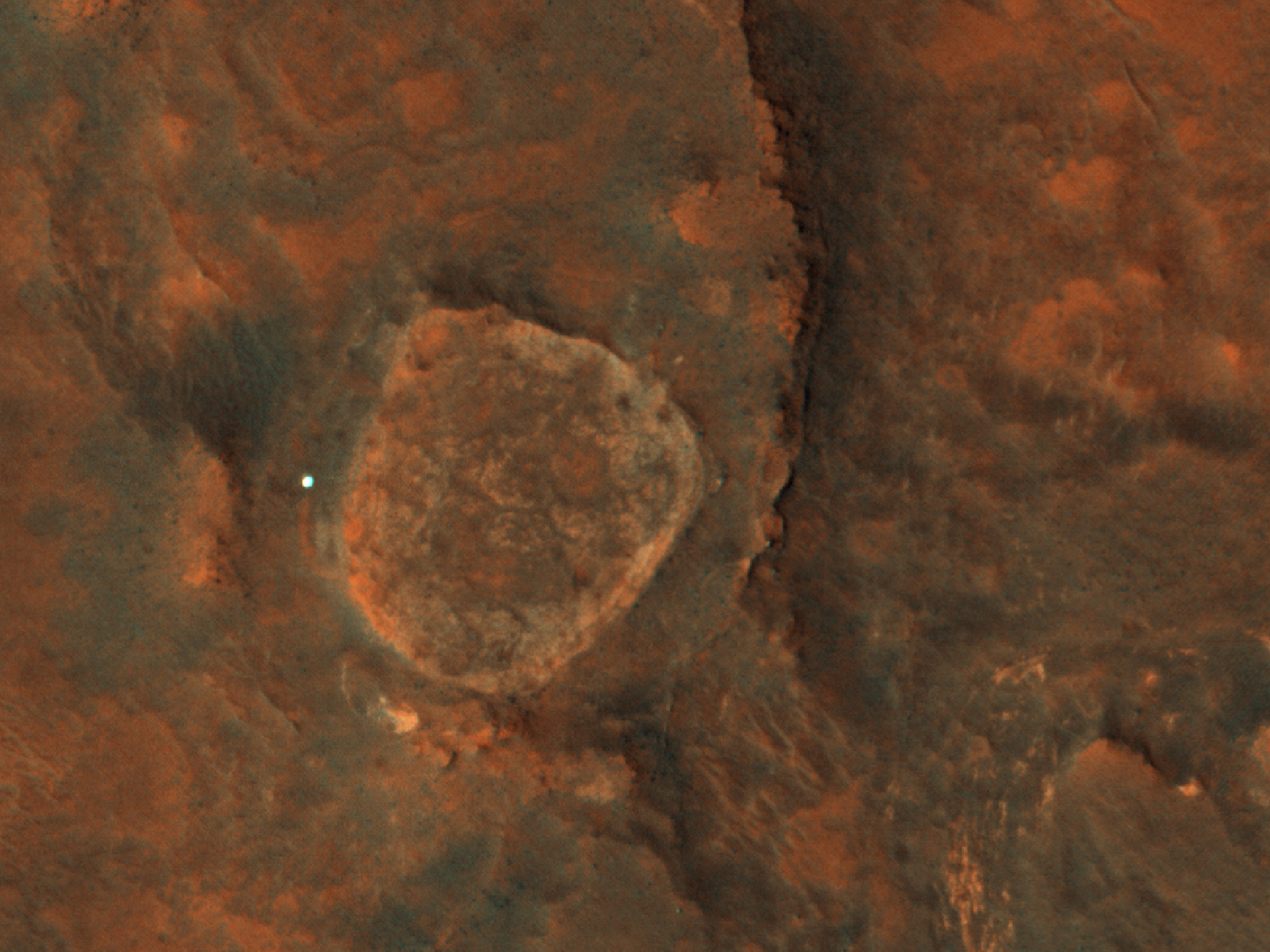
ExoMars Trace Gas Orbiter Conceptualization
Credit: ESA
The decision to invite Russia comes after budget issues forced NASA to downgrade its participation and cut their contribution of a second Atlas V rocket needed for the whole mission to launch. With only one rocket the mission would have to be cut in half and the ExoMars Trace Gas Orbiter would be forsaken in favor of the rover. The planned orbiter intended to use equipment provided almost entirely by NASA to detect trace gases in the Martian atmosphere, but has since been forced to look for alternative providers. 


And what other country has the funds, hardware, and interest to support a mission to Mars? 


Russia does, so the ESA has turned to Russia, hoping that they will contribute a Proton rocket, equipment, and additional funding to the mission, in return for making them a full partner in the ExoMars project. This would enable them to conduct their own scientific experiments with the rover and orbiter while giving them a say in all aspects of the mission. ESA Director-General Jean-Jacques Dordain emphasized that “This could end up being an even grander mission than it would have with a full Russian participation, It’s not simply a matter of asking the Russians, ‘Please provide us a launcher.’” The added participation of Russia would ensure adequate funding and even allow for the mission to be expanded.


Early reports suggest that Russia will accept the ESA's proposal. Oleg Korablyov, deputy chief of the Space Research Institute of the Russian Academy of Sciences was quoted by Ria Novosti as saying that "from the scientific point of view such [a] mission would be of great interest to us, it would boost our own Mars research," while claiming that "it would be a bargain and a tangible step towards Mars Net," a Russian plan to to create a network of meteorological stations on Mars. 

Russia has a long history of failure when it comes to Mars. Two Russian landers have made it to the surface, only to cease communication upon touch down. The Mars 2 and Mars 3 Orbiter's sent in late 1971 were the only real successes and they were terminated in August of 1972. The last Russian attempt at a mission to Mars was Mars 96 in 1996, but it suffered a launch failure.

Russia does have a mission to the Martian moon Phobos scheduled to launch in November of 2011. This ambitious mission, dubbed Phobos-Grunt, will be an orbiter, lander, and sample return mission of the Martian moon. However the 2018 ExoMars lander mission would be their first attempt at reaching The Red Planet's surface since 1996.

We won't know for sure until Russia makes an official announcement, but all indications point to them becoming full partners in the ExoMars mission. As more information emerges it will be posted here!

Mars Photo of the Day - Oct 17 2011

Today's Image of Mars takes us inside the "Grand Canyon of Gale Crater." This enormous channel bisects Gale Crater, cutting through the large central mound. When Mars Science Laboratory lands at Gale Crater in August 2012, it will hopefully begin exploring this channel, which, like the Grand Canyon on Earth, has many exposed layered deposits which will teach geologists a lot about the planet's history.

Research suggests that Gale Crater may once have contained a giant lake. The MSL team hopes to find evidence that Mars was once habitable, and this channel will provide them with the insight into Mars' past they need to make that determination.

I'll do a story on Gale Crater again soon since the tentative launch date for the Mars Science Laboratory Curiosity is November 25 2011.

This image is from HiRISE but they haven't captioned it so clicking it will link to the Mars Travel article about the selection of Gale Crater as Curiosity's landing site. [See the less zoomed-in version of the channel from HiRISE]
.


Mars Photo of the Day - Oct 16 2011

Today's Image of Mars is of a doublet crater, which occurs when two meteorites impact at the same time. The shock waves that emitted from the double impact created the slight central rim and the wing-like debris visible on the outside of the rims.

This image was taken on December 19 2010 by Mars Odyssey Orbiter's Thermal Emission Imaging System (THEMIS). Click the image to see the informational page from the THEMIS site. 


Mars Photo of the Day - Oct 15 2011

Today's Image of Mars is of Athabasca Valles, an outflow channel on Mars created by catastrophic flooding. The source of water for the flooding is most likely Cerberus Fossae, a series of fissures and scarps on the surface of Mars. 

It's difficult to tell how long ago the floods in Athabasca Valles occurred because they have almost entirely been covered by a lava flow the size of Oregon. This lava flow is considered the youngest discovered on Mars and is believed to have developed during the Amazonian Epoch, around 3 billion years ago.

This image links to the original captioned image from Mars Odyssey Orbiter's Thermal Emission Imaging System (THEMIS).


Hurricane Force Winds on Mars

There are some powerful winds on Mars, but just how powerful was only discovered recently. David Choi of NASA's Goddard Space Flight Center used images of dust devils taken by Mars Reconnaissance Orbiter's HiRISE camera to determine the speed of the swirling dust devils. 


Tracks Left by Dust Devils on Mars
Source: HiRISE
But just how did he do this?

Choi looked at different HiRISE images of the same dust devil and determined how far four distinct cloud features had moved from one photo to the next. Because he knew the time elapsed between each image he was able to calculate how fast the swirling dust devil was moving. 

So just how fast was the wind blowing on Mars?

Really fast. In some cases the wind speeds were 45 m/s (162 km/hr), well above 33 m/s (118.8 km/hr) which constitutes hurricane force winds on Earth. The typical wind speed was from 20-30 m/s (72-108 km/hr). 

The dust devils observed were anywhere from 30-250 meters in diameters and rose from 150-700 meters into the sky.

These findings were presented in Nantes, France on October 3 2011 to the European Planetary Science Congress and the American Astronomical Society’s Division for Planetary Sciences.

Mars Photo of the Day - Oct 14 2011

Today's Image of Mars shows what is possibly the newest part of Cerberus Fossae. And what exactly is Cerberus Fossae? 

Cerberus Fossae is a series of roughly parallel fissures created by faults which pulled the Martian crust apart in the Cerberus region, which is located at around 9°N, 197°W. These faults are the result of the formation of the Elysium Volcanic Field. They pass through preexisting features, like hills, which indicates that the faults are relatively recent.

Research suggests that the formation of these fossae released massive amounts of pressurized underground water, which led to the creation of Athabasca Valles, a large outflow channel on Mars.

Clicking on this photo of Mars will take you to the original HiRISE image, but they have yet to provide a caption.


Mars Photo of the Day - Oct 13 2011

Today's Image of Mars is is a color mosaic of the "Kirkland Lake" boulder field, as compiled and colored by The Road to Endeavour's Stuart Atkinson from images taken by Mars Exploration Rover Opportunity.

Opportunity is now leaving all this behind as the MER team directs it toward the location of the low-acidic clays detected by CRISM and HiRISE in orbit. The MER team is hoping that these clays can tell them more about how hospitable Mars was in the past.

This image links to the larger, amazing version from The Road to Endeavour, but the post in which the image is found is here. The small photo below really doesn't do the image justice because the original is extremely detailed.


Mars Photo of the Day - Oct 12 2011

Today's Image of Mars gives us a glimpse of a possible source for the outflow channels that have so drastically shaped the surface of Mars.  The large depression in the ground is likely where millions of tons of ground water erupted onto the surface of Mars. This generally occurs due to a rupture of the surface, usually the result of a meteorite impact or past tectonic activity on the planet. 

This particular scarp is located in Aurorae Chaos, which is 750 km in diameter and located at the eastern end of Valles Marineris. Aurorae Chaos is the largest discovered area on Mars of chaos terrain, or terrain where cracks, ridges, and plains appear jumbled together in a random and chaotic manner. 

This image links to the original captioned image from HiRISE.


Mars Photo of the Day - Oct 11 2011

Today's Image of Mars shows a lava flow on Olympus Mons' northwestern side. This is just one example of the many lava flows on the solar system's largest volcano. Flows like these occur when lava pushes through the ground and leaves a path behind it. Many of the lava flows on Mars are currently inactive and thus leave behind hollow tubes like this one, though some are still active

This image links to the original image from HiRISE, though they have not currently provided a caption.


Compilation of Images from Mars Exploration Rover Opportunity


This video shows 309 photos of Mars taken by Mars Exploration Rover Opportunity during its 3 year trek 

from Victoria Crater to Endeavour Crater. The 13 mile trek produced thousands of images; these have been selected by the JPL team.


Mars Photo of the Day - Oct 10 2011

Today's Image of Mars is of layered deposits in the southern polar regions of Mars. This images clearly shows how drastically the layers can differ from each other in appearance. The changes in color and content of deposits generally reflects changes in the climate on Mars during the time of deposit.

This image links to the original image from HiRISE, but they do not currently provide a caption.


Mars Photo of the Day - Oct 9 2011

Today's Image of Mars was taken by the Viking II Orbiter on June 7 1977. It shows wave clouds near the Martian south pole. These clouds result from wind passing over craters and picking up dust from the last global dust storm.

Unfortunately this image isn't as colorful or interesting as some, but it is important because it helps us to understand more about the Martian environment.

This photo of Mars links to the NASA's page for the photo.


Mars Photo of the Day - Oct 8 2011

Today's Image of Mars is of Mars Exploration Rover Opportunity when it was at Victoria Crater, located in Meridiani Planum. This image was taken by the HiRISE camera aboard the Mars Reconnaissance Orbiter in 2006. Opportunity is currently along the rim of Endeavour crater, where it has begun a new mission.

Clicking on this image will take you to all posts related to Mars Exploration Rover Opportunity.


Mars Photo of the Day - Oct 7 2011

Today's Image of Mars is of an unnamed crater with a 'bench' surrounding it located in Sinus Meridiani. The 'bench' is formed because the surface layers are more easily eroded than the older underlying materials that make up the rest of the crater.

This photo links to the original captioned image by HiRISE.


Mars Photo of the Day - Oct 6 2011

Today's Image of Mars is of a central peak in one of Mars' unnamed craters. These colorful rocks are the result of variations in mineral content due to water activity sometime in Mars' past. 

Who would have guessed that Mars could be home to such a beautiful array of colors?

Click the image to see the original captioned photo from HiRISE.


Mars Photo of the Day - Oct 5 2011

Today's Image of Mars is of the amazing dunes found in Richardson Crater. Richardson Crater is located in the south polar region of Mars, where it goes through dramatic temperature changes throughout the year. The dark streaks are due to the movement of material as a result of wind and defrosting. 

These dunes are just another example of the remarkable landscapes to be found on Mars.

This image links to the original captioned image by HiRISE.


Mars Travel - A New Company Seeking to Revolutionize the Commercial Space Industry


Like many space enthusiasts I despaired every time I heard another space project was cancelled or postponed due to funding issues. But what could I do? Even simple space projects and missions cost millions, if not billions of dollars. Most people don't have that kind of money lying around (no really?!), and I definitely don't.

Does that make us helpless? Should we have to accept that space is only the domain of the government or super rich? Can average people actually make an impact on this multi-billion dollar industry? Most people will say no, that such a thing is impossible, but are they right? 

Mars Travel Logo
That is the question I struggled with for a long time because like millions of other people, space fascinates me and I hate seeing it relegated to the back burner as if it isn't important to humanity. I decided I was going to do something about it, so I created Mars Travel, a company dedicated to connecting space projects and missions with corporate sponsors. {Learn More About Mars Travel} The company is just starting out, but soon I hope to begin linking space projects with funding from corporate sponsors. To do this I will need your help, but first let me explain why this will work.

Mars Photo of the Day - Oct 4 2011

Today's Image of Mars is of Shoemaker Ridge, which is the next destination for Mars Exploration Rover Opportunity.  Once again, Stuart Atkinson of The Road to Endeavour assembled and colored this amazing image. His work helps excite the whole world about Opportunity's exploration by transforming the raw images into beautiful scenes that make everyone who sees them envious of the Mars rover. 

Shoemaker ridge promises to provide a spectacular view of the surrounding area and very possibly the most amazing photos of Mars yet! We will definitely keep you updated with the Mars Photo of the Day!

This photo links to the post on The Road to Endeavour where this image of shoemaker ridge was compiled and colored from Oppy's raw images. 


Mars Photo of the Day - Oct 3 2011

Today's Image of Mars is of the floor of the trough Tithonium Chasma, located in Valles Marineris, a large canyon system on Mars. As discussed in yesterday's Mars Photo of the Day, scientists are interested in these canyon systems because they provide a view of older material beneath the surface, which can provide insight into the past climate of Mars and changes that occurred. 

Mars Reconnaissance Orbiter's CRISM has determined that sulfates and iron oxides are present in the general region in the form of layered deposits. This implies the past existence of water because sulfates are typically formed in the presence of water.

This photo links to the original captioned photo by HiRISE.


Mars Photo of the Day - Oct 2 2011

Today's Image of Mars is of layered deposits in the northern polar region of Mars. The layered deposits of dusty ice can stack up to 3 km. Differences in each layer's composition can tell a lot about the climate of the planet at the time of deposit.
These layered deposits are visible from orbit when troughs and scarps cut through the deposits. This is similar to a canyon on Earth, or a cliff, where the erosion has cut through the deposits and the layers can be seen by looking down the canyon. What is unusual about these deposits in Chasma Boreale is that not only are there layered ice deposits, but there are layered sand deposits as well. 
This photo was taken by Mar Reconnaissance Orbiter's HiRISE camera in 2008. Clicking on this image will take you to the original captioned image by HiRISE where you can find more information on layered deposits.


Mars Photo of the Day - Oct 1 2011

Today's Image of Mars is remarkable because that little white dot you see is none other than Mars Exploration Rover Spirit. The photo was taken at the exact right time, and in the exact right position, that the sun was reflecting off of Spirit's solar panels. Apparently this was done completely by accident and was a surprise to the HiRISE team when they discovered it. Spirit was last heard from on March 22 2010; this photo was taken on May 25 2011

This image links to the original with the caption provided by HiRISE.