Google+ Mars Travel: THEMIS
Showing posts with label THEMIS. Show all posts

Mars Photo of the Day - 4 Jul 2012

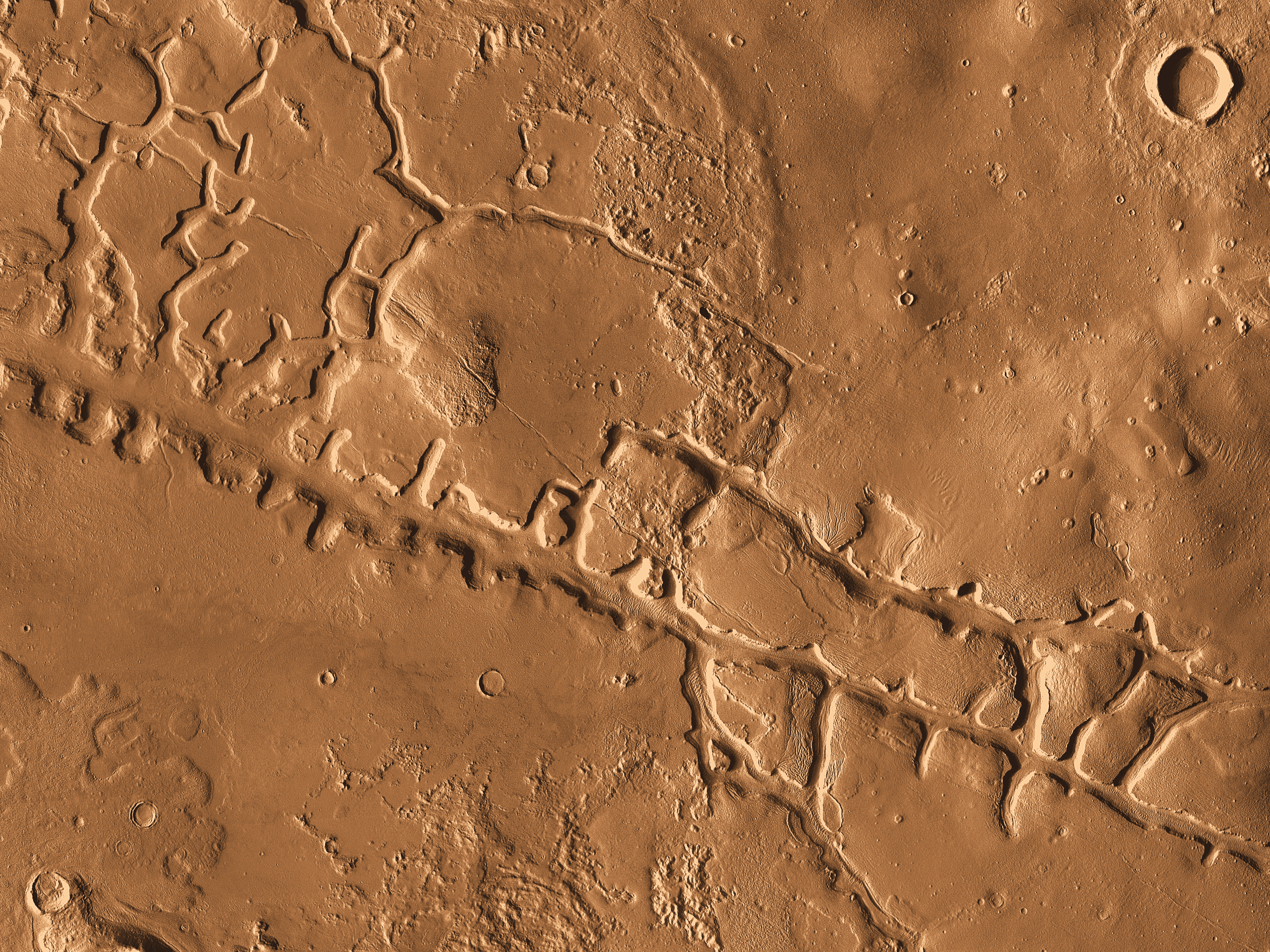
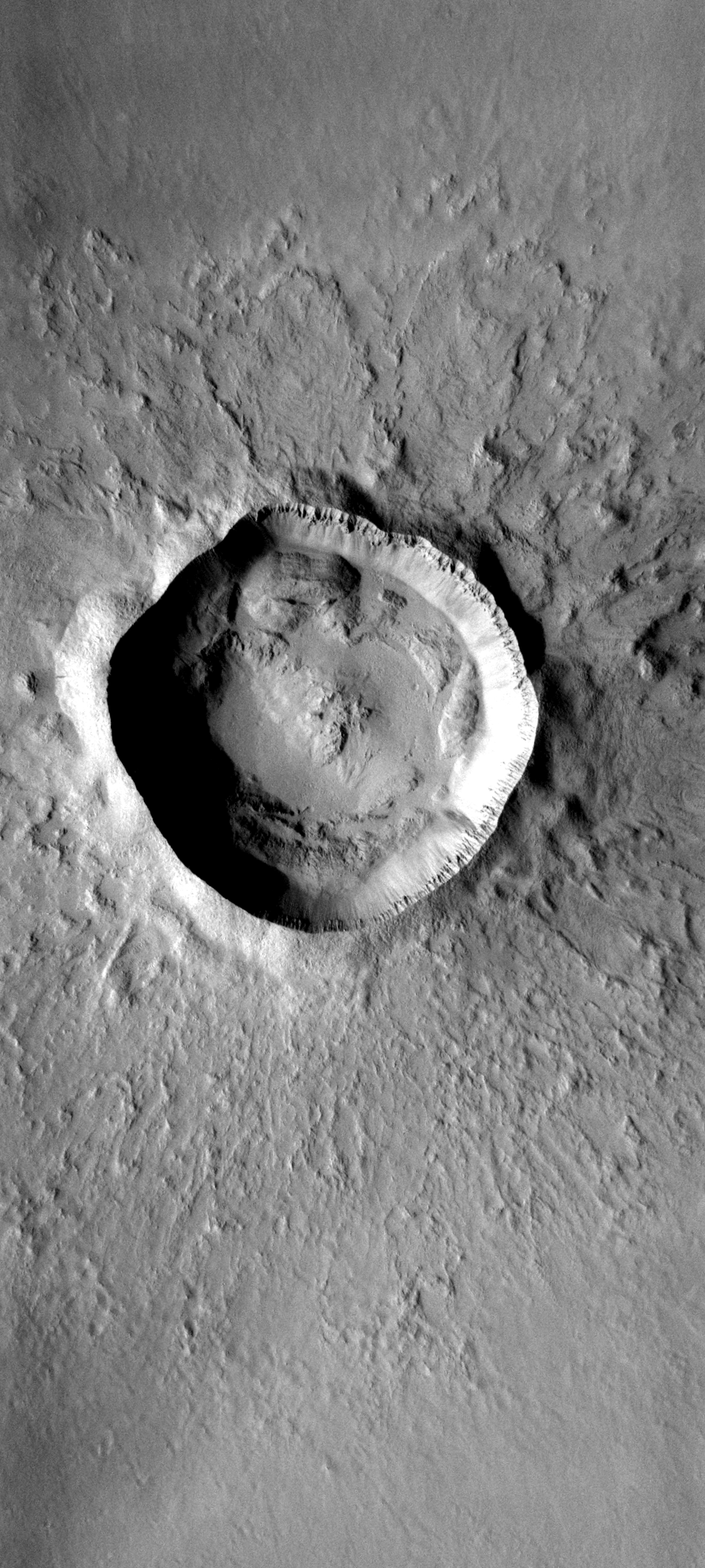
Today's Image of Mars shows how drastically one impact can change the Martian landscape. Scientists believe that one impact near the edge of Noctis Labyrinthus set off an enormous landslide into the canyon. The landslide spans over 25 km, bigger than most of the other landslides within this canyon. What was the source of this landslide?
Click to see high resolution image from THEMIS.
Credit: NASA/JPL/Arizona State University, R. Luk.

There is an approximately 6km wide crater (left center) that scientists speculate caused the massive landslide. This just goes to show that Mars is an ever changing environment and that new discoveries can be made everyday. What one day may look like a boring slab of rock, could the next day be struck by an asteroid, revealing something magnificent and never before seen.

Throughout the course of the planets history Mars has been impacted millions of times by asteroids and comets. On occasion these impacts have ruptured underground water reservoirs, causing water to flood the surface. While this has not happened in recent history, scientists speculate that these underground aquifers still exist on Mars today, which means that at any time one of them could crack, spilling massive amounts of water onto the surface. While the possibility of that happening is very small, it is just that, a possibility.

Let us hope that one day an asteroid does rupture an underground water reservoir because that might get people interested in Mars again, which would mean that we'd get more funding for future missions!

Mars Photo of the Day - May 15 2012

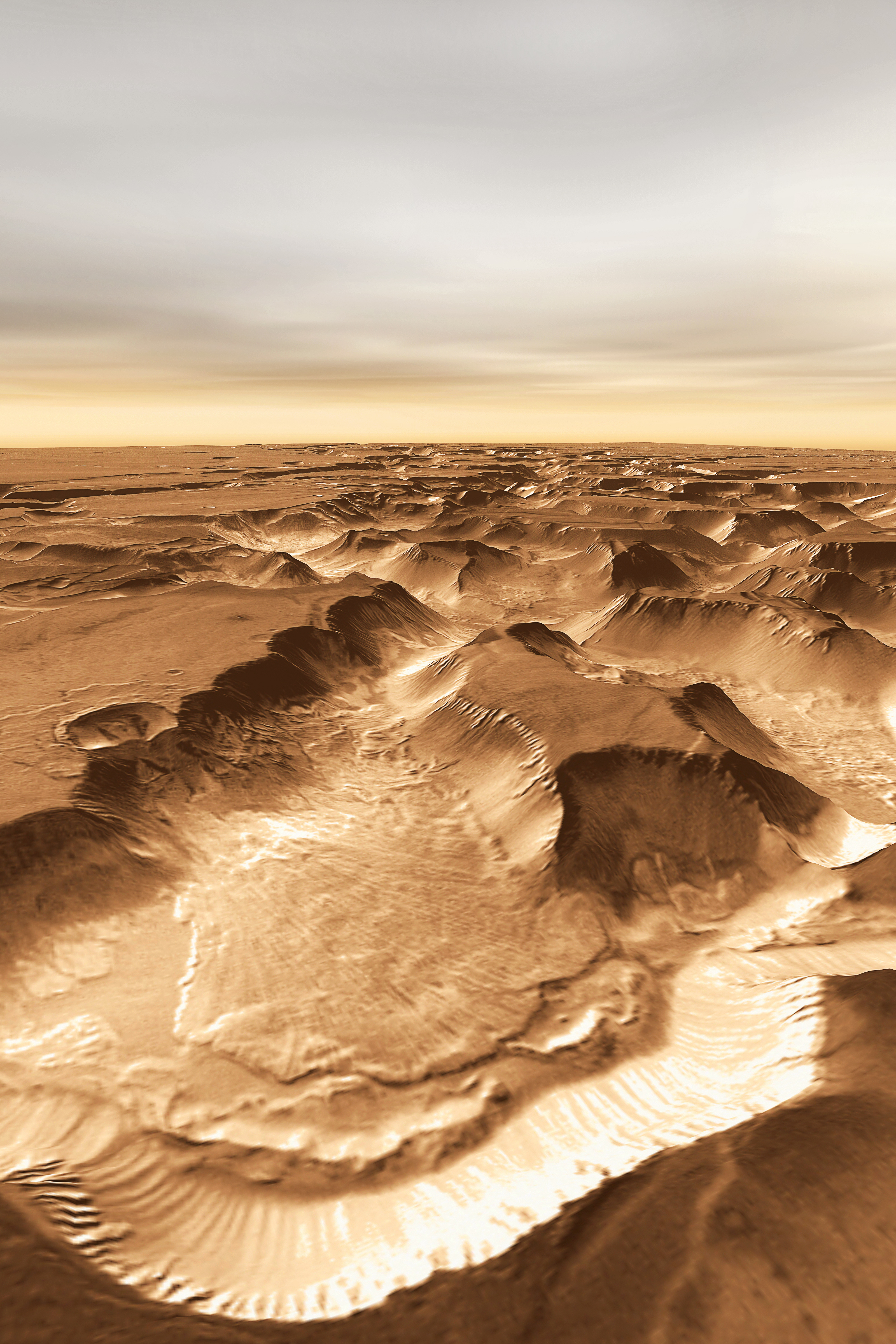
Today's Image of Mars shows the Tharsis Trio (Arsia, Pavonis, and Ascraeus Mons) and Olympus Mons off to the Northwest. This image is very similar to one previously showcased by Mars Travel from the European Space Agency's Mars Express.

The Tharsis Trio are aligned in almost a perfect line pointing Northeast. Scientists speculate that all these volcanoes formed from a larger fracture/vent system that caused the three initial eruptions that created the Tharsis Trio. In other images you can see the vents pointing Northeast from Arsia Mons toward Pavonis and Ascraeus Mons, which lend credence to this theory. 

As far as I can tell this image was taken by Mars Odyssey Orbiter's THEMIS (please correct me if I'm wrong) Click on this image to see the original high resolution image.


Mars Photo of the Day - Mar 27 2012

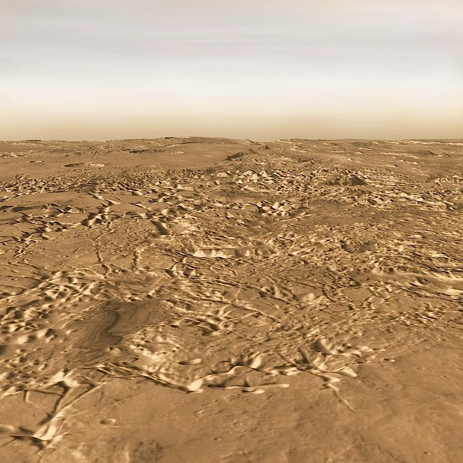
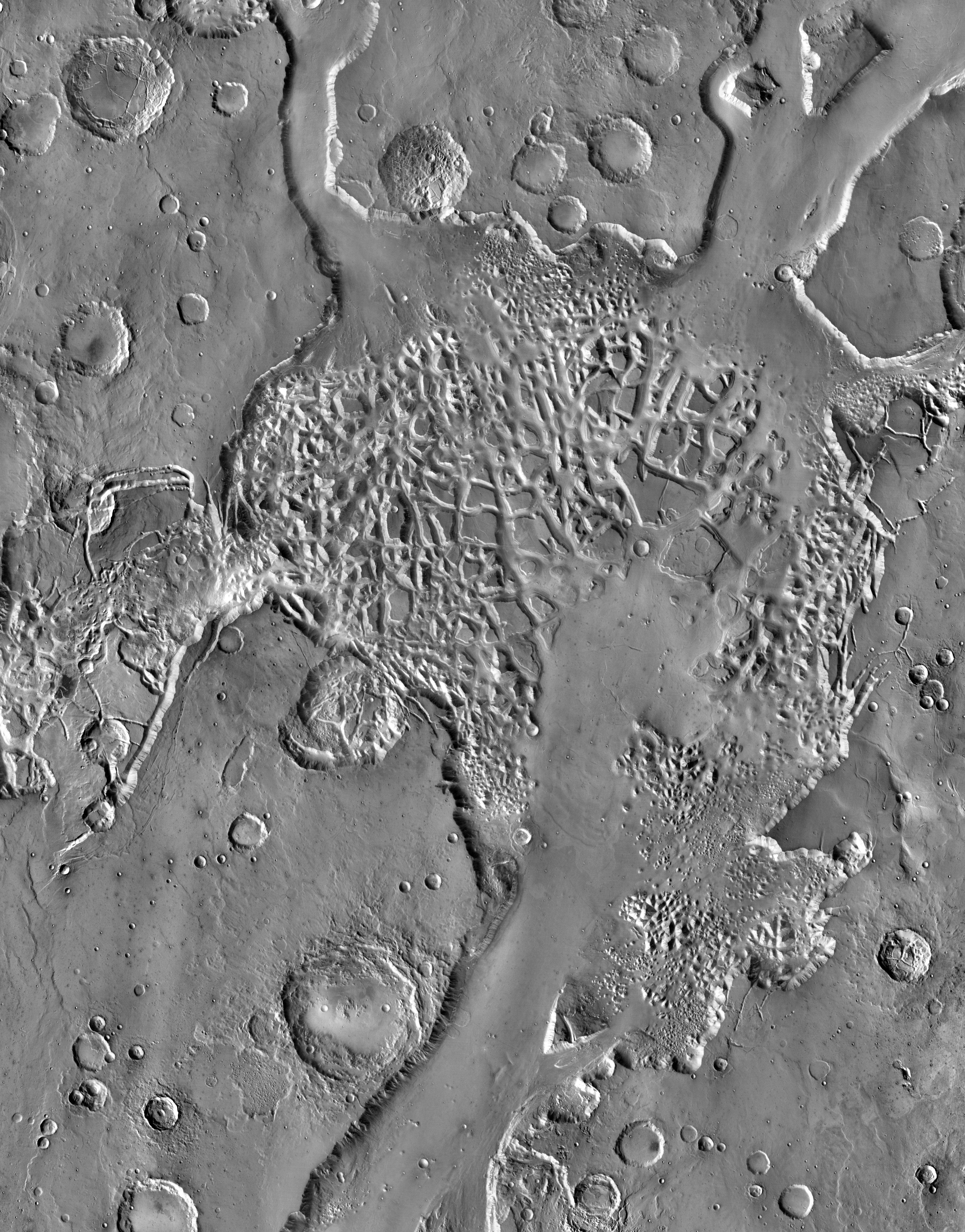
Today's Image of Mars comes from THEMIS shows some very intricate chaotic terrain in Hydraotes Chaos. Chaotic terrain is typically made up of valleys punctured with numerous mesas and hills, as well as occasional pits. These features usually combine in a way that makes them seem patterned. The terrain in the center resembles a spiderweb, with many interlocking features.

Hydraotes Chaos measures about 300km from East to West and 350km from North to South and lies in a valley leading northeast out of Ganges Chasma to the east of Valles Marineris. The channels in this image were created by catastrophic flooding of the region approximately 2-3.8 billion years ago.

This dating was determined by counting craters on the surface, a method used by scientists to determine the relative age of terrain on extraterrestial bodies. The idea is that the more craters there are, the older the feature is since a recent feature is less likely to have been impacted by as many asteroids.

This image is so small because if I make it any bigger it will take forever to load. To see the original, huge, high resolution image, just click on it. [See the original article on Hydraotes Chaos]


Mars Photo of the Day - Mar 18 2012

Today's Image of Mars comes from THEMIS and shows a filled crater in the Tharsis Quadrangle. The only indication that this had once been a crater is what remains of the rim.

Before a crater becomes filled like one below the lava must break through the raised rim by pushing through gaps or weaknesses. Once it does this the lava pours into the crater, widening the gap in the rim and filling the crater. 

Clicking on the image will take you to the original high resolution version from THEMIS. 


Mars Photo of the Day - Mar 17 2012

Today's Image of Mars was taken by Mars Odyssey Orbiter's THEMIS and shows Galaxias Fossae, a 400km long fault cutting through Utopia Planitia. It is thought that Galaxias Fossae was created by lava that forced its way into a small vertical crack in the crust and expanded it. 

Galaxias Fossae - Clicking on this image will take you to the high resolution version from THEMIS. [Read their article]
The fault that originated Galaxias Fossae was likely created by the growth of the Elysium Volcanoes. Into that underground fault a small ribbon of molten rock forced it's way through, making the fault wider and bringing hot rock closer to the surface. That hot rock then encountered ground that was saturated with water and ice. The hot rock caused the ice to melt, which made the ground collapse.

Mars Photo of the Day - Mar 16 2012

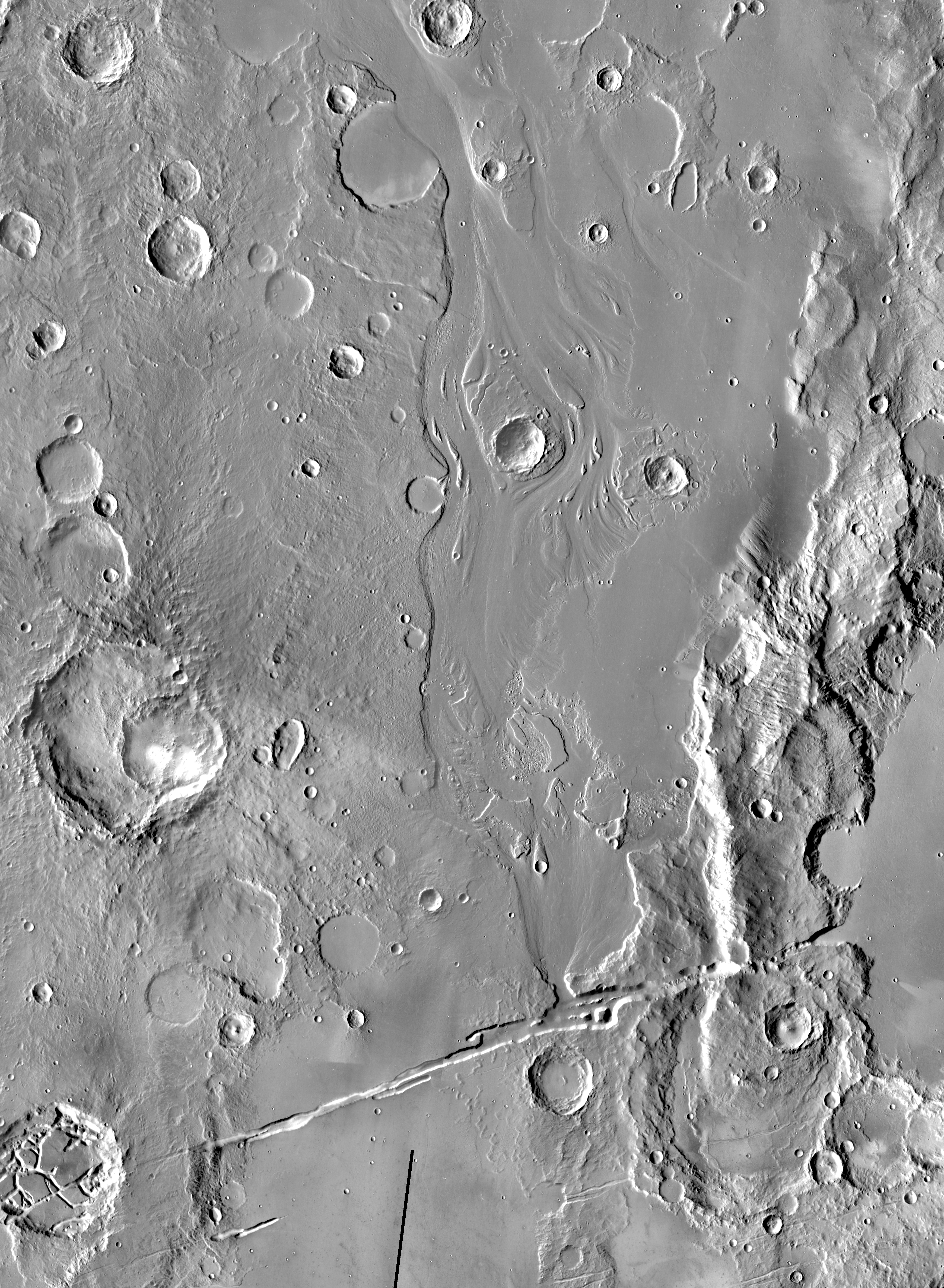
Today's Image of Mars shows what was once an island in the middle of a Maja Valles,  a large sea on Mars, as taken by THEMIS aboard the Mars Odyssey Orbiter. The valley was created by a huge torrent of water likely released from a ruptured underground aquifer. If you can imagine, the water came rushing into the area, pushing everything in it's path aside and leaving the relatively smooth surface we see below.

The small island we see below was terrain raised high enough above the water that it wasn't covered. We can see that at some point this island may have been hit by an asteroid near it's bottom tip. If the asteroid hit while there was still water present that would explain why there are no visible remnants of the impact anywhere else but on the island. 

Clicking on this image will take you to the original high resolution image from THEMIS.


Mars Photo of the Day - Feb 29 2012

Today's Image of Mars shows clouds in The Red Planet's North Polar Region obscuring the view of Mars Odyssey's THEMIS. Some of the lower portion of this image is entirely shrouded by clouds, so much so that THEMIS can't even make out the surface.

Clouds on Mars are generally 10-15km above the surface and primarily made up ofsublimated carbon dioxide ice. Occasionally the clouds will be made up of tiny water particles. That doesn't mean it rains on Mars though! 

Mars is so cold that it couldn't rain, but scientists speculate that it does snow! Scientists have only seen snow fall in the upper atmosphere a few times and have no evidence that it ever reaches the surface, but who knows! Maybe it only happens every so often, like a leap year every four years! (See how I worked that in there? Don't worry, you can hold your applause!)

Clicking on this image will take you to the high resolution image from THEMIS. [See Universe Today's caption for a subimage of this one]


Mars Photo of the Day - Feb 26 2012

Today's Image of Mars comes from Mars Odyssey Orbiter's THEMIS and shows Mangala Valles, which was created when Mangala Fossae released a torrent of ground water, carving out the 900km valley we see below.

There is substantial evidence that Mars once had, and may still have underground ice and water. In some underground reservoirs the water cannot break through the rock encasing it, so it has built up over billions of years. When something, like an asteroid impact, ruptures the surface it releases the water onto the surface creating an outflow channel, or valley, like the one below.

Clicking on this image will take you to the original high resolution image from THEMIS. [See their article on Mangala Valles]

Mars Photo of the Day - Feb 5 2012

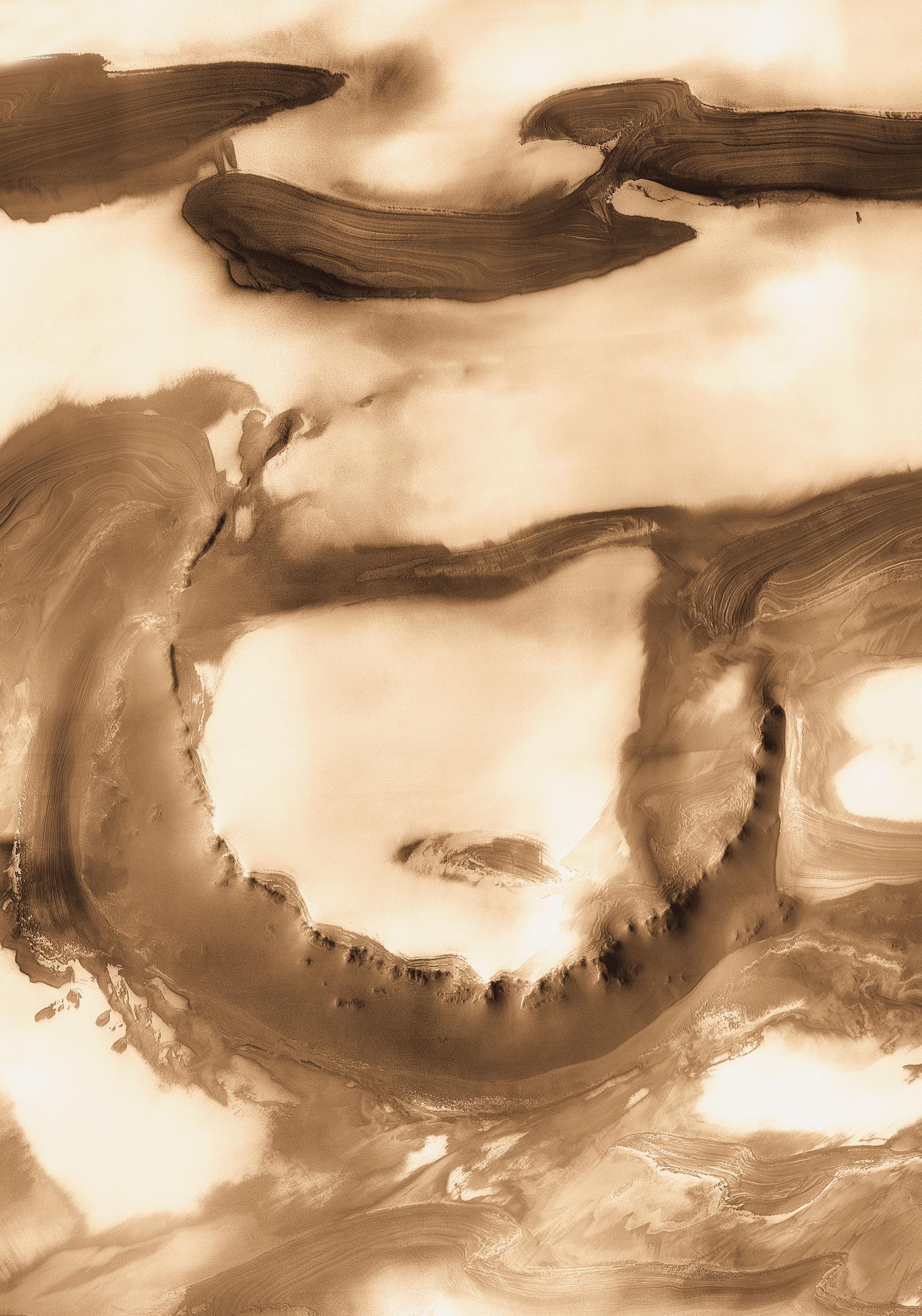
Today's Image of Mars is of Udzha Crater, as taken by the Mars Odyssey Orbiter's THEMIS. Udzha Crater is 45km in diameter, but has been almost entirely covered by layers of ice and dust, so much so that only the highest part of the crater rim rise above the polar deposits and hint at its circular form. 

Unfortunately there wasn't much information on Udzha Crater, so I created a Wikipedia page with the information I gathered. It is the first of many Wikipedia pages that Mars Travel will contribute to!

Clicking on this image will take you to the original high resolution image from THEMIS. 


Mars Photo of the Day - Jan 23 2012

Today's Image of Mars shows a portion of Cerberus Fossae, a series of roughly parallel fissures in the Cerberus Region measuring 1,630km long. Cerberus Fossae was formed from faults created by the formation of the Elysium Volcanic Field. It passed through preexisting features, like hills, which indicates that the faults are relatively recent.

Research suggests that the formation of Cerberus Fossae released massive amounts of pressurized underground water, which led to the creation of Athabasca Valles, a large outflow channel on Mars.

Clicking this image will take you to the original high resolution image from Mars Odyssey Orbiter's THEMIS. [See the original THEMIS caption]


Mars Photo of the Day - Jan 15 2012

Today's Image of Mars is a north-looking view of Iani Chaos, the source for the huge outflow channel, Ares Valles. The features that you see in this image were created by enormous amounts of ground water that erupted from an underground reservoir when it became ruptured by geologic faults. 

Iani Chaos was considered a candidate landing site for Mars Science Laboratory because of the large role of water in its formation. Two Mars orbiters (Mars Global Surveyor and Mars Express) have found mineralogical evidence that there was once an abundance of water in Iani Chaos. They found hematite and gypsum in the area, two minerals that are only known to be formed in the presence of an abundance of water.

Clicking on this image will take you to the original article on floods in Iani Chaos by the THEMIS team.


Mars Photo of the Day - Dec 27 2011

Today's Image of Mars shows Zunil Crater, located in Mars' Cerberus Plains, the youngest (least cratered) large lava plain on Mars. This 10km in diameter crater was created just a few million years ago. The impact is thought to have created 10 million secondary craters measuring 10m in diameter or larger. These secondary craters reach as far as 1600km.

It is thought that the Zunil impact crater could be the source of many shergottites, or meteorites from Mars that fall to Earth. Shergottites from two different periods (1.5 and 2.7 million years ago) are known to exist.

This image was taken by Mars Odyssey Orbiter's THEMIS camera. Clicking on the image will take you to the original THEMIS page.


Mars Photo of the Day - Nov 25 2011

Today's Image of Mars is of crescent shaped depressions on the surface created by strong winds.  The Earth equivalent are called blowouts, but occurrences on Mars are much larger than those on Earth. This image is from North Azimuth on Mars, but there are many similar features in other parts of Mars. 

On Mars, wind is the currently the primary cause of erosion. [How strong are the winds on Mars?] There is evidence that water helped shape much of the Martian surface, but over billions of years Mars is now devoid of the massive seas, rivers, and lakes that once played a part in shaping the planet.

This image links to the original image page from Mars Odyssey's THEMIS.


Mars Photo of the Day - Nov 22 2011

Today's Image of Mars is of a crater filled in by lava flows from the volcano Arsia Mons, one of the northern most Tharsis volcanoes. 

What's amazing about this crater is the fact that the rim remains almost entirely intact.  Oftentimes all evidence of an impact will be erased by a lava flow, but not in this case. The lava flows surrounded this crater and eventually broke through the crater rim, filling it to the same level as the surrounding terrain, but the rim is still distinct.

Clicking this image will take you to the original captioned image from Mars Odyssey Orbiter's THEMIS.

Source: THEMIS

Mars Photo of the Day - Nov 18 2011

Today's Image of Mars is of Gale Crater as taken by Mars Odyssey THEMIS. Between August 6 and August 20 2012 Mars Science Laboratory Curiosity is set to land at Gale Crater.

Gale Crater is 150 kilometers (around 93.21 miles) in diameter and contains an enormous mound near the center that rises even higher than the southern rim of the crater. It rises 5.5 km above the northern crater floor and 4.5 km above the southern crater floor. The mound contains many layers; it is estimated that its foundation may be as old as 2 billion years old. Curiosity will be able to examine these different layers and determine at which point, if any, Mars was able to support life. It is speculated that the mound is what remains of sedimentary layers that once filled the entire crater and that these were initially deposited on a lake bed. 

This image will link to the original full page, high resolution image from THEMIS. Be sure to check back soon because I'll have an article on the whole Mars Science Laboratory mission!


Mars Photo of the Day - Nov 6 2011

Today's Image of Mars is of a channel in Tyrrhena Terra. Tyrrhena Terra is located just northeast of Hellas Basin. This image is evidence that water once flowed on Mars, but who really needs evidence of that anymore?

This image was taken by Mars Odyssey's Thermal Emissions Imaging System (THEMIS) on Sept 22 2011. Clicking on this image will take you to the original page from THEMIS.


Mars Photo of the Day - Nov 5 2011

Today's Image of Mars is of Arsia Mons, the southernmost of the Tharsis volcanoes. This volcano is larger than any on Earth, measuring nearly 12 miles high and over 270 miles wide. 

The fractures in the top right and bottom left of the image are aligned with Pavonis Mons and Ascreaus Mons to the Northeast. This may represent a large fracture or vent system that was responsible for the eruptions which created the volcanoes.  

This image was taken by the Thermal Emissions Imaging System (THEMIS) aboard Mars Odyssey Orbiter. The image was released to the public on June 13 2005. Click the image to see the original captioned image from THEMIS.


Mars Photo of the Day - Oct 16 2011

Today's Image of Mars is of a doublet crater, which occurs when two meteorites impact at the same time. The shock waves that emitted from the double impact created the slight central rim and the wing-like debris visible on the outside of the rims.

This image was taken on December 19 2010 by Mars Odyssey Orbiter's Thermal Emission Imaging System (THEMIS). Click the image to see the informational page from the THEMIS site. 


Mars Photo of the Day - Oct 15 2011

Today's Image of Mars is of Athabasca Valles, an outflow channel on Mars created by catastrophic flooding. The source of water for the flooding is most likely Cerberus Fossae, a series of fissures and scarps on the surface of Mars. 

It's difficult to tell how long ago the floods in Athabasca Valles occurred because they have almost entirely been covered by a lava flow the size of Oregon. This lava flow is considered the youngest discovered on Mars and is believed to have developed during the Amazonian Epoch, around 3 billion years ago.

This image links to the original captioned image from Mars Odyssey Orbiter's Thermal Emission Imaging System (THEMIS).