
Today's Image of Mars was taken by Mars Odyssey Orbiter's THEMIS and shows Galaxias Fossae, a 400km long fault cutting through Utopia Planitia. It is thought that Galaxias Fossae was created by lava that forced its way into a small vertical crack in the crust and expanded it.
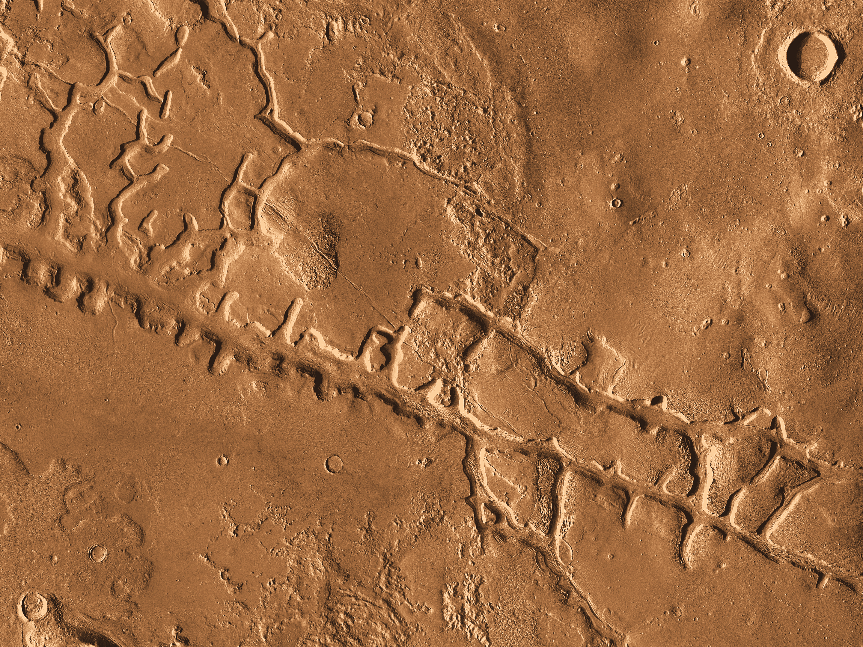 |
| Galaxias Fossae - Clicking on this image will take you to the high resolution version from THEMIS. [Read their article] |
Why did the ground collapse? Because when you melt ice its total volume decreases and the ground was so saturated with ice that this caused a huge increase in ground density because the mass stayed the same, but was now distributed over less space. When that density increased and the ground contracted, it collapsed, forming what we see below.The same thing happened to a lesser degree in the channels branching off from the primary fault.
We can't forget to talk about that crater in the top right of this image because it is even further evidence that the ground was saturated with water. Scientists determined the ground was saturated at the time of impact by examining the ejecta pattern, which is much smaller than it would have been if the ground was dry.
So what happened to all the water that once saturated the surface?
Scientists using gamma-ray and neutron spectrometers on Mars Odyssey have discovered that an abundance of hydrogen atoms lie at depths of only one or two meters below the surface in this area and many others on Mars. They speculate that this is indicative of water just below the surface. Perhaps one day we will be able to drill a couple meters down and sample that water!
0 comments:
Post a Comment