Google+ Mars Travel: Mars Photo of the Day
Showing posts with label Mars Photo of the Day. Show all posts

Mars Science Laboratory's First Autonomous Drive

On Mars Science Laboratory (MSL) Curiosity's 376th sol on Mars (August 27 2013) the rover completed its first autonomous drive on Mars, when its computers chose a route and drove the rover for 10 meters (33 feet) through previously uncharted terrain before stopping. This feature analyzes photos taken by MSL to determine a safe path ahead, enabling the rover to safely and efficiently cover ground on its own, without guidance from human controllers. This technology can identify safe routes beyond what human controllers are able to assess; thus MSL can move further every drive. 

As Mark Maimore, MSL driver and mobility engineer, explained "Curiosity takes several sets of stereo pairs of images, and the rover's computer processes that information to map any geometric hazard or rough terrain. The rover considers all the paths it could take to get to the designated endpoint for the drive and chooses the best one." 

Below is a mosaic of many images taken immediately following that drive. Click the image to see it in high resolution.

Mosaic of images taken by MSL on its 376th Sol on Mars. East is left and North is right (Southwest is center)
Source: NASA/JPL (Click Image for High Resolution Version)

The large mound in the left of the image is not Mount Sharp, but rather it is called Discovery Ridge and contains rocks no larger than .3 meters (1 foot) in diameter. The rise to the right of Discovery Ridge is wind-deposited material that has accumulated on the surface. This accumulation of material is approximately 4 meters (13 feet) long and lies approximately 10 meters (33 feet) from Curiosity

Kasei Valles and Echus Chasma

Most people know by now that Mars once contained a massive amount of water on its surface. It was during this period that Kasei Valles (shown below) was created by flood waters on Mars.

Kasei Valles
Image Credit: European Space Agency's Mars Express

One of the largest outflow channels on Mars, Kasei Valles measures 3000 km in length with a depth of 3 km, spanning a total of 1.55 million square kilometers.

Kasei Valles
Source: HiRISE
Within Kasei Valles lies the remains of Sharanov Crater, which had its southern rim collapsed by the floods that created the valley. This 100 km wide crater is depicted at top center in the below perspective view of Kasei Valles.

Sharanov Crater in Kasei Valles perspective view
Image Credit: European Space Agency's Mars Express

The floods that created Kasei Valles are thought to have emanated from Echus Chasma, which is imaged below. Echus Chasma spans 100km long and 10km wide and cuts into Lunae Planum, which is north of Valles Marineris.

Echus Chasma
Image Credit: European Space Agency's Mars Express
Echus Chasma was likely created when an impact or tectonic shift released water from a pressurized acquifer. Much like a dam breaking with enormous pressure, the force of the water ruptured the ground, leaving the incision we call Echus Chasma.

Echus Chasma
Image Credit: European Space Agency's Mars Express
The resulting release of water flooded the area directly north of Echus Chasma, thus creating Kasei Valles.

Western Rim of Endeavour Crater Digital Terrain Model

The labeled image below is a digital terrain model (DTM) of the Western rim of Endeavour Crater overlain with a northward perspective from HiRISE and compositional data from the Compact Reconnaissance Imaging Spectrometer for Mars (CRISM). This is the area Mars Exploration Rover Opportunity has been investigating since 2011.

Click to see hires version from HiRISE

This image has been instrumental in planning Opportunity's movements and continuously developing mission. As indicated in the image above, orbital data has identified areas where clay (red), sulfate (green), and volcanic (blue) minerals could be present. Clays and sulfates are indicative of a watery past on Mars as they often only form in the presence of significant moisture.

Opportunity is currently around Cape York, but heading south in an attempt to discover more about the geology of Endeavour Crater.


1.3 Billion Pixel Mosaic from Mars Science Laboratory

Below is a panoramic mosaic of Mars compiled from almost 900 images taken by Mars Science Laboratory. Click on the image to see the interactive photo with over 1.3 billion pixels, then zoom in on any feature that interests you!

Click above to view the interactive 1.3 billion pixel image from MSL Curiosity!
Source: NASA/JPL

This images used to create this mosaic was taken while Curiosity was at Rocknest between October 5 and November 16 2013. The center of the image is directly south of the rover, while the right and left edges are north of it.

Definitely click on this image so that you can view all 1.3 billion magnificent pixels of Mars!

'Rat' on Mars

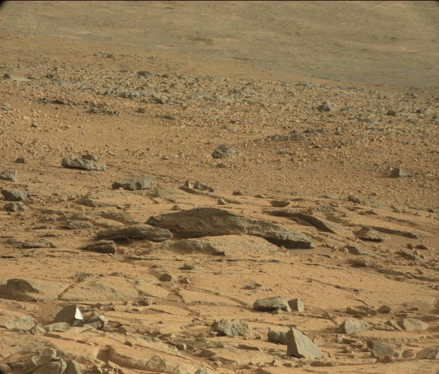
Recently a lot of people have been talking about a 'Rat' on Mars, so I thought I'd show you what all the fuss is about. To see this supposed 'rat' click on the first image for the high resolution version from NASA then zoom in on the upper left corner. See anything?

Click on the image for the High Resolution version from NASA then zoom in on the upper left corner. See anything?
What you might think is an animal is actually a psychological phenomena called pareidolia where your brain interprets vague objects as familiar shapes, or in this case, an animal.  This is an evolutionary trait in humans that once allowed us to easily identify predators on the horizon because we could easily identify their faces and features

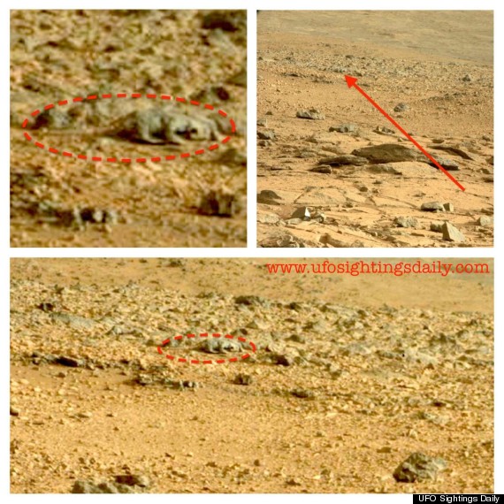
In case you can't find the 'rat' in the photo above, I've included the zoomed in and circled version that Huffington Post compiled from UFO Sightings Daily below. UFO Sightings Daily was the first to report on the 'rat'.

While I believe this 'rat' on Mars is simply pareidolia, yet again on Mars, I leave it up to you to decide whether it is a 'rat' or simply your mind playing a trick on you. 

Examining Images of Aureum Chaos for Change

The primary source of erosion on Mars today is the wind. Scientists try to learn more about the wind and the changes it makes to the surface by studying images of Mars. To find these changes we often have to examine two pictures from a location taken at different times. This is true of the below photos taken of Aureum Chaos.

Acquired two Mars years ago. Source: HiRISE

Source: HiRISE

Although the above images are not exact overlays of one another, one can still pinpoint areas present in both images. Once done scientists can determine if there have been any changes or movements to material in the area. Although a preliminary look shows no changes in the past two years, a more fine-tuned examination will likely reveal minor changes.

Studying changes to the terrain allows scientists to assess the real affect of the wind on the environment. Knowing this will help us to know what we might see on the ground and what to watch out for on future prolonged missions to the surface. Imagine if you are living on Mars and you wake up one day to see rocks moved and sand displaced you might be disconcerted, but if you know about the wind you won't worry as much. Understanding how much effect the wind has on the surface also ensures that scientists take frequent images of landing areas because they know what might be a smooth area one week could be rocky terrain the next.

Studying images like the ones above ensures scientists learn the most they can about the wind on Mars and its effects on the environment.

Nearly 90% of Mars Mapped by Mars Express

Earlier this month the the ESA made an astounding revelation: their Mars Express Orbiter's High Resolution Stereo Camera (HRSC) has successfully mapped nearly 90% of Mars' surface! Thus far 87.8% of the surface has been imaged, with 61.5% being imaged at a resolution of 20m per pixel or better. Mars Express was launched just ten years ago this June, making this feat even more remarkable.

The below map is a mosaic of 2702 individual images showing the entire Martian globe. The latest image was taken on the orbiter's 10,821st orbit of Mars, which took place on 20 June 2012 orbit. This map does not include areas that were particularly affected by dust and/or atmospheric distortions; these areas are shown in black.

Click to see the ESA's caption for this photo. From there you can download the high resolution version.

The slight change in color tones is primarily due to changes in Mars Express' solar elevation, but can also be attributed to variations in dust content in different parts of the atmosphere. I encourage you to go to the ESA's website (just click the above image) and download their high resolution version! Once you do that, try and find some of the more prominent features on Mars, like Olympus Mons (top left) and the Tharsis Trio (below Olympus Mons and to the right), or Valles Marineris (further right of the Tharsis Trio).

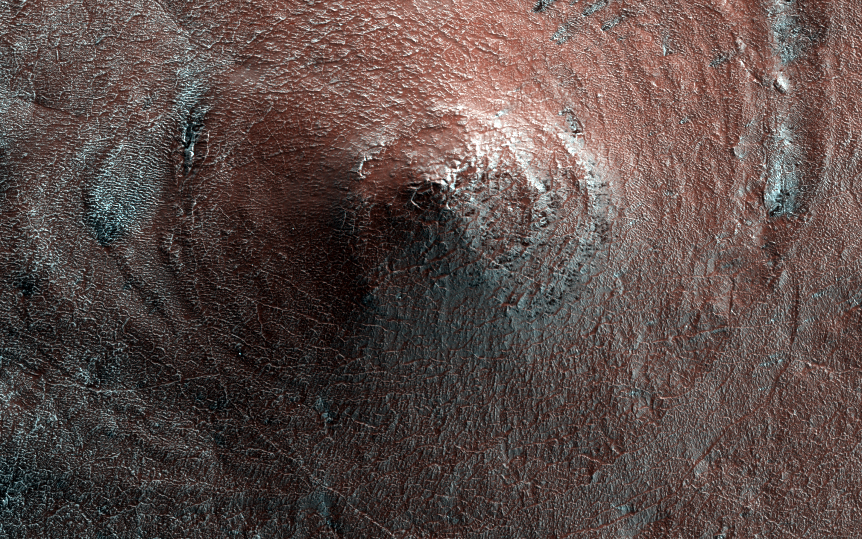
Cone-Shaped Hill on Mars

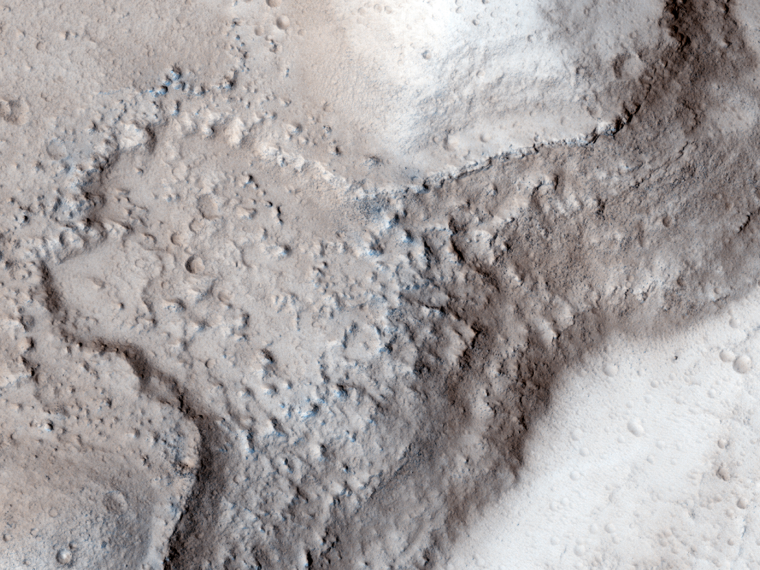
In the South Polar Region of Mars' Promethei Lingula there is an unusual cone shaped hill, measuring about 20-30 meters high. The white streaks are areas where carbon dioxide ice has not yet thawed. The unusual shape of this hill can likely be attributed to large scale erosion. Scientists still aren't sure why the area wasn't eroded evenly, but as they study more images of features like this they will gain a better understanding of the environment that created them.

Click to see HiRISE's original high resolution version. [See HiRISE caption]


One possible way this cone-shaped hill was created would have occurred long ago, when it once rained on Mars. A meteor could have hit the area, creating a crater, which would eventually developed a central uplift. After millions of years of rainfall the central uplift would have been smoothed out to what we see above, as the water flowed down its slopes. Over millions of years the distinguishing characteristics of the surrounding crater would have been washed away by the rain, blending it into the regional terrain. That's just a theory and an example of the fact that we may never know what caused this feature on Mars to develop.


ESA's New ESTRACK Antenna Receives a Photo of Mars

Take a look at this image of Mars beamed back from the European Space Agency's Mars Express Orbiter to Europe's newest deep-space ESTRACK tracking station in Malargüe, Argentina. Mars Express used its Visual Monitoring Camera to take this image of Mars from 9,761 km (5065 mi) away.


It took the signal 18 minutes to cross the 327M km (203M mi) expanse of space between the Mars Express Orbiter and the new space tracking station in Argentina. 

Because of the angle of the orbiter, Mars appears to be lying on its side, daylight side down. On the dayside of this photo you can see three, possibly four large volcano domes, as well as numerous large canyons. 

The new European deep-tracking station makes the ESA only the second space agency (after NASA's Deep Space Network) to have coverage of the whole sky for deep space missions. The other two large 35m Deep Space Antennas in the ESA's Estrack system are located in New Norcia, Australia, and Cebreros, Spain. However, they have multiple tracking stations throughout the world, depicted below:

The Importance of MSL Curiosity's Self-Portraits

Below is a self portrait of Mars Science Laboratory Curiosity at Rocknest created by combining dozens of high resolution images taken by the rover on 31 October and 01 November 2012. A previous self-portrait at the same location did not include the magnificent view of MSL's ultimate target, Mt. Sharp, that this photo does.

You can see in this photo the five scoops MSL took out of the soil at Rocknest in order to first calibrate its sample-handling mechanisms, then test the Martian soil to determine its content. You can also see tire tracks made by the rover as it moved into Rocknest.

If you click on the image below and zoom in you will be better able to appreciate the majesty of Gale Crater's rocky terrain. You will also get a better view of Mount Sharp and the clays that lie around the base of Gale Crater's central uplift.

Source: NASA/JPL

Self portraits like the ones above serve a couple key purposes, one of which may not be so obvious:

Five Impacts, Same Time - How?

This HiRISE image shows a new impact site within a crevice in Fortuna Fossae, east of the Tharsis Quadrangle. There are five distinct craters that were created nearly simultaneously, indicating the meteorite broke up into 5 different pieces just prior to hitting the surface. This likely happened because the object was a loosely held aggregate of material that broke apart when put under pressure by the Martian atmosphere. Each of the craters has a dark distinctive ejecta pattern surrounding it. 

Scientists estimate that the impact was created sometime between September 2005 and May 2008. Click on the image to see the original high definition image. [See the original HiRISE caption]


Five Scoops at Mars' Rocknest

This image shows the five scoops taken by Mars Science Laboratory Curiosity at Rocknest. This image was taken on 9 Nov 2012, the 93rd Martian day, or sol of MSL's mission. The fifth and last scoop was taken on the same day and is the second from the left in this image. Each scoop is approximately 5cm (2in) wide.

Why were five scoops taken? The first two and part of the third were used to calibrate the inside surfaces of the "sample-handling mechanisms" (NASA). The third, fourth and fifth scoops were analyzed by the Sample Analysis at Mars (SAM) set of instruments, primarily the Chemistry and Mineralogy instrument aboard the rover.

Click the image to see the original from NASA/JPL-Caltech

Election Day - Vote For Your Favorite Photo of Mars!

For election day we're going to have a vote! Which Mars photo is your favorite? Let me know through Mars Travel's social media!

Facebook, Twitter or Google+

Click the photos to see the original showcased images and Mars Travel posts!


Sunset on Mars
Sojourner Rover at Yogi Rock
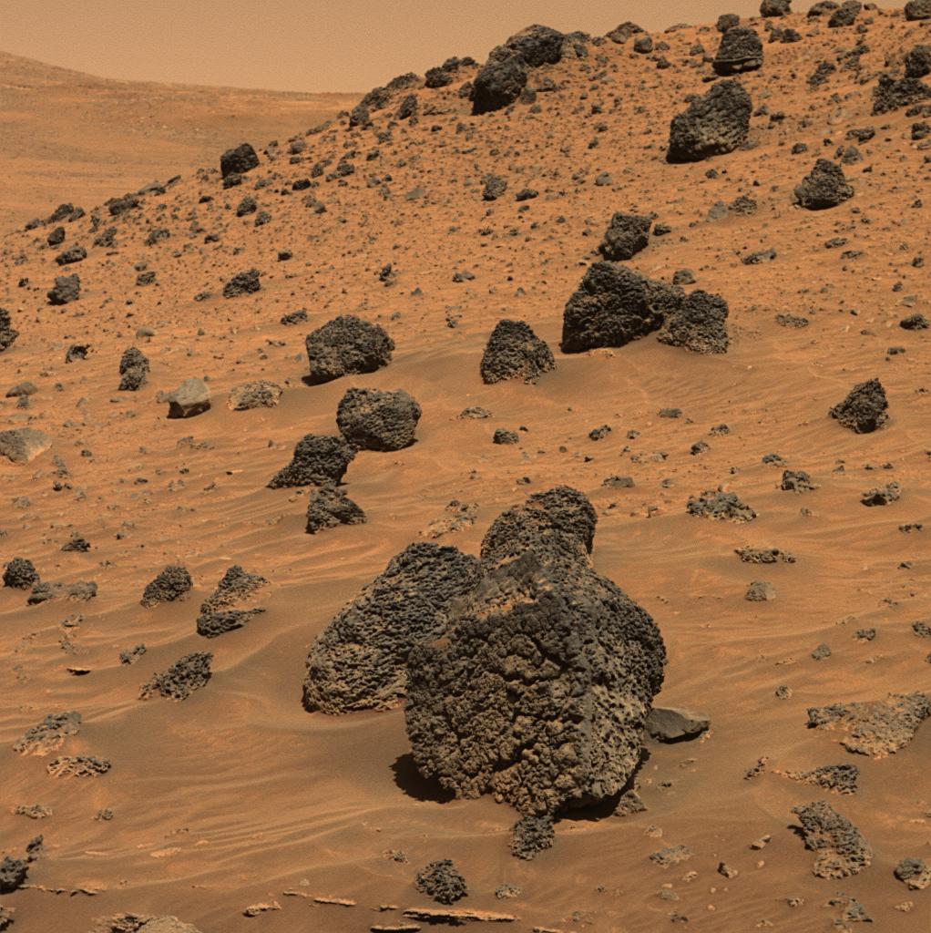
Boulders with interesting texture on Low Ridge

Nili Fossae
MSL Curiosity self-portrait at Rocknest

MSL Curiosity Self Portrait - Rocknest

This self-portrait of Mars Science Laboratory Curiosity is a masterpiece.

Click to see the high resolution version from NASA! It's worth it!

This image is a mosaic of 55 high resolution images taken by the rover's Mars Hand Lens Imager (MAHLI) taken on Halloween 2012. In this image the rover is located at Rocknest, the location in Gale Crater where MSL took its first scoop sampling. You can see four markings in front of the rover where MSL scooped the surface.

On the right side of this image you can see the central mound, Mount Sharp rising above the horizon, while in the background on the left you can see the northern wall of Gale Crater. 

Self-portrait images like this one let MSL engineers and mission specialists examine the state of the rover. Understanding the rover's condition will help to extend it's life. This self-portrait technique has been used on other Mars rovers, including Opportunity and Spirit, and helped to increase their life more than tenfold. 

Closeup of Bright Object in 'Rocknest'

Today's Image of Mars is a closeup of a mysterious bright object located at Rocknest on Mars taken by MSL Curiosity's Mars Hand Lens Imager (MAHLI). The image shows an area spanning only 4cm across, which should give you a better idea of how big these bright particles are. MSL took this image after it had taken a scoop of the terrain.

Click this image to see the high resolution image from NASA. 
The MSL team was originally worried that the bright objects could be a part of the rover that had fallen off, as this has already happened once before, but after further image analysis it was determined that these bright particles are natural to Mars. 

Mars Photo of the Day - 14 Oct 2012

Today's Image of Mars is an annotated photo of the rock Jake Matijevic, which MSL Curiosity recently examined with two different instruments. The image was taken on 21 Sep 2012, or Sol 46 of MSL's mission on Mars. 

Click to see original high resolution image from NASA.

The purple circles represent areas where the rover's Alpha Particle X-ray Spectrometer trained its gaze. The red dots are where Curiosity's ChemCam zapped the rock with its laser and examined the chemical composition of the vapors. Understanding the chemical makeup of rocks like Jake Matijevic will give scientists a better idea of the environment in which they were created.

Mars Photo of the Day - 10 Oct 2012

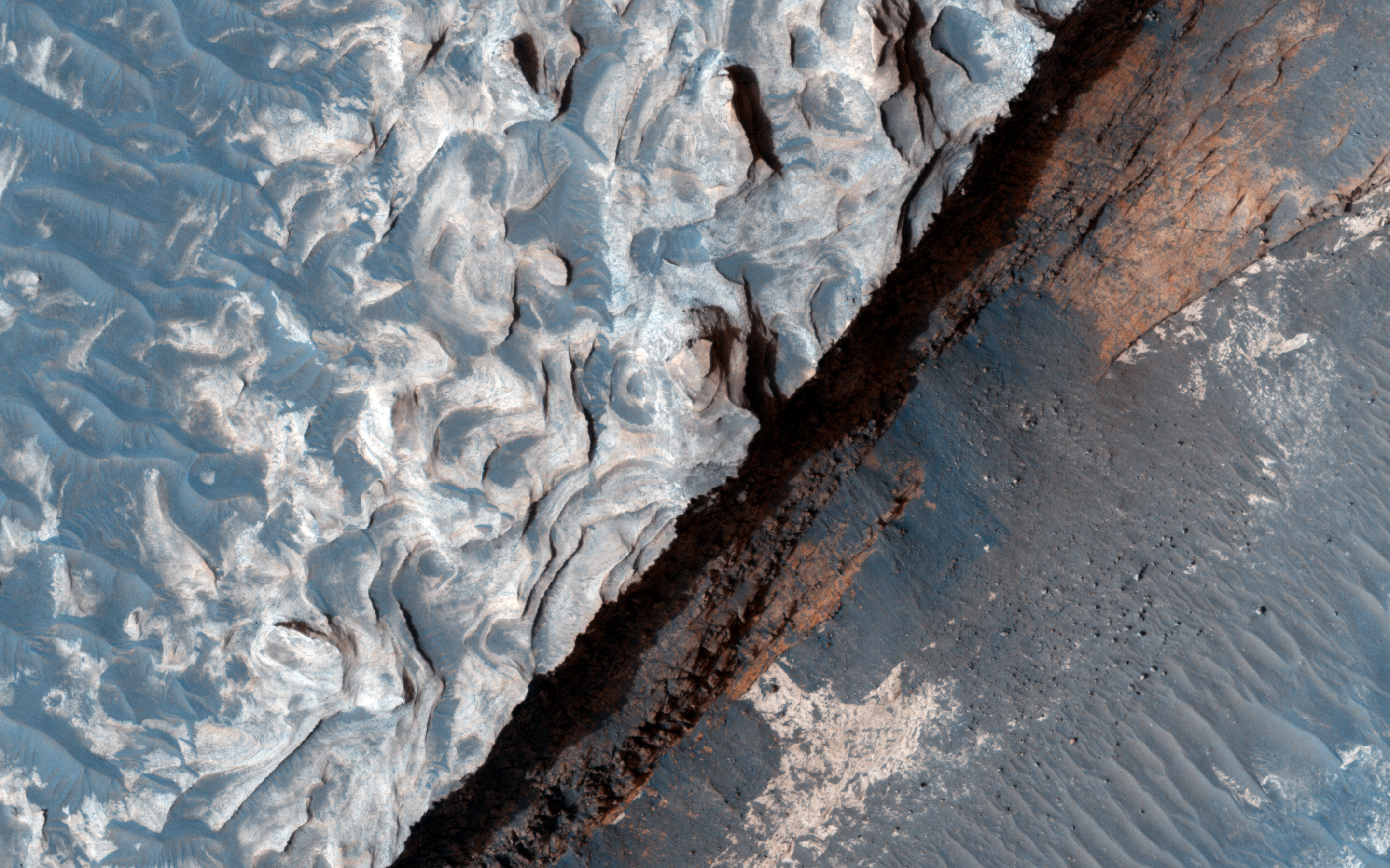
Today's Image of Mars shows an area at the base of Gale Crater's Mount Sharp where Mars Science Laboratory Curiosity will eventually explore. The darkest colored materials are deposits small grained, windblown sand. The blue areas represent unaltered igneous rock, whereas the lighter brownish-red colors are indicative of the same type of rock altered by what most scientists believe was water. 

MSL Curiosity's mission is to search for signs that Mars could have once supported life as we know it; examining minerals that have been altered by the presence of water will help us to determine that. Studying the chemical composition of these rocks will provide us with unparalleled insight into the past environment on Mars. 

Clicking on this image will take you to the original high resolution image. [HiRISE caption for the image]

Mars Photo of the Day - 30 Sep 2012

Today's Image of Mars was taken by MSL Curiosity; it shows further evidence that water once existed on Mars. What you see here are remnants of an ancient riverbed on Mars, including the prominent rock outcrop Hottah, named after Hottah Lake in Canada's Northwest Territories.

Click to see full size original
Source: NASA/JPL
This rock outcrop is a sedimentary conglomerate, meaning that it is comprised of small fragments cemented together. The outcrop is tilted up due to some sort of disruption, most likely as a result of nearby impacts and their associated tremors.

We can tell that this used to be an ancient stream because of the size and rounded shape of the small rocks/gravel and the fact that small bits of the gravel and sand sized grains are cemented into the outcrop. Because some of the cemented gravel is round and too large to have been transported by the wind, scientists believe that it was transported by fast moving water, which is further evidence for this once having been a stream/river.

Mars Photo of the Day - 26 Sep 2012

Today's image of Mars is of the first rock examined in earnest by Mars Science Laboratory, Jake Matijevik. The odd, 25cm tall pyramid shaped rock is named after the late surface operations systems chief engineer, who passed away on 20 Aug 2012. He had worked on all three other rovers, Sojourner, Spirit,  and Opportunity

The rock Jake was used to test and calibrate some of Mars Science Laboratory's many tools, including the laser attached to the rover's ChemCam instrument, which determines the rocks chemical composition by analyzing the vaporized particles. 


On 24 Sep 2012 MSL Curiosity finished up it's examination of Jake and began its longest drive thus far on the Mars, 42 meters. Over the next few days and weeks, scientists hope to test the rest of Curiosity's instruments, including it's scooping system and drill, which scientists hope will give them unprecedented insight into the composition of surface materials on Mars, as well as material that may lie right below the surface. 

Mars Photo of the Day - 20 Sep 2012

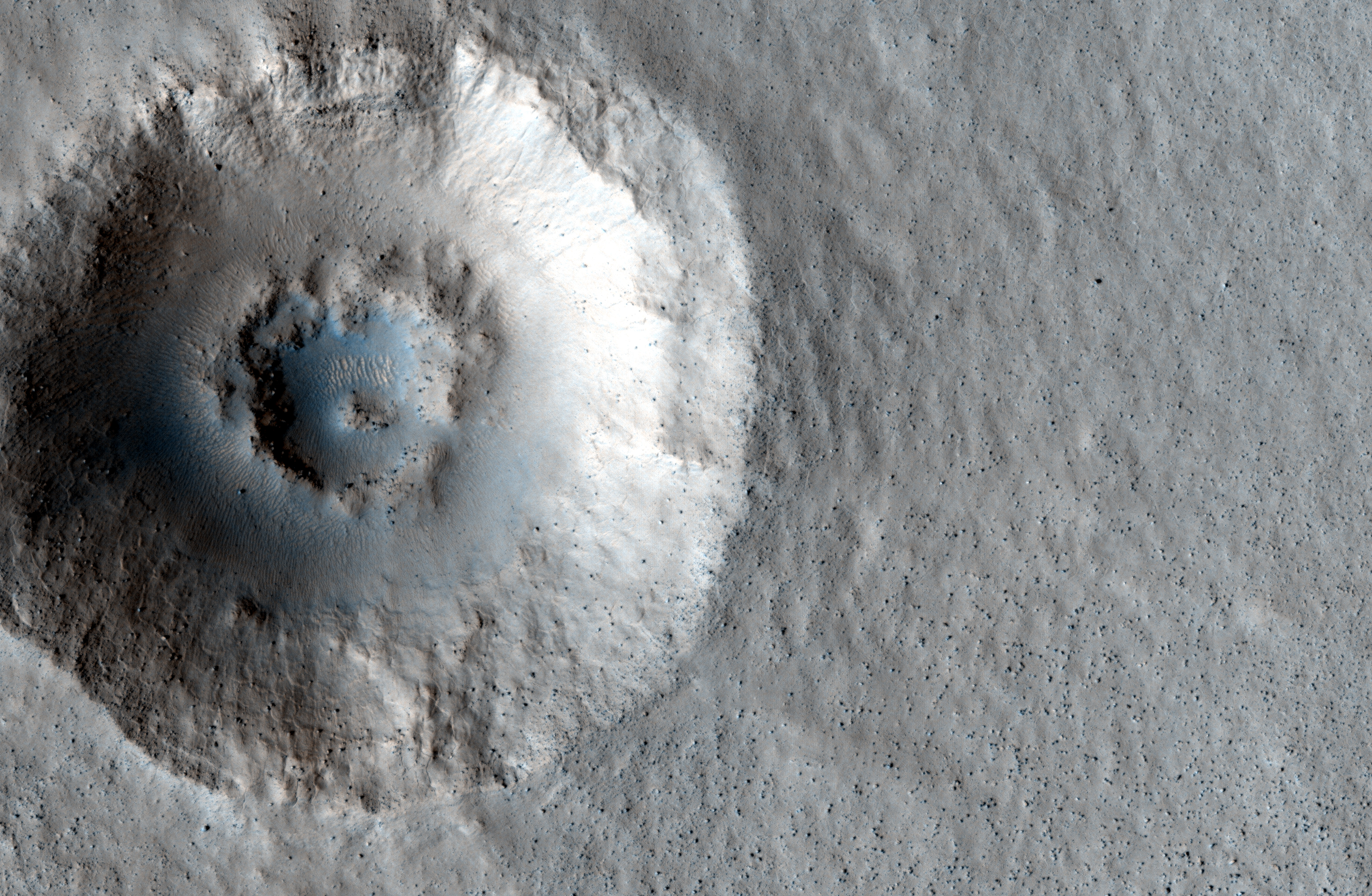
Today's Image of Mars shows two distinctive layers exposed in a 230m wide crater caused by a meteorite impact in the Northern Plains. The impact excavated material from both layers at different rates because the layers are different densities. If you want to conduct an experiment to see how this happens, follow these steps:
  • Fill a bowl halfway with water and freeze it. 
  • After it's frozen, place a layer of sugar (powdered or granular) over the surface.
  • (This is the messy part) Take a marble or other hard object and throw it down into the bowl. (The impact will eject a lot of sugar from the surface)
  • Carefully remove the marble.
  • Take a photo from above. You will notice that the marble made more of an impact in the sugar, but faced increased resistance when it hit the ice. 
This is a simplified version of what happened when the meteorite created this impact. The layer under the surface was denser so the meteorite faced much more resistance and excavated the material at a much lower rate, as seen below.

Click for high resolution image from HiRISE. [See their caption]
Radar images taken by SHARAD, the radar instrument aboard the Mars Reconnaissance Orbiter indicate the presence of ice below the surface, which makes this area a potential site for future exploration of Mars. If we can access ice beneath the surface of Mars then we could use it not only for sustenance, but as a source of fuel for future missions to Mars.