Google+ Mars Travel: 2012

ESA's New ESTRACK Antenna Receives a Photo of Mars

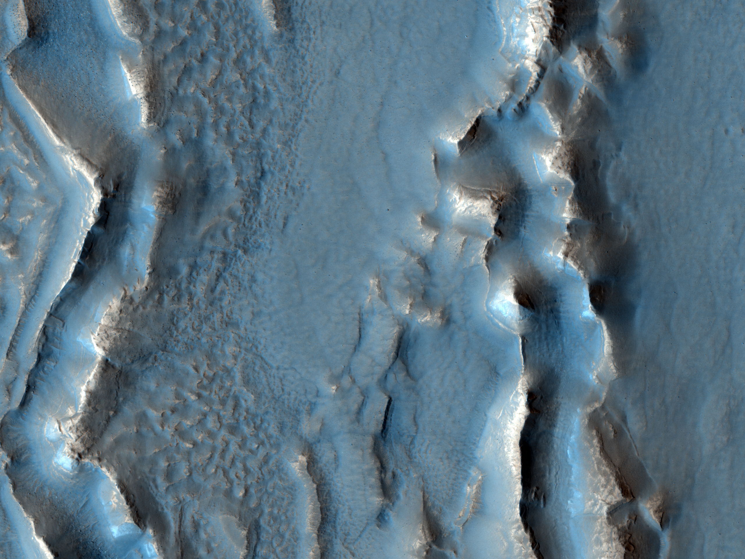
Take a look at this image of Mars beamed back from the European Space Agency's Mars Express Orbiter to Europe's newest deep-space ESTRACK tracking station in Malargüe, Argentina. Mars Express used its Visual Monitoring Camera to take this image of Mars from 9,761 km (5065 mi) away.


It took the signal 18 minutes to cross the 327M km (203M mi) expanse of space between the Mars Express Orbiter and the new space tracking station in Argentina. 

Because of the angle of the orbiter, Mars appears to be lying on its side, daylight side down. On the dayside of this photo you can see three, possibly four large volcano domes, as well as numerous large canyons. 

The new European deep-tracking station makes the ESA only the second space agency (after NASA's Deep Space Network) to have coverage of the whole sky for deep space missions. The other two large 35m Deep Space Antennas in the ESA's Estrack system are located in New Norcia, Australia, and Cebreros, Spain. However, they have multiple tracking stations throughout the world, depicted below:

The Importance of MSL Curiosity's Self-Portraits

Below is a self portrait of Mars Science Laboratory Curiosity at Rocknest created by combining dozens of high resolution images taken by the rover on 31 October and 01 November 2012. A previous self-portrait at the same location did not include the magnificent view of MSL's ultimate target, Mt. Sharp, that this photo does.

You can see in this photo the five scoops MSL took out of the soil at Rocknest in order to first calibrate its sample-handling mechanisms, then test the Martian soil to determine its content. You can also see tire tracks made by the rover as it moved into Rocknest.

If you click on the image below and zoom in you will be better able to appreciate the majesty of Gale Crater's rocky terrain. You will also get a better view of Mount Sharp and the clays that lie around the base of Gale Crater's central uplift.

Source: NASA/JPL

Self portraits like the ones above serve a couple key purposes, one of which may not be so obvious:

Five Impacts, Same Time - How?

This HiRISE image shows a new impact site within a crevice in Fortuna Fossae, east of the Tharsis Quadrangle. There are five distinct craters that were created nearly simultaneously, indicating the meteorite broke up into 5 different pieces just prior to hitting the surface. This likely happened because the object was a loosely held aggregate of material that broke apart when put under pressure by the Martian atmosphere. Each of the craters has a dark distinctive ejecta pattern surrounding it. 

Scientists estimate that the impact was created sometime between September 2005 and May 2008. Click on the image to see the original high definition image. [See the original HiRISE caption]


What Has MSL Curiosity Discovered?

Click for showcased image/post from Mars Travel
On 20 Nov 2012 MSL Curiosity's chief scientist John Grotzinger made a tantalizing announcement. He told NPR that MSL's Sample Analysis at Mars (SAM) Instrument discovered something extremely interesting, claiming that "the data is gonna be one for the history books. It's looking really good." He went on to say that the discovery was made from a soil sample taken by the SAM Instrument. This was most likely one of the five scoop samples taken from Rocknest (imaged right).

But what could it be? 

Could organics have been discovered? Or evidence of past or present life? Such a finding would shake the foundations of not only the scientific community, but of humanity's perception of themselves in the grand scheme of the universe. In a previous post (excerpted below) I delved into why finding life on Mars would be significant and what it would mean for us here on Earth.

Should we find life on Mars, there are two possible scenarios:

Five Scoops at Mars' Rocknest

This image shows the five scoops taken by Mars Science Laboratory Curiosity at Rocknest. This image was taken on 9 Nov 2012, the 93rd Martian day, or sol of MSL's mission. The fifth and last scoop was taken on the same day and is the second from the left in this image. Each scoop is approximately 5cm (2in) wide.

Why were five scoops taken? The first two and part of the third were used to calibrate the inside surfaces of the "sample-handling mechanisms" (NASA). The third, fourth and fifth scoops were analyzed by the Sample Analysis at Mars (SAM) set of instruments, primarily the Chemistry and Mineralogy instrument aboard the rover.

Click the image to see the original from NASA/JPL-Caltech

Election Day - Vote For Your Favorite Photo of Mars!

For election day we're going to have a vote! Which Mars photo is your favorite? Let me know through Mars Travel's social media!

Facebook, Twitter or Google+

Click the photos to see the original showcased images and Mars Travel posts!


Sunset on Mars
Sojourner Rover at Yogi Rock
Boulders with interesting texture on Low Ridge

Nili Fossae
MSL Curiosity self-portrait at Rocknest

MSL Curiosity Self Portrait - Rocknest

This self-portrait of Mars Science Laboratory Curiosity is a masterpiece.

Click to see the high resolution version from NASA! It's worth it!

This image is a mosaic of 55 high resolution images taken by the rover's Mars Hand Lens Imager (MAHLI) taken on Halloween 2012. In this image the rover is located at Rocknest, the location in Gale Crater where MSL took its first scoop sampling. You can see four markings in front of the rover where MSL scooped the surface.

On the right side of this image you can see the central mound, Mount Sharp rising above the horizon, while in the background on the left you can see the northern wall of Gale Crater. 

Self-portrait images like this one let MSL engineers and mission specialists examine the state of the rover. Understanding the rover's condition will help to extend it's life. This self-portrait technique has been used on other Mars rovers, including Opportunity and Spirit, and helped to increase their life more than tenfold. 

Closeup of Bright Object in 'Rocknest'

Today's Image of Mars is a closeup of a mysterious bright object located at Rocknest on Mars taken by MSL Curiosity's Mars Hand Lens Imager (MAHLI). The image shows an area spanning only 4cm across, which should give you a better idea of how big these bright particles are. MSL took this image after it had taken a scoop of the terrain.

Click this image to see the high resolution image from NASA. 
The MSL team was originally worried that the bright objects could be a part of the rover that had fallen off, as this has already happened once before, but after further image analysis it was determined that these bright particles are natural to Mars. 

Bright Object Embedded in MSL Curiosity's Path

Mars Science Laboratory Curiosity took this 5cm wide image of the soil just beneath the surface sampled by the rover on 12 Oct 2012 (sol 66 of MSL's mission). This image showed a bright object embedded in the soil at the top center. Can you see it? 

Click to see high resolution version from NASA.

Because the object is embedded in the soil scientists on the MSL team have determined that the bright object is native to Mars. This comes after MSL saw a similar bright object on the ground next to it. It was determined that that bright object was a piece of the rover that had fallen off. What's different about this is that it appears to be native to Mars, which begs the question, what is this bright object?

In the days to come MSL will be examining the area throroughly, which will enable us to better determine what this object is. Stay tuned to find out!


Mars Photo of the Day - 14 Oct 2012

Today's Image of Mars is an annotated photo of the rock Jake Matijevic, which MSL Curiosity recently examined with two different instruments. The image was taken on 21 Sep 2012, or Sol 46 of MSL's mission on Mars. 

Click to see original high resolution image from NASA.

The purple circles represent areas where the rover's Alpha Particle X-ray Spectrometer trained its gaze. The red dots are where Curiosity's ChemCam zapped the rock with its laser and examined the chemical composition of the vapors. Understanding the chemical makeup of rocks like Jake Matijevic will give scientists a better idea of the environment in which they were created.

Mars Photo of the Day - 10 Oct 2012

Today's Image of Mars shows an area at the base of Gale Crater's Mount Sharp where Mars Science Laboratory Curiosity will eventually explore. The darkest colored materials are deposits small grained, windblown sand. The blue areas represent unaltered igneous rock, whereas the lighter brownish-red colors are indicative of the same type of rock altered by what most scientists believe was water. 

MSL Curiosity's mission is to search for signs that Mars could have once supported life as we know it; examining minerals that have been altered by the presence of water will help us to determine that. Studying the chemical composition of these rocks will provide us with unparalleled insight into the past environment on Mars. 

Clicking on this image will take you to the original high resolution image. [HiRISE caption for the image]

Frost in Argyre Basin on Mars

Just like on Earth, a frost can develop on Mars. What you see below is a swath of land within the 1800km wide, 5km deep Argyre Basin, which was created from an enormous impact in the early part of Mars' history. The prominent crater partially captured in this image from Mars Express' High Resolution Stereo Camera is the 138km wide Hooke Crater.

Click to see original high resolution image from Mars Express. [See their article]
The frost you see in this image is actually carbon dioxide ice, which scientists believe only forms at ground level when it freezes out of the atmosphere. The reason why only the frost is only abundant in the southern (left) lowlands of this image is because of the angle of the sun at the time this image was taken. This image was taken at 1630 local time on Mars, when the Sun was at a 20 degrees above the horizon. It only had enough time to melt the frost off the north facing crater walls, but wasn't yet able to melt any in the low lying area to the south.

Understanding when and for how long frost can cover the surface of Mars will save future explorers from facing potential surprises! Imagine waking up in your space capsule only to look out the window and see the ground covered in ice!


Live Streaming: SpaceX Resupply of ISS

Watch below for live streaming coverage of the first commercial resupply of the International Space Station (ISS).

At 2035ET on 7 Oct 2012, the SpaceX's Falcon 9 is set to lift off carrying a Dragon capsule with 882 pounds of cargo for the ISS.

This live video feed comes from SpaceFlightNow.

 for live text updates on the launch!


Watch live streaming video from spaceflightnow at livestream.com

Mars Rock vs Earth Rock - Can You Tell the Difference?

The below image shows us just how difficult it can be to differentiate the surface of Mars from Earth's. This image was taken by MSL Curiosity on 2 Sep 2012, it's 27th sol (Martian day) since it's operation in Gale Crater

Which one is which?

Click to see larger, annotated version from NASA.

Mars Photo of the Day - 30 Sep 2012

Today's Image of Mars was taken by MSL Curiosity; it shows further evidence that water once existed on Mars. What you see here are remnants of an ancient riverbed on Mars, including the prominent rock outcrop Hottah, named after Hottah Lake in Canada's Northwest Territories.

Click to see full size original
Source: NASA/JPL
This rock outcrop is a sedimentary conglomerate, meaning that it is comprised of small fragments cemented together. The outcrop is tilted up due to some sort of disruption, most likely as a result of nearby impacts and their associated tremors.

We can tell that this used to be an ancient stream because of the size and rounded shape of the small rocks/gravel and the fact that small bits of the gravel and sand sized grains are cemented into the outcrop. Because some of the cemented gravel is round and too large to have been transported by the wind, scientists believe that it was transported by fast moving water, which is further evidence for this once having been a stream/river.

Mars Photo of the Day - 26 Sep 2012

Today's image of Mars is of the first rock examined in earnest by Mars Science Laboratory, Jake Matijevik. The odd, 25cm tall pyramid shaped rock is named after the late surface operations systems chief engineer, who passed away on 20 Aug 2012. He had worked on all three other rovers, Sojourner, Spirit,  and Opportunity

The rock Jake was used to test and calibrate some of Mars Science Laboratory's many tools, including the laser attached to the rover's ChemCam instrument, which determines the rocks chemical composition by analyzing the vaporized particles. 


On 24 Sep 2012 MSL Curiosity finished up it's examination of Jake and began its longest drive thus far on the Mars, 42 meters. Over the next few days and weeks, scientists hope to test the rest of Curiosity's instruments, including it's scooping system and drill, which scientists hope will give them unprecedented insight into the composition of surface materials on Mars, as well as material that may lie right below the surface. 

Mars Photo of the Day - 20 Sep 2012

Today's Image of Mars shows two distinctive layers exposed in a 230m wide crater caused by a meteorite impact in the Northern Plains. The impact excavated material from both layers at different rates because the layers are different densities. If you want to conduct an experiment to see how this happens, follow these steps:
  • Fill a bowl halfway with water and freeze it. 
  • After it's frozen, place a layer of sugar (powdered or granular) over the surface.
  • (This is the messy part) Take a marble or other hard object and throw it down into the bowl. (The impact will eject a lot of sugar from the surface)
  • Carefully remove the marble.
  • Take a photo from above. You will notice that the marble made more of an impact in the sugar, but faced increased resistance when it hit the ice. 
This is a simplified version of what happened when the meteorite created this impact. The layer under the surface was denser so the meteorite faced much more resistance and excavated the material at a much lower rate, as seen below.

Click for high resolution image from HiRISE. [See their caption]
Radar images taken by SHARAD, the radar instrument aboard the Mars Reconnaissance Orbiter indicate the presence of ice below the surface, which makes this area a potential site for future exploration of Mars. If we can access ice beneath the surface of Mars then we could use it not only for sustenance, but as a source of fuel for future missions to Mars.


Mars Photo of the Day - 15 Sep 2012

Today's Image of Mars shows Hadley Crater, just west of Al-Qahira Vallis. In this image from Mars Express you can see that the southern (left) side of the crater is much shallower than the north side. This is due mass wasting, an erosion process by which material slides down a slope under the force of gravity.

Click to see the original high resolution image from Mars Express [See ESA article]

Mass wasting can be started by the presence of water, an earthquake, erosion at the slope base, or ice splitting rocks on the surface. In this instance we cannot be certain what caused the mass wasting evident in this crater, or the period of time over which the process occurred, but by examining the smaller impact craters within Hadley crater, we will get a better idea of the past conditions in the crater. Why is this the case?

Generally the deeper the material the older it is. The impact that created Hadley Crater dredged up material from deep below the surface.  Following the impact of Hadley Crater, numerous other meteorites struck the same area, dredging up even deeper material. We can determine what conditions on Mars had to be present in order to create the ejected material. Scientists can determine how old the material is and combine that with their conclusions about the environment it was created in to determine when Mars had those conditions.

Rock Age + Environment Required for Specific Rock Formation = Environment on Mars During Time of Rock Formation

Studying MSL's Tracks Will Help Future Missions to Mars

Take a look at this remarkable image from HiRISE showing Mars Science Laboratory Curiosity and the tracks it made during the first few drives in Gale Crater. Scientists will be keeping a close eye on these tracks so as to track the rate of surface change on Mars. 

Click to see high resolution version from HiRISE.

Unlike Earth's Moon, Mars does have wind and other weather, so tracks will get covered up. Examining these tracks will let scientists determine the quantity and frequency of dust deposits in Gale Crater, as well the rate of erosion. Knowing how often features on the surface of Mars can change or be covered up will help current and future missions to Mars; let me explain how:

Imagine a Mars rover takes a long distance shot and sees something slightly protruding out of the surface. If we have a good idea of the rate of change on Mars then we can determine how long that feature will be there before getting covered up. If it will be covered up in a matter of days then it would become a higher priority then something that might be visible for a few weeks or months.

If you send a manned mission to Mars it is essential that they are knowledgeable about the rate of surface change. If you were going to take a walk on Mars you would make some reference points so as not to get lost. If you weren't aware of the rate of change you might use a field of hematite (blueberries) to the right of base camp as a reference point, not realizing that it might be covered up in a couple hours. You could get lost because you didn't know how fast something could get covered up!

As you can see, images like the one above are essential to our understanding of Mars and could help us save the lives of future explorers and billions in hardware!


Mars Photo of the Day - 2 Sep 2012

Today's Image of Mars shows mounds in Chryse Planitia formed by a process called diapirism, which occurs when older material of lower density than overlying layers gets dredged up to the surface. Just imagine the rock as a very viscous liquid. If you put two types of liquid together the one with the lower density will eventually float to the top. That is what happened in this image of Mars.

HiRISE images like the one below of these mounds will show us if clays or other aqueous materials are present. If they are present then scientists will be able to determine the material's age, which will tell us when water was abundant on Mars.

Clicking on this image will take you to the high resolution version from HiRISE. [See the caption from HiRISE]


Mars Photo of the Day - 29 Aug 2012

Today's Image of Mars is a perspective view of Sigli and Shambe craters in Ladon Valles, taken by Mars Express' High Resolution Stereo Camera. Scientists believe these two connected craters, called a doublet crater, were formed by the same projectile, which broke apart just before impact. Sometime following the impacts the craters were partially filled with sediments

The ejecta pattern indicates the presence of subsurface ice at the time the impact occurred. The heat from the impact melted the subsurface ice, and the ice that didn't sublimate was thrown out with the rock ejecta.

The fractures you see in the two craters were most likely created by sedimentary compaction and the subsequent dry spell that has been gripping Mars for the last couple billion years.

Clicking on this image will take you to the original high resolution image. [See the ESA's associated article]


Mars Photo of the Day - 25 Aug 2012

Today's Image of Mars shows the first tracks left by Mars Science Laboratory since it's arrival in Gale Crater. On 22 Aug 2012 MSL made it's first drive, moving to a spot 4.5m from it's landing site before rotating 120 degrees and reversing 2.5m. The rover is now 6m away from it's landing site, which is now called Bradbury Landing.

Unlike on the Moon, these tracks will likely be covered up in the weeks and months to come because of weather on Mars. The most likely ways these tracks will be erased is by a dust devil or dust storm, a weather phenomena that is a frequent occurrence on Mars.

To the left and right of the track marks you can see marks left from the descent stage landing. At the top of this image close to the center you can see the lower slopes of Mount Sharp, MSL's ultimate destination. Clicking on this image will take you to the original high resolution image from NASA.

Credit: NASA/JPL

Mars Photo of the Day - 20 Aug 2012

Today's Image of Mars shows a recent impact crater in Echus Chasma with a magnificient blast zone. This image comes from HiRISE and it has made the contrast between the material exposed by the blast very evident by excentuating the color difference. The true color would likely be a different shade of grey.

An image of this area was taken by THEMIS aboard Mars Odyssey Orbiter in 2009 and it didn't show this impact, but an image taken by Mars Reconnaissance Orbiter's Context Camera in 2011 showed what looked like an impact. This then prompted the HiRISE team to investigate, resulting in the image you see below. The discovery of this recent impact crater is a testament to how well multiple instruments on different orbiters can coordinate to make even more significant discoveries!

Clicking on this image will take you to the original high resolution image from HIRISE. [See their caption for the image]

Mars Photo of the Day - 19 Aug 2012

Today's Image of Mars shows Mars Science Laboratory's landing site and it's most immediate destination, Glenelg. This area was chosen because it marks the area where three different types of terrain intersect:


Credit: HiRISE with overlays from NASA. Click for high resolution version


1. In the top right you see the brighter terrain, which scientists are interested in because it may be a type of bedrock that Curiosity can eventually try and drill into. 

2. The bottom right shows terrain that scientists believe is harder and older than the surrounding terrain. Scientists know this because the terrain has many more small impact sites from meteors, which is generally an indicator of an older surface area. 

3. The next type of terrain is found at MSL's landing site and scientists are interested to see if it is duplicated at Glenelg.

But why was the name Glenelg chosen? Because MSL will be visiting the area twice, both coming and going, and the word glenelg is a palindrome, meaning it is spelled the same backward as it is forward.

Following MSL's examination of Glenelg, the rover will begin its southward drive toward the base of Mount Sharp!

Mars Photo of the Day - 15 Aug 2012

Today's Image of Mars shows Mars Science Laboratory and the surrounding terrain in color, as taken by Mars Reconnaissance Orbiter's HiRISE camera. The blue in this image would look grey to the human eye, but the color was enhanced to make differentiating terrain easier.

Mount Sharp, MSL's ultimate destination is outside of this frame to the southeast, where up is North. To give you an idea of scale, MSL is about 300m from the bottom of the image. As MSL moves south toward Mount Sharp, it will encounter much different terrain, including dune fields. In the days, weeks, and months to come MSL will study this terrain and the material that makes it up, providing us an unprecedented close up look at the clays and sulfates making up the base of Mount Sharp.


The View From MSL Curiosity's Gale Crater Landing Site

As Mars Science Laboratory looks around its landing spot in Gale Crater, what does it see? This! 


You need to click on the image to see it in magnificent high resolution! Just looking at it you can see that the terrain looks very similar to something you might see in the southwestern United States. This mosaic combines 79 different images taken by MSL's Mastcam since the rover's arrival on Mars. The black overlays you see are areas that were unable to be processed or which were lost during transmission back to Earth.

What can we see of note in this image?

We can see the area excavated by the blast of MSL's descent stage engines. Of most interest to scientists is the uppermost layer of fine material embedded with rock fragments. The characteristics of the exposed sediments will tell scientists a lot about the conditions under which they formed and will give them a greater understanding of the past Martian environment.


In the mosaic you can also see the rim of Gale Crater about 18 km north of MSL. There you can see where a network of valleys are thought to have entered into Gale Crater in the distant past.


This is actually the first time that a river system has been imaged from the surface of Mars! MSL will not be investigating this particular fluvial system because it's main target, Mount Sharp, is to the south, but the images it provides from this distance are still the most detailed images we have and will tell us a lot about Martian river systems!

In the days and weeks to come there will be much more to discover about Gale Crater! Keep checking back for the latest and greatest!


Mars Photo of the Day - 10 Aug 2012

Today's Image of Mars shows where all the hardware for Mars Science Laboratory (MSL) ended up 24 hours after landing. If you click on this image you can see the HiRISE high resolution image, in which you can spot the parachute, back shell, heat shield, sky crane, and MSL itself!

The reason you see dark patches is because the impact and/or the thrusters blew away the light surface layering of dust, revealing the darker soil underneath. 


Mars Photo of the Day - 6 Aug 2012

Today's Image of Mars comes from Mars Science Laboratory and shows Mount Sharp, the 5.5km high central uplift of Gale Crater. MSL will be studying Mount Sharp as it attempts to determine whether Mars once did, or still does have the building blocks for life.

Click to see the high res image from MSL Curiosity
Source: NASA/JPL
Mount Sharp's base is thought to be at least 2 billion years old and it is contains numerous layers of clays and sulfates, two materials that are only known to form in the presence of water. The layers directly on top of those are comprised primarily of sulfates, with very few clays, which implies that they were formed in an environment where Mars was becoming drier and water was evaporating.

By studying these layers scientists can verify that Gale Crater once contained a lake of water. They will also give us insight as to the time frame the water begin disappearing from the surface of Mars! There is so much that MSL will learn from examining Mount Sharp; what it will find only time will tell!


First Two MSL Images of Mars

The first two images from Mars Science Laboratory (MSL) Curiosity Mars' Gale Crater are of the rover's wheel and the other is of it's shadow! This is incredible! Within minutes of MSL touching down it sent back these images! The landing went off remarkably well!


Mars Science Laboratory Lands - Live Updates

UPDATE: MSL Landing was successful! The first two images returned can be seen by following this link. The post landing News Conference can be viewed below around 0230EDT, where I have changed the video to that of SpaceFlight Now's Live Streaming one!

. Mars Travel will be live tweeting the Entry Descent and Landing of Mars Science Laboratory, as well as the subsequent NASA news conference. You can watch NASA TV below for video updates, while following live tweets in the right sidebar! The first commentary for the mission will be aired live at 2330EDT, just over 2 hours before touch down!

Touchdown will be confirmed at 0131EDT on 6 Aug 2012! Alan Chen will be the voice of mission control.


Watch live streaming video from spaceflightnow at livestream.com

MSL Curiosity - The First Week

When Mars Science Laboratory Curiosity begins its entry, descent and landing (EDL) it will go through 7 minutes of terror, as the largest payload ever to touch down on Mars slows from over 21,000 to 3.6km/hr as it maneuvers to the surface. If all goes to plan we will get confirmation of MSL touchdown at 0131:37EDT (0531:37UT) in Gale Crater near the base of Mount Sharp, thus beginning the most heavily anticipated Mars mission since Mariner 4 first imaged the Red Planet in July 1965.


The European Space Agency's Mars Express will be in position to image MSL during the different stages of EDL. It will begin monitoring MSL 45 minutes prior to it entering the Martian atmosphere and continue to do so after touchdown. The ESA will be working extensively with NASA throughout MSL's mission. [Details of ESA-NASA cooperation]

Click for larger image with stages of MSL's Entry, Descent & Landing
Credit: ESA/Mars Express
Upon landing MSL will remain in position for approximately 5 days, during which time mission control will ensure the ground right below the rover is safe to drive on. They will also use this time to deploy the high gain antenna, mast and sampling system, while ensuring that everything else deployed properly and is in working order. To get an idea of what MSL is carrying, click the image to your right.

Following the initial system checks MSL will make its first drive through uncharted Martian terrain and begin work to determine if the conditions on Mars were or still are favorable to life.

As many scientists have proclaimed. The most exciting aspect of MSL's mission is that we really don't know what we'll find in Gale Crater! One thing is for sure; MSL's journey will be new, informative, and exciting, as exploration of the unknown always is!

What is Mars Science Lab Looking for?

Below is an image pointing out clays and sulfates in the lower portion of Mount Sharp within Gale Crater. Mars Science Laboratory (MSL) Curiosity is set to land in Gale Crater on Monday 6 Aug at 0100ET.  From there MSL will begin examining the surrounding terrain, with special emphasis on the clay minerals and sulfates because those were likely formed during a period when Mars was more hospitable to life as we know it.

Source: Space.com
We know this because clays and sulfates are formed in the presence of water. Orbital studies of Gale Crater have indicated that the water that once filled the crater was less acidic than in other areas previously studied on Mars. Water is more hospitable to life when it is less acidic, so scientists hope that examining the clays and sulfates formed in that water will tell them whether Mars was, or still is a conducive environment to life as we know it. 

A lot of people think that Mars Science Laboratory was sent to Mars to find life, but this isn't the case. It is landing on Mars to determine if the conditions on Mars were or still are favorable to life. That doesn't mean MSL couldn't find life, it just means that it isn't searching for it.

Source: NASA/JPL

So why does Mars Science Laboratory's mission matter? If we find out that Mars was or still is an environment that can sustain life, it will raise our hopes that it did once contain life. The mission will examine the layers in Mount Sharp, giving us a better understanding of the timeframe during which the water on Mars disappeared. If we know when the water on Mars disappeared we can better determine why and perhaps learn how to prevent such a catastrophe from happening to us on Earth!

When we determine how long ago water was abundant on Mars we can start narrowing down our search for life by only examining sediments and other material formed during those time periods since water is generally thought to be necessary for the development of life. So Mars Science Laboratory is key to understanding more about the past on Mars and in the solar system!

Mars Photo of the Day - 25 Jul 2012

Today's image of Mars shows banded features indicative of past (and maybe present) glacial flow in Hellas Basin on Mars. The banded features we see in this HIRISE image are similar to those left on Earth where glaciers once flowed. 

Being able to understand these banded features on Mars will help scientists create a better image of what Mars looked like in the past. Being able to map out the Martian past will let scientists determine at which rate the icy glaciers moved. Understanding the Martian past will help us deal with the present and prepare for future exploration. 

Just as understanding Earth's past has helped us figure out why different continents have similar features, studying the geologic history of Mars will give us insight into the different features on Mars.

Clicking on this image will take you to the original high resolution image from HiRISE. [See the HiRISE caption]

Mars Photo of the Day - 22 Jul 2012

Today's Image of Mars comes from Mars Exploration Rover Opportunity during its fifth Martian winter. This image is a panorama of the rover's view from Greeley Haven during its winter stay at the location, between Sol 2811 (21 Dec 2011) and 2947 (8 May 2012) of its mission. The center of this image is looking North, while South is on both sides of the image. Imagine this image wrapped around you with both ends connected, so that you have a 360 degree view.


Center left in this image you can see the tracks left by MER Opportunity as it navigated through the area and up to Greeley Haven. The tracks have revealed that the bright soil we see over much of the surface is just a thin layer, under which lies darker soil. Future examinations of surface soil will likely require an examination of the top layer of dust and the underlying darker layer because the two layers are distinctly different.

In this image you can see the interior of Endeavour Crater on the right. On the left you can see bright wind blown deposits against an outcrop of Greeley Haven. North, northeast, and east of Greeley Haven  you can see even more bright deposits. At the center of the image is a bright patch called North Pole, which MER Opportunity examined in May 2012, as an investigation into bright wind-blown dust.

This panorama is a compilation of 817 different images taken by the rover's panoramic camera. I highly recommend you click on the image so you can see the high resolution version and zoom in on all the amazing features!


Mars Photo of the Day - 21 Jul 2012

Today we'll take a look at two images of the same area taken a few years apart. Sometime between July 2005 and October 2008, a weak impactor broke up in the atmosphere of Mars and it's constituent parts hit the surface. Scientists know this because a THEMIS image from July 2005 of this area shows no indication that an impact had taken place, while a subsequent image taken by the Context Camera (CTX) aboard Mars Reconnaissance Orbiter in August 2008 showed the surface peppered with small impacts and a dark ejecta blanket. This led the HiRISE team to investigate the impact site in October 2008.
Clicking on this image will take you to the original HiRISE caption referencing this image.

In the first HiRISE image we can see the small impact sites and a dark ejecta blanket that seems to stem from the largest of the craters. In the subsequent image taken a few years later we see that the dark ejecta blanket has begun fading. This means that the wind either blew away the dark ejecta, or covered it with the surrounding lighter sediments.

Understanding this process and how long it takes is extremely important to future exploration of Mars. When we understand how fast erosion occurs on Mars we can infer how fast the wind is blowing and the amount of sediment that it picks up. Knowing this will help us to take the appropriate precautions that may end up saving lives and equipment. When we know how ferocious erosion will be we will be able to create barriers that can withstand that erosion.

Additionally, if we understand the rate at which erosion occurs we can ensure that we choose a more permanent features as navigational references once we do send a manned mission to Mars. This will ensure that people don't get lost or lose sight of their shelter because they expect to see a feature that has recently eroded away. Studying images like the two below will increase scientists understanding of the eroding elements on Mars, and help us to better prepare for the time when we do send a manned mission to Mars.

Mars Photo of the Day - 15 Jul 2012

Today's Image of Mars shows a spectacular, yet potentially dangerous feature on Mars at the North Pole. What we see here is a massive ice sheet which, at its center measures a few miles thick. The edges of the ice sheet are sharp cliffs that can sometimes drop over 800m! Scientists are extremely interested in these cliff faces because understanding how they formed helps us understand the record of climate change they hold within them!

This image truly highlights why we should continuously, thoroughly examine an area from orbit before sending manned or unmanned missions. By studying this image, and others of the area, scientists have determined that ice pieces are constantly falling from the edge, only to shatter into a million pieces at the bottom! What if we had not studied many different images of the area taken at different times and we tried to send a rover, or worse, a manned mission to Mars to study the cliff faces? People could die, or billions of dollars could be lost because we didn't take and examine more HiRISE images like the one below!

So if someday in the future you're taking a stroll on Mars, make sure to check out the HiRISE and other orbital images of the area! You wouldn't want to be walking over a cliff!

Click to see original high resolution image from HiRISE. [See their caption]

Mars Photo of the Day - 4 Jul 2012

Today's Image of Mars shows how drastically one impact can change the Martian landscape. Scientists believe that one impact near the edge of Noctis Labyrinthus set off an enormous landslide into the canyon. The landslide spans over 25 km, bigger than most of the other landslides within this canyon. What was the source of this landslide?

Click to see high resolution image from THEMIS.
Credit: NASA/JPL/Arizona State University, R. Luk.

There is an approximately 6km wide crater (left center) that scientists speculate caused the massive landslide. This just goes to show that Mars is an ever changing environment and that new discoveries can be made everyday. What one day may look like a boring slab of rock, could the next day be struck by an asteroid, revealing something magnificent and never before seen.

Throughout the course of the planets history Mars has been impacted millions of times by asteroids and comets. On occasion these impacts have ruptured underground water reservoirs, causing water to flood the surface. While this has not happened in recent history, scientists speculate that these underground aquifers still exist on Mars today, which means that at any time one of them could crack, spilling massive amounts of water onto the surface. While the possibility of that happening is very small, it is just that, a possibility.

Let us hope that one day an asteroid does rupture an underground water reservoir because that might get people interested in Mars again, which would mean that we'd get more funding for future missions!

Mars Photo of the Day - 2 Jul 2012

Imagine being able to hike on Mars! How would you plan such a trip? Where would you go?  Would you climb mountains, or explore ancient riverbeds? What marvels of Mars would you encounter? One thing's for sure, you'd probably carry a map!

But just what would a typical hiking map of an area on Mars look like? Let's look at an area where all sorts of terrain comes together, from mountains to canyons to great expanses of plains! In the map below we see Chryse Planitia, Meridiani Planum, Ares Valles, Iani Chaos, Margaritfer Terra, and Valles Marineris, all distinctly different types of terrain, but interconnected. 

We also see a future tourist destination: the 1997 landing site of Mars Pathfinder! Sites where the first rovers touched down may one day become extremely popular locations for tourists wishing to see a part of history and marvel at how far we've come! I look forward for the day when I can wait in line to see the great robotic explorers of my childhood!

Click on this image to see the original high resolution map from Mars Express.

Source: Mars Express High Resolution Stereo Camera

Mars Photo of the Day - 29 Jun 2012

Today's Image of Mars shows colorful layers in Nili Fossae that are thought to contain carbonates. On Earth carbonates are commonly formed by marine organisms! Could it be that there was once life in the waters of Mars? Maybe!

Despite this tantalizing possibility, most scientsts are more reserved in their assessments, believing instead that there is some currently unknown reason why the carbonates formed on Mars. However, the scientists do say that water was most likely involved in the formation of the carbonates.

One day we may send a mission to this area in Nili Fossae, but for now we can only speculate and wonder about the origins of the carbonates. Clicking on this image will take you to the original high resolution image from HiRISE. [See their caption for the image]


Entry, Descent & Landing for Mars Science Laboratory Curiosity - 7 Minutes of Terror

When Mars Science Laboratory (MSL) Curiosity performs its entry, descent and landing (EDL) sequence, it will be 7 minutes of terror. 

"EDL is referred to as the 7 minutes of terror because we've got literally 7 minutes to get from the top of the atmosphere to the surface of Mars. Going from 13000 miles per hour to 0, in perfect sequence, perfect choreography, perfect timing... If any one things doesn't work just right it's game over" - Tim Revellini, EDL Engineer for MSL Curiosity.

Below is the NASA/JPL video about landing Curiosity on Mars. Touchdown is anticipated at 0131 ET on 6 Aug 2012!


Mars Photo of the Day - 25 June 2012

Today's Image of Mars shows what happened in Deuteronilus Mensae when ice quickly disappeared from the surface. The image below is of glaciers that once contained an abundance of ice, but when the climate changed, much of the ice on and near the surface disappeared into the atmosphere.

When the ice sublimated into the atmosphere it caused overlying terrain to collapse in on itself, creating the sharp, irregular features you see below. If we can determine when the features changed then that could tell us exactly when the climate on Mars went through a transition. If we know when the transition occurred we can make better guesses as to the reason behind the climate change. Perhaps an enormous asteroid collided with the planet, or maybe the rotational axis changed; there are unlimited possibilities, but knowing the time frame can help us narrow them down.

Clicking on this image will take you to the original high resolution HiRISE image.
[See their caption for the image]

Mars Photo of the Day - 19 June 2012

Today's Image of Mars shows bright material on the floor of a trough in Noctis Labyrinthus, which lies on the far western edge of Hellas Basin, just east of the Tharsis Volcanoes. What is this bright material, and under what circumstances did it form?

Examination of this bright material by Mars Reconnaissance Orbiter's CRISM shows that the bright material contains water. The hydrated material likely formed when ground water welled up into low lying depressions or when ice within Noctis Labyrithus was melted by volcanic activity in the nearby Tharsis region.

One day we may send a rover or even a manned mission to this area to find out exactly where the water came from, and more importantly, where it disappeared to. Until that time, further analysis from orbiting camera like those aboard the Mars Reconnaissance Orbiter will still provide valuable insight about the past and present climate on Mars. Maybe one day we will image something that will help us pinpoint the exact reason and time that water disappeared from the surface of Mars. For that answer, and many others, we will continue searching.

Clicking on this image will take you to the original high resolution image from HiRISE. [See their caption for this image]