Google+ Mars Travel: Gale Crater Landing Site
Showing posts with label Gale Crater Landing Site. Show all posts

Mars Photo of the Day - 19 Aug 2012

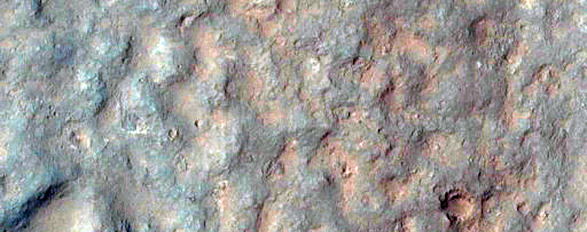
Today's Image of Mars shows Mars Science Laboratory's landing site and it's most immediate destination, Glenelg. This area was chosen because it marks the area where three different types of terrain intersect:


Credit: HiRISE with overlays from NASA. Click for high resolution version


1. In the top right you see the brighter terrain, which scientists are interested in because it may be a type of bedrock that Curiosity can eventually try and drill into. 

2. The bottom right shows terrain that scientists believe is harder and older than the surrounding terrain. Scientists know this because the terrain has many more small impact sites from meteors, which is generally an indicator of an older surface area. 

3. The next type of terrain is found at MSL's landing site and scientists are interested to see if it is duplicated at Glenelg.

But why was the name Glenelg chosen? Because MSL will be visiting the area twice, both coming and going, and the word glenelg is a palindrome, meaning it is spelled the same backward as it is forward.

Following MSL's examination of Glenelg, the rover will begin its southward drive toward the base of Mount Sharp!

Mars Photo of the Day - 10 Aug 2012

Today's Image of Mars shows where all the hardware for Mars Science Laboratory (MSL) ended up 24 hours after landing. If you click on this image you can see the HiRISE high resolution image, in which you can spot the parachute, back shell, heat shield, sky crane, and MSL itself!

The reason you see dark patches is because the impact and/or the thrusters blew away the light surface layering of dust, revealing the darker soil underneath. 


Weekend Feature: Gale Crater

Looking down on Mars we see Gale Crater as a crater among many craters, but even from this distant perspective Gale Crater is unique, special, and above all, intriguing. In the image below we can spot the 150km in diameter Gale Crater because of its massive central uplift, Mount Sharp, which rises 5.5 km above the northern crater floor and 4.5 km above the southern crater floor. It is Mount Sharp that makes Gale Crater so intriguing and worthy of future study.


Mount Sharp's base is thought to be at least 2 billion years old. It is comprised of clays and sulfates, two materials that are only known to form in the presence of water. The layers directly on top of those are comprised primarily of sulfates, with very few clays, which implies that they were formed in an environment where Mars was becoming drier and water was evaporating. See the next image for an idea of what these intriguing layers look like.

Mars Photo of the Day - Apr 25 2012

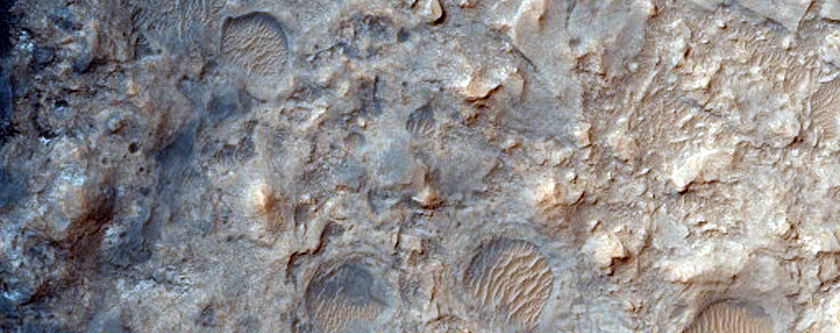
Today's Image of Mars shows terrain in Gale Crater slightly southwest  of the Mars Science Laboratory Curiosity's August 2012 landing site. This image captures three different features: older plains, overlain with some sedimentary deposits and active sand dunes.

Scientists speculate that the sedimentary deposits are hardened mud, which has fractured over time. Hardened mud is a prime target for Mars Science Laboratory because it can help scientists to determine the acidity of the water in which the mud formed. Water with low acidity is more conducive to life as we know it, so examining some could give us some idea as to the habitability of the area at various points in the Martian past.

Study of the sand dunes has shown that they were formed by heavy winds blowing from the southwest toward the northeast. The sand dunes are still active, but moving very slowly across the surface.

Clicking on this image will take you to the original high resolution image from HiRISE. [See their caption for the image]


Mars Photo of the Day - Apr 7 2012

Today's Image of Mars comes from HiRISE and shows the Northwest part of the ellipse where Mars Science Laboratory Curiosity has a 99% chance of landing. This ellipse was showcased in a previous Mars Photo of the Day.

The imaged area is located at the base of Gale Crater's central mound, Mount Sharp, which the Mars Reconnaissance Orbiter, Mars Express, and Mars Odyssey Orbiter have determined is rich in clays and sulfates, both of which can only be formed in the presence of water. The plan is to have Mars Science Laboratory examine these clays and sulfates to help scientists get a better picture of what the environment on Mars used to be like. Doing this will help to determine whether Mars was once hospitable to life and whether it may still be.

Clicking on this image will take you to all other images of Gale Crater showcased by Mars Travel.


Mars Photo of the Day - Apr 1 2012

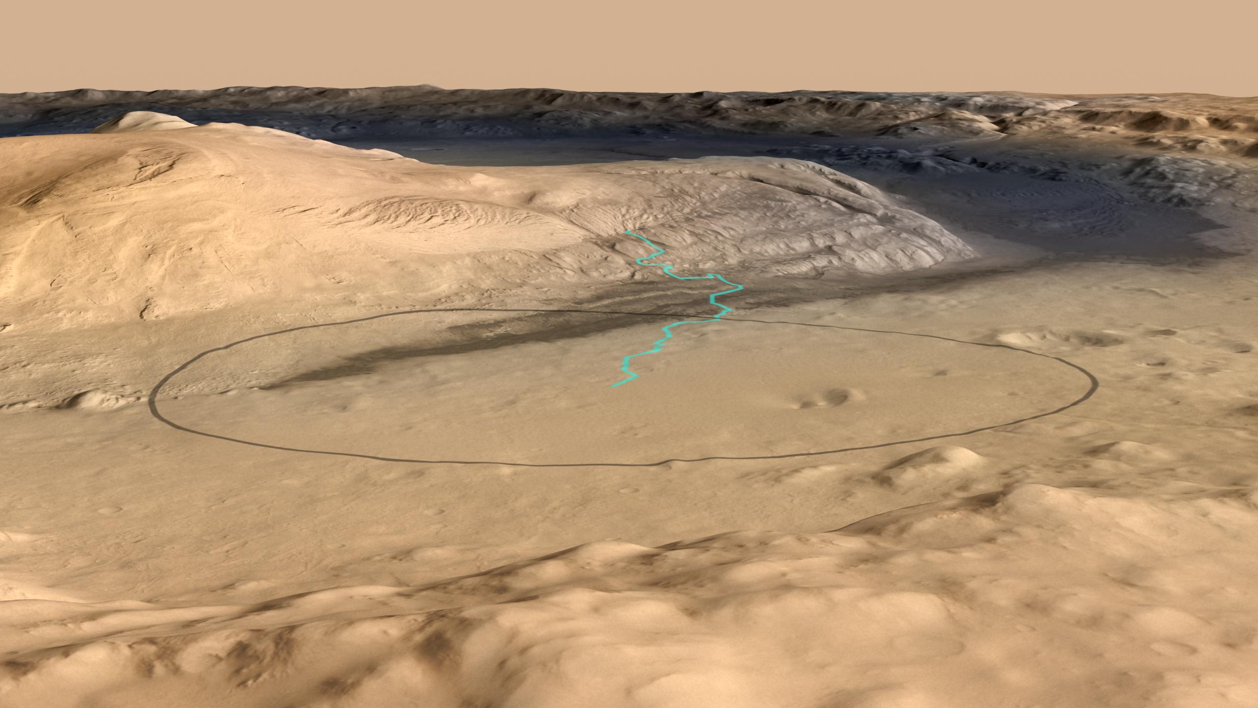
Today's Image of Mars shows the landing site for Mars Science Laboratory Curiosity at the foot of Mount Sharp, the 5km high central mound in Gale Crater. The turquoise line shows the expected path of MSL after it lands and begins navigating its way up Mount Sharp. The black oval measures about 20km by 25km and is the area in which MSL Curiosity has a 99% probability of landing.

The lowest portion of Mount Sharp is comprised of clays and sulfates, materials which are formed in the presence of water. The overlying layers contain sulfates, but very little clay, indicative of an environment in which water was evaporating and Mars was becoming drier. Scientists hope that studying Mount Sharp's layers can provide insights into the past Martian climate and give them a better idea as to whether Mars was once, or may still be habitable.

This image combines data from the High Resolution Stereo Camera on the European Space Agency's Mars Express orbiter, with data from the Context Camera on NASA's Mars Reconnaissance Orbiter, and color information from the Viking Orbiter. Clicking on this image will take you to the original higher resolution image from NASA. [See the NASA article on Mount Sharp]


Mars Photo of the Day - Feb 28 2012

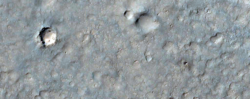
Today's Image of Mars shows a possible Mars Science Laboratory (MSL) landing site in Gale Crater, as imaged by HiRISE. Even though the rover launched in November 2011, the MSL team still isn't positive where within Gale Crater it will land. Even if they plan for a specific spot they can't guarantee the exact landing location.

You can see that this location has many interesting features, including Dunes, sub-craters, and evidence of past water on Mars.

MSL Curiosity is set to land in Gale Crater sometime between August 6 and August 20th 2012. To learn more about the mission of NASA's most advanced Mars rover and the reason Gale Crater was chosen as the destination, just click on the image below.


Mars Photo of the Day - Dec 11 2011

Today's Image of Mars is of Mars Science Laboratory Curiosity's landing site in Gale Crater. In a previous post I showed the MSL landing site in context of the larger crater, but in this image you can get a better idea of the terrain the rover will be navigating through.

MSL Curiosity is set to land here in August 2012. For more on the MSL mission check out my article entitled Mars Science Laboratory Mission.

This image is from HiRISE, but they have not currently captioned it. Clicking this image will take you to other photos and articles on Gale Crater.