Google+ Mars Travel: future landing site
Showing posts with label future landing site. Show all posts

Mars Photo of the Day - May 16 2012

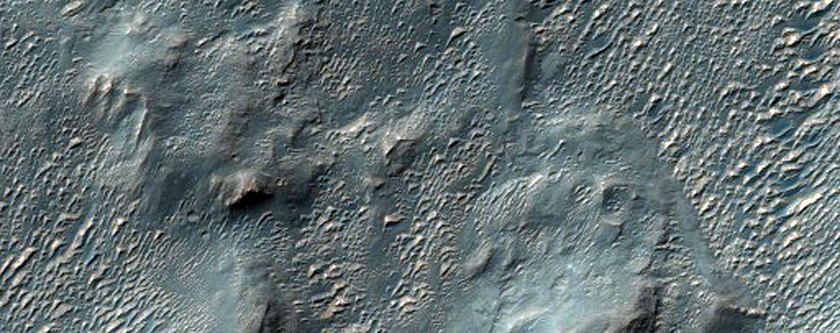
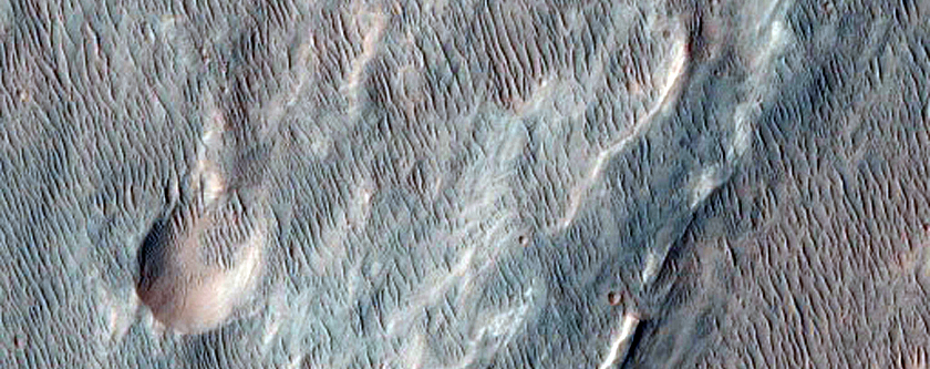
Today's Image of Mars shows a potential landing site for future missions to Mars west of Aeolis Planum, as imaged by HiRISE. Within this potential site we see numerous ridges with a general North-South orientation, which measure about 10 meters wide and 100 meters long. These ridges appear to have formed from wind, which suggests that the soil is made of fine grained sand and rocks, easily moved and oriented by the wind.

The crater that you see on the right of this image has been filled by soil, as have many other smaller crater you can see in different subimages. This implies that the bedrock underlying the top layer of windblown soil may be easily eroded. This could be the mos likely reason why there is so much sand able to form the ridges described above.

Clicking on this image will take you to the original high resolution image form HiRISE. 


Mars Photo of the Day - May 8 2012

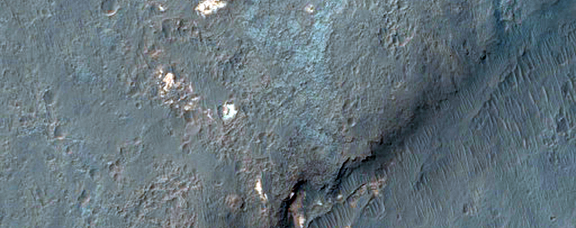
Today's Image of Mars shows a potential landing site for future missions to Mars in Trouvelot Crater. Trouvelot Crater is 154.7km in diameter and located in Oxia Palus Quadrangle, which is known for an abundance of chaos terrain, like Aram Chaos, and numerous outflow channels, most prominently Ares Valles.

Trouvelot Crater is being considered as a possible landing site for the the 2018 joint ESA-Roscosmos ExoMars Rover. One of the features that intrigues scientists are the sedimentary deposits on the crater floor, that many believe could only have been deposited by an abundance of water. On the ground study of these sediments would be able to determine when and how long there was water on the surface and could even provide insight as to where the water went.

Click on this image to see all the other potential landing sites for the ExoMars Rover showcased by Mars Travel.

Credit: HiRISE

Weekend Feature: Arsia Mons

Arsia Mons measures nearly 16km (12mi) high and over 435km (270mi) wide, with a caldera (opening) measuring 110km (72mi) in diameter It is the southernmost of the Tharsis Trio, which also consists of Pavonis Mons to the north and Ascraeus Mons to the north of that.

While Arsia Mons may be larger than any volcano on Earth, it pales in comparison to the largest volcano yet discovered in the solar system, Olympus Mons, which measures 22km (16mi) high. Coincidentally Olympus Mons is relatively close to the Tharsis Trio (right).

These volcanoes lie in the Tharsis Quadrangle on Mars, which contains an abundance of volcanoes. The region is thought to have been volcanically active as recently as 100-250 million years ago, which is relatively recent in geological terms.Scientists believe that the abundance of volcanoes in this region had an astronomical impact on the climate of Mars because the carbon dioxide and water vapor emitted from them would have been enough to create an atmosphere thicker than that on Earth!

This means that the environment we currently see on Mars may be drastically different than what it used to be! The Tharsis volcanoes would have had a direct impact on that, so determining how long ago they were active will help scientists to determine at which point the Martian climate changed!

Mars Photo of the Day - Apr 24 2012

Today's Image of Mars shows a potential landing site for future missions to Mars in Ismenius Cavus. Ismenius Cavus is a 600m deep basin that was once a lake, located north of Arabia Terra. The basin has six distinct valleys that run into it, lending credence the idea that the basin once contained a large lake. 

Further evidence that water was abundant in Ismenius Cavus is found in the minerals. Iron and magnesium phyllosilicates, as well as clays have been discovered in the area, which are only ever formed in the presence of  water.

The outline below indicated the candidate landing site for the Mars Science Laboratory. It was beaten out by Gale Crater, but will most definitely remain at the top of the list of potential landing sites for future missions to Mars!

Clicking on this image will take you to the original high resolution image. [See a separate article from the Lunar Planetary Institute on Ismenius Cavus]


Mars Photo of the Day - Apr 17 2012

Today's Image of Mars was taken by HiRISE and shows Atlantic Chaos, a 161km stretch of jumbled and disrupted terrain on Mars. Atlantic Chaos was once considered a candidate landing site for Mars Science Laboratory, but it was beaten out by Gale Crater. Atlantic Chaos is located in Phaethontis quadrangle on Mars and measures roughly 161km across.

Could this be a future landing site for missions to Mars? We'll have to find out, but since it was already a candidate it seems likely! Clicking on this image will take you to all other images of potential landing sites showcased by Mars Travel. 


Mars Photo of the Day - Apr 16 2012

Today's Image of Mars comes from HiRISE and shows a potential future landing site in Utopia Planitia for future missions to Mars. This area is thought to have once held a giant lake, the water from which seems to have at least partially retreated underground. It was once among the top candidate destinations for the Mars Science Laboratory, but lost out to Mount Sharp in Gale Crater.

Recent imaging with gamma-ray and neutron spectrometers on Mars Odyssey has revealed that an abundance of hydrogen molecules lie just one or two meters below the surface, which is indicative of water being right below the surface! You can bet that Utopia Panitia will remain on the list of potential landing sites for future missions to Mars!

Clicking on this image will take you to other potential future landing sites showcased by Mars Travel, since the original HiRISE image isn't much larger and has no caption as of yet.


Mars Photo of the Day - Apr 15 2012

Today's Image of Mars shows what was once a potential landing site in Libya Montes for the Mars Science Laboratory. Libya Montes are a ring of mountains on Mars that was created by the giant impact which created the Isidis Basin to the north. Think of Libya Montes as the rim to the crater that is Isidus Basin. 

The Isidis Basin is extremely ancient, so studying the uplift created from the impact will allow scientists to look extremely far back into the Martian past. There is evidence that Libya Montes has also been eroded by water in the past, so it is possible that it was once a habitable region! That's why Libya Montes has consistently been at the top of the list for candidate landing sites, and will likely remain that way until we send a mission to those ancient mountains. 

Clicking on this image will take you to other potential landing sites for future missions to Mars!

Image Credit: HiRISE

Mars Photo of the Day - Apr 3 2012

Today's Image of Mars shows a potential landing site in Holden Crater for the 2018 joint ExoMars rover, as taken by HiRISE. Holden Crater is 140km in diameter and numerous clays and sediments that could only have formed in the presence of water.

Holden Crater was one of the top four candidate landing sites for the Mars Science Laboratory, which is landing in August 2012. The crater holds some of the best exposed lake deposits yet discovered on Mars, which makes it a prime landing site for any and all future missions to Mars that hope to determine whether Mars once did, or still does support life.

NASA recently backed out of the ExoMars mission due to budgetary cuts, which forced the Russian Space Agency (Roscosmos) to take a much larger role in the mission. The joint ESA-Roscosmos mission appears to be going ahead on schedule with an orbiter expected to launch in 2016 and the rover expected to launch in 2018, but at this point anything could happen.

It remains to be determined where on Mars the ExoMars rover will be sent, but we can be sure that Holden Crater is among the top candidates! Clicking on this image will take you to all Mars Travel posts related to Holden Crater because the original HiRISE image is not yet captioned.


Mars Photo of the Day - Feb 20 2012

Today's Image of Mars comes from HiRISE and shows a potential landing site for a future missions to Mars in Holden Crater. Holden Crater is a 140km wide crater located in the southern highlands. It is believed that Uzboi Valles fed into Holden Crater and created a massive lake.

Currently, potential landing sites require at least a 12 mile wide circle of smooth, flat terrain so that the spacecraft can lend safely even within a margin of error.

Mars Reconnaissance Orbiter determined that Holden Crater contains numerous sediments and clays that could only have formed in the presence of water. The crater also has some of the best exposed lake deposits scientists have ever seen, making it a prime candidate for future missions to Mars.

Holden Crater made it into the top four candidate landing sites for Mars Science Laboratory Curiosity, but was ultimately beaten out by Gale Crater. We can be sure that Holden Crater will remain among the top candidates for future missions to Mars!

Clicking on this image will take you to other potential future landing sites showcased by Mars Travel!


Mars Photo of the Day - Feb 19 2012

Today's Image of Mars comes from HiRISE and shows a possible future landing site in Antoniadi Crater, a 394km long crater on Syrtis Major Planum. It is evidenced that Antoniadi Crater once had rivers and lakes, as evidenced by the inverted features, like riverbeds.

Inverted features are formed when the sediment deposited by water is harder than the surrounding terrain. Over billions of years erosion wore down the surrounding terrain, but because the lake and riverbeds were more resistant to erosion they were reduced much less, thus creating inverted features.

The fact that there was once flowing water in Antoniadi Crater makes it a prime target for future missions to Mars. This particular patch shows a particular candidate landing site in the crater. It was chosen because it has been observed to have relatively flat terrain and is close to features of interest.

Clicking on this image will take you to other showcased images of potential landing sites for future missions to Mars because HiRISE has not yet provided a caption for this image. [EDIT 24 June 2012: HiRISE has added a caption.]


Mars Photo of the Day - Feb 11 2012

Today's Images of Mars come from the Mars Odyssey Orbiter and show seven different pits on Mars that scientists believe lead to underground caverns. These pits were found over 700km along the side of Arsia Mons, the second largest mountain on Mars, after Olympus Mons.

Cavern entrances like these ones are called skylights. They have no raised rim or ejecta, which differentiates them from impact craters. Can you see the seventh one?

In recent years scientists have suggested that underground caverns like these are likely to be much more suitable to life than the surface, which many believe is presently hostile to life as we know it.

Caverns like the ones below are likely destinations for future manned and unmanned missions to Mars! Some scientists speculate that colonies could be set up inside of caverns because they act as a natural shield to space radiation and the harsh Martian environment.

There are two skylights located in the image labeled "E", making the total number of skylights imaged below seven.

The entrances imaged below are only some of many potential cavern entrances discovered and imaged on Mars. Clicking the images will take you to other Mars Travel posts about skylights. These images were compiled by National Geographic. [See their original short caption for the images]

Images courtesy NASA/JPL/LPI


Mars Photo of the Day - Feb 7 2012

Today's Image of Mars is of a candidate landing site in Horowitz Crater, as taken by the HiRISE camera aboard the Mars Reconnaissance Orbiter. In August 2011 NASA released evidence that water was currently flowing in Horowitz Crater, making it a prime destination for for future manned and unmanned missions to Mars.

Scientists discovered features on Mars called Recurring Slope Linae (RSL). Repeated imaging has shown that these features appear and gradually grow during the warm season on Mars, only to fade during the cold season. It is thought that the best explanation for these recurring features is the existence of briny water just below the surface, but that is unconfirmed as of yet.

A mission to Horowitz Crater would help scientists to definitively determine whether there is liquid water just below the surface. If the evidence is substantiated then this will have huge implications for future missions to Mars that could use the water as a source of fuel, or to help sustain manned missions. 

Clicking on this image will take you to the original article by Mars Travel in which the August findings were discussed. [See the original uncaptioned HiRISE image]


Mars Photo of the Day - Feb 4 2012

Today's Image of Mars shows what is very likely the entrance to an underground cavern on Mars. The cavern is located Northeast of Arsia Mons and can be seen at the top of this image.

Cavern entrances like this one are called skylights. They have no raised rim or ejecta, which differentiates them from impact craters. This skylight is so special because even the extremely sensitive HiRISE camera cannot detect what lies within the shadow if the skylight. In fact, HiRISE cannot see inside the shadows of this pit at all; it can't even see the walls of the pit.

Scientists speculate that this skylight must have overhanging or completely vertical walls, which brings them to the conclusion that this is a collapse pit into an underground cavern. This pit must be very deep for sunlight not to illuminate the bottom.

In recent years it has been suggested that underground caverns like this one are probably much more suitable to life than the surface, which has been irradiated and is hostile to life as we know it. Caverns like the one below are likely to be prime targets for future manned and unmanned missions to Mars! Some scientists even speculate that colonies could be set up inside of caverns because they act as a natural shield to space radiation and the harsh Martian environment.

Clicking on this image will take you to the original, captioned image from HiRISE.


Mars Photo of the Day - Feb 1 2012

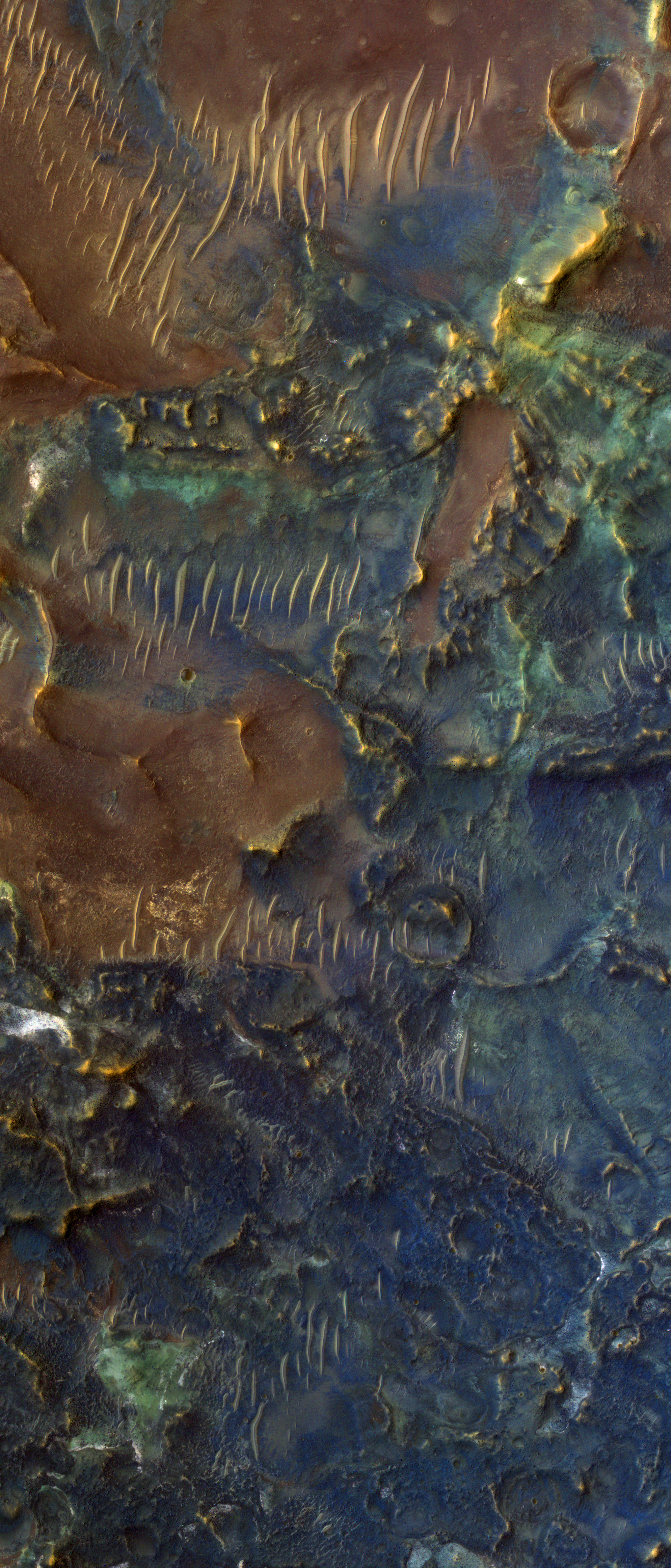
Today's Image of Mars shows the floor of Toro Crater, a 42km diameter crater in Syrtis Major, which exhibits phenomenal colors due to the different minerals within the crater.

The north-south oriented features are dunes crafted by the wind; they are much younger than the bedrock on which they lie. Scientists can determine the direction and strength of the wind in the crater by analyzing dune orientation and size.

Scientists speculate that Toro Crater experienced hydrothermal alteration, which is caused by the interaction of materials with water and heat. The blue and green colors are unaltered minerals like pyroxene and olivine, whereas the warmer colors are indicative of alteration in clays and other materials.

Toro Crater is of great interest to scientists because hydrothermal interactions are indicative of an environment hospitable to life. Because of this we may find that Toro Crater becomes the destination for a future mission to Mars!

Clicking on this image will take you to the original subimage from HiRISE. [See their captioned image]


Mars Photo of the Day - Jan 20 2012

Today's Image of Mars is a north-looking perspective view of Juventae Chasma, a large fissure that cuts 5000m into Lunae Planum on Mars and measures 180km east-west and 250km north-south.
Juventae Chasma obvious interaction with water led NASA to consider it as a candidate destination for Mars Science Laboratory Curiosity. Though it was not selected to be the MSL landing spot, there is still much to be learned from the chasm.

Scientists believe that sometime 3-4 billion years ago Juventae Chasma was filled with water, which then created the large deposits of clays, gypsum, and other sulfate minerals we see today. They have speculated that Juventae once had a habitat that was suitable to life, which keeps it on the list of potential landing sites for future missions to Mars. 

How did Juventae Chasma form?

Scientists speculate that Juventae Chasm formed as a result of faulting and volcanic heat opening up cracks in the surface, which then let water and subsurface ice out, causing the surface to collapse from the floods that resulted. There was enough water that it poured out of the northern end and created the outflow channel, Maja Valles, which flows all the way to the Chryse impact basin.

Eventually Juventae Chasma stopped growing, but the water within the canyon altered the rocks and surface materials, turning them into the gypsum and other aqueous material we see today.

The ridge you see in the northeast of Juventae Chasma's valley measures 59km long, 23km wide, and 2500m high, making it half as high as the chasm's walls.. This mountain became of interest to scientists when they determined that it was composed of sulfate deposits.

On the top part of the ridge, Mars Express' OMEGA instrument detected gypsum, with 12 distinct layers present. Below the gypsum layers lies kieserite, a form of magnesium sulfate. Both gypsum and kieserite are classified as evaporates, meaning that they often form where lakes of salty water dry up. 

The potential landing site for future missions to Mars lies on the southern tip of this ridge. Any rover would then likely move along the western side of the ridge where there are numerous layered deposits that could provide answers as to whether Mars ever sustained life. 

This image was taken by the High Resolution Stereo Camera (HRSC) aboard Mars Express. Clicking on the image will take you to the original high resolution image from them.


Mars Photo of the Day - Nov 15 2011

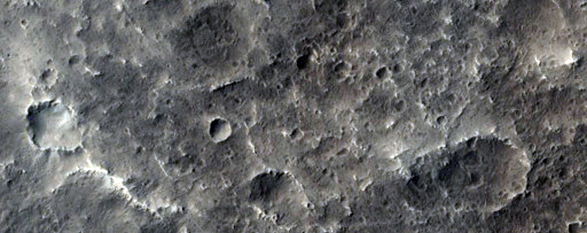
Today's Image of Mars is of a proposed future landing site in Ladon Valles on Mars. Ladon Valles is a 278km long outflow channel that connects with Ares Valles. It is part of a larger system that heads to Argyre Basin, which many scientists believe once contained a large ocean of water. 

This image was published by HiRISE on November 1 2011, but is not currently captioned.

There are many sites on Mars that have been proposed as landing sites for future missions. Clicking on the image will take you to all HiRISE images of candidate landing sites.