Google+ Mars Travel: HiRISE
Showing posts with label HiRISE. Show all posts

Western Rim of Endeavour Crater Digital Terrain Model

The labeled image below is a digital terrain model (DTM) of the Western rim of Endeavour Crater overlain with a northward perspective from HiRISE and compositional data from the Compact Reconnaissance Imaging Spectrometer for Mars (CRISM). This is the area Mars Exploration Rover Opportunity has been investigating since 2011.

Click to see hires version from HiRISE

This image has been instrumental in planning Opportunity's movements and continuously developing mission. As indicated in the image above, orbital data has identified areas where clay (red), sulfate (green), and volcanic (blue) minerals could be present. Clays and sulfates are indicative of a watery past on Mars as they often only form in the presence of significant moisture.

Opportunity is currently around Cape York, but heading south in an attempt to discover more about the geology of Endeavour Crater.


Russian Citizen Scientists Have Likely Discovered Mars 3 Lander

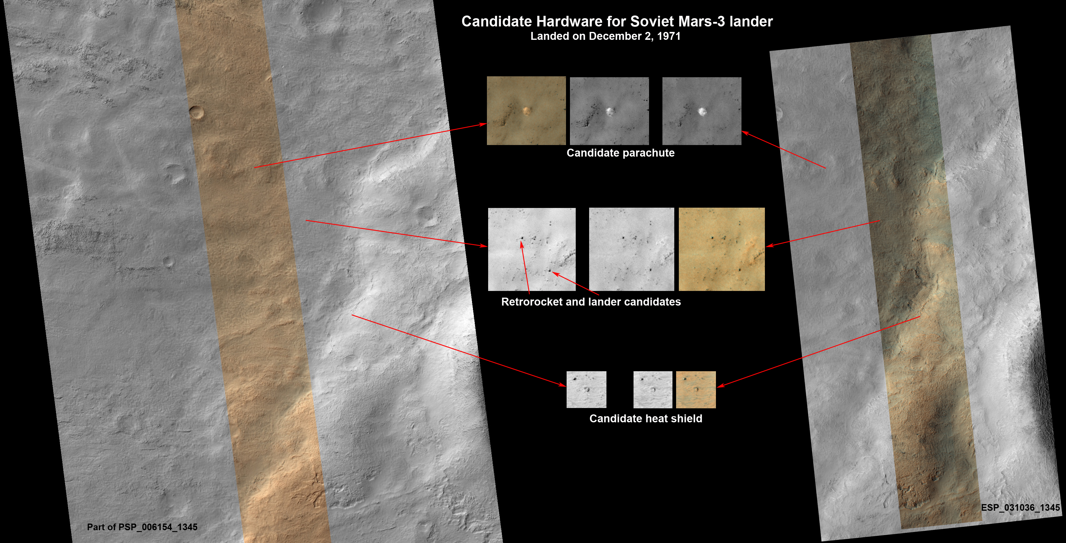
Recently, Russian citizen scientists claimed to have found the remnants of the failed Mars 3 Lander, which landed on Mars on December 2 1971, but had a communication failure after transmitting for only 14.5 seconds. This speculation led the Mars Reconnaissance Orbiter Team to further investigate the proposed sites on March 10 2013. Below you will see an image explaining what they investigated. To see the enlarged version from HiRISE simply click on the image below.


The candidiate descent module/retrorocket can be seen in the image above as well. It had a 4.5 meter chain attaching it to the lander, which is also visible. While the line is 4.8 meters, this difference could be explained if one assumes that it's momentum dragged it slightly across the surface. To best see this feature you will need to view the larger image from HiRISE by clicking on the image above.

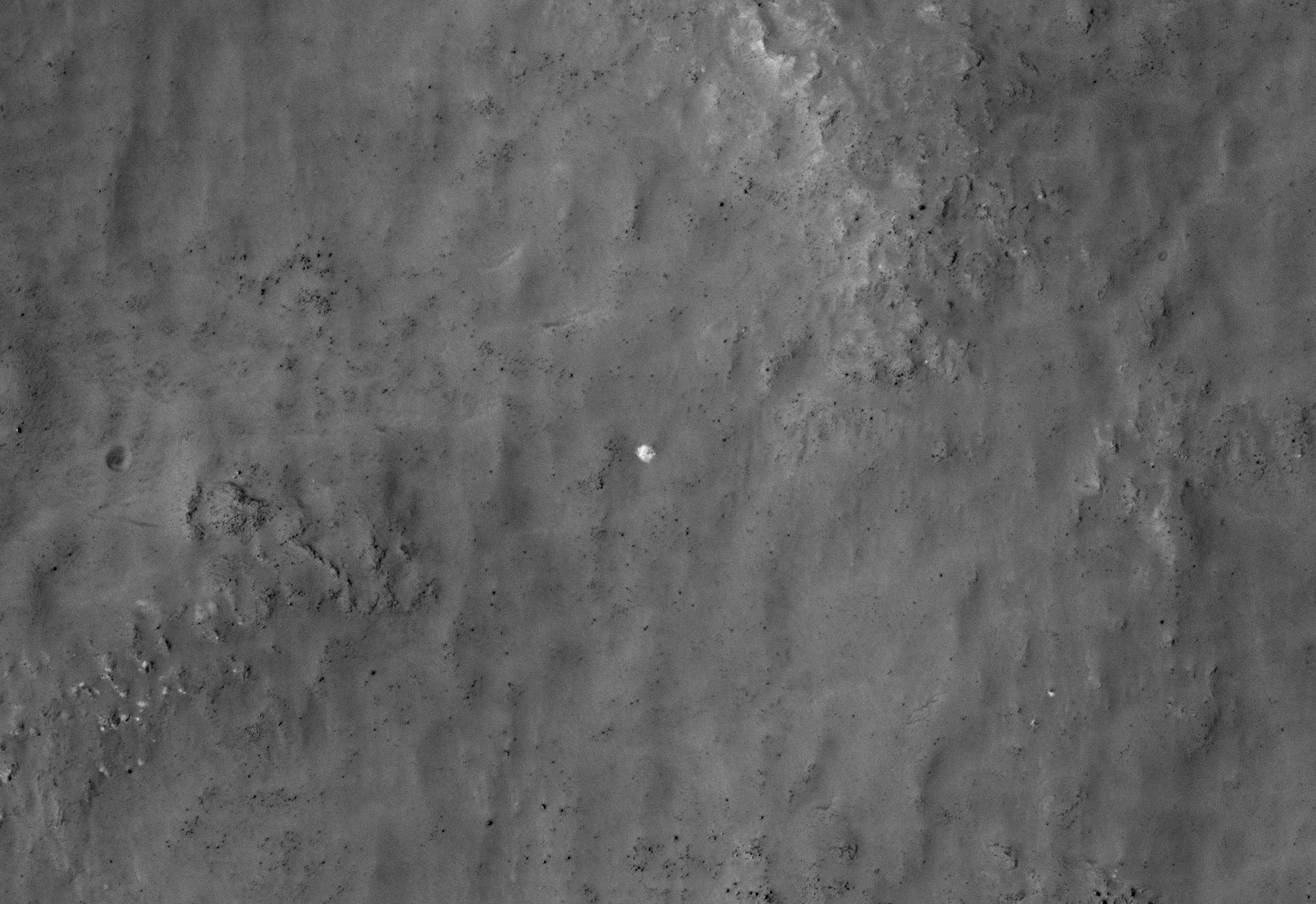
The candidate site for the parachute can be seen below. I'm betting you can guess where it is even in this small version, but if you can't just click on it to see the larger high defintion image from HiRISE.


The parachute is the unusually bright spot right in the center of the image, which measures approximately 7.5 meters in diameter. Mars 3 had a paerachute that measured 11 meters in diameter if fully spread out, so a 7.5 meter diameter is consistent in that the parachute would most likely not be completely unfurled. In previous images of the area the parachute was likely covered in dust because the bright spot seen in the most recent image was not there. It's likely that the wind blew dust off the parachute recently, making its white color stand out against the backdrop of the Martian surface.

In 2007 HiRISE took an image of the the predicted landing site for the Mars-3 lander in Ptolemaeus Crater, but according to their website that image "contains 1.8 billion pixels of data, so about 2,500 typical computer screens would be needed to view the entire image at full resolution. Promising candidates for the hardware from Mars 3 were found only very recently." (HiRISE 2013)

The Russian citizen scientists were members of Russia's largest online community about Mars Science Laboratory Curiosity, started by Vitali Erogov. They crowdsourced the preliminary research that led to finding the candidate site for Mars 3. Vitali Erogov then compiled the below graphic of the candidate Mars 3 hardware pieces.

While all of these images match to what would be expected of the corresponding hardware, there is still some investigation to be done. Further analysis of the data, as well as current and future images, will help scientists to verify these findings and potentially determine what caused the communication failure in the first place. While the latter is a long-shot, you never know! For right now though, it looks like we have finally discovered Mars 3!

If nothing else, this just goes to show you the importance of citizen scientists. There is so much data out there it is impossible for scientists to look at it all, but when ordinary people take their free time to examine the data they can make extraordinary disoveries. I encourage every space enthusiast to join one of these citizen science programs by participating in NASA citizen science programs.

One of the biggest programs, whose participants have made numerous historic discoveries is Planet Hunters, which enlists people like you to help discover new planets. Planet Hunters has had and will continue to have enormous impact not only on the scientific community, but on all of mankind, as one day we must find a planet that we can survive on and colonize it, else we keep the fat eof our entire species tied to that of a single planet or solar system.

So if you have some free time, join Planet Hunters and help humanity live on forever!

Cone-Shaped Hill on Mars

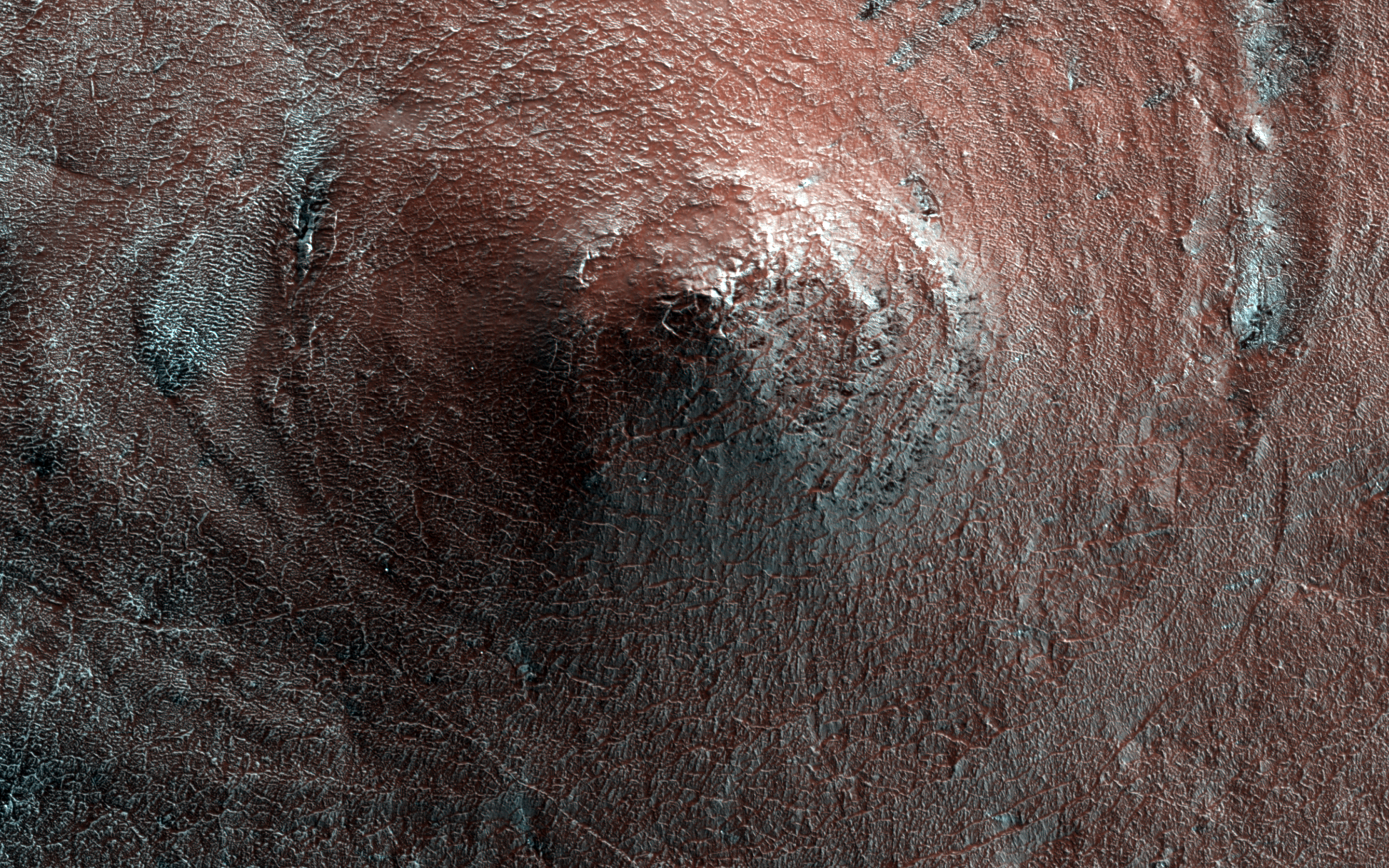
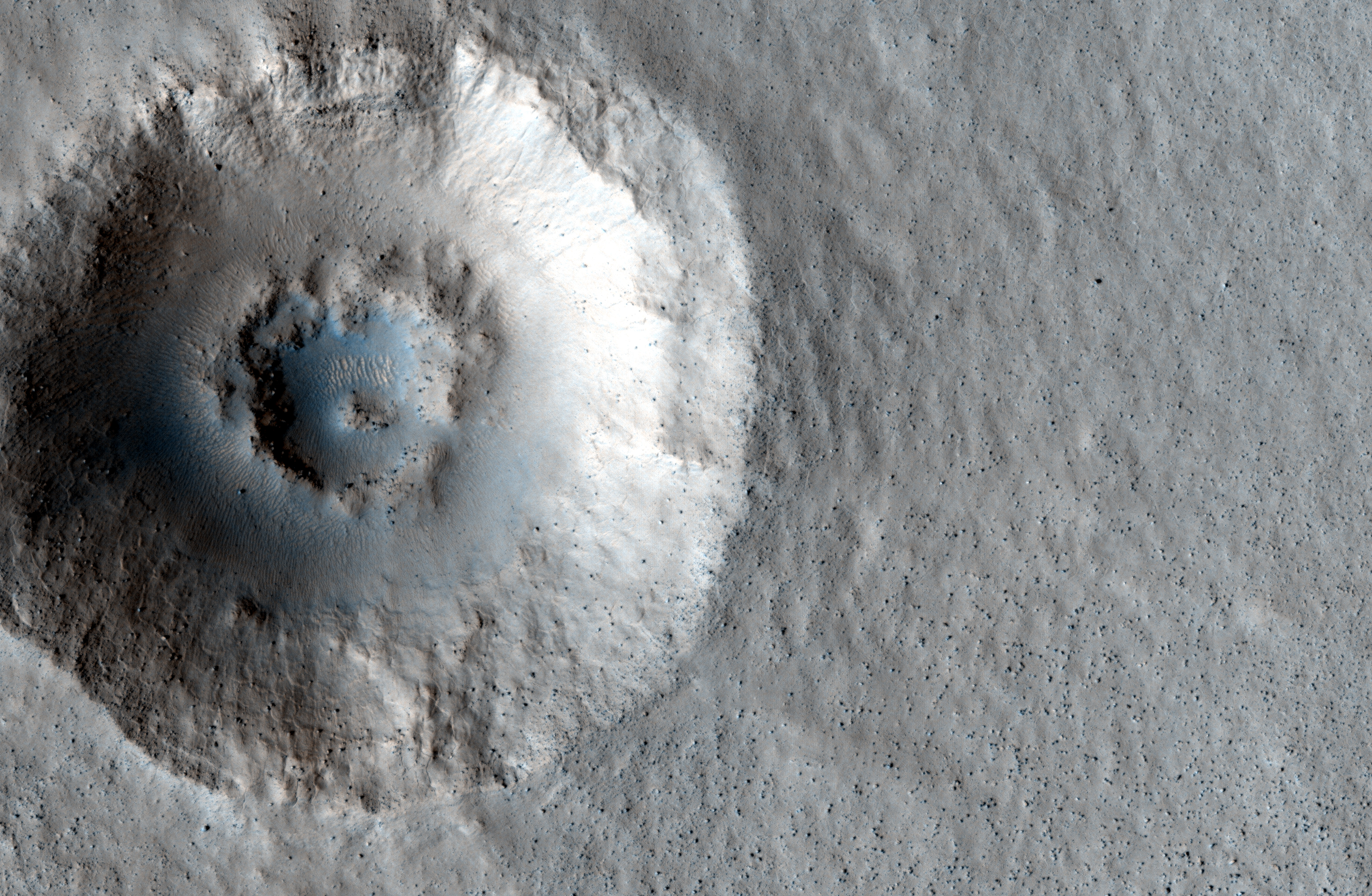
In the South Polar Region of Mars' Promethei Lingula there is an unusual cone shaped hill, measuring about 20-30 meters high. The white streaks are areas where carbon dioxide ice has not yet thawed. The unusual shape of this hill can likely be attributed to large scale erosion. Scientists still aren't sure why the area wasn't eroded evenly, but as they study more images of features like this they will gain a better understanding of the environment that created them.

Click to see HiRISE's original high resolution version. [See HiRISE caption]


One possible way this cone-shaped hill was created would have occurred long ago, when it once rained on Mars. A meteor could have hit the area, creating a crater, which would eventually developed a central uplift. After millions of years of rainfall the central uplift would have been smoothed out to what we see above, as the water flowed down its slopes. Over millions of years the distinguishing characteristics of the surrounding crater would have been washed away by the rain, blending it into the regional terrain. That's just a theory and an example of the fact that we may never know what caused this feature on Mars to develop.


Colorful Crater on Mars

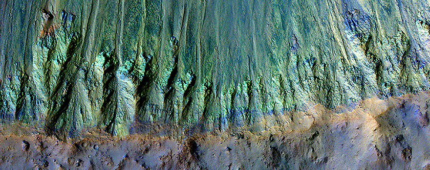
Check out these colorful images of a young, well preserved crater on Mars! When this 5km (3.1 mi) diameter crater was created it exposed a whole litany of minerals that may otherwise have been hidden under millions of years of dust build up and layered deposits.

The green (pictured bottom left) along the crater's south rim is representative of minerals like olivine and pyroxene, typically found in lava and underground magma flows. The yellow seen at the top of the image could be indicative of material changed by water, however, scientists also say it could just be a coating of dust. If the yellow material is just dust that could be indicative of a north blowing wind, which pushed the dust up against the south-facing north wall of the crater.

Click on the photo on the right to see the high resolution version from HiRISE. Click the bottom left photo to see the HiRISE caption


Birds-Eye View of MSL Curiosity

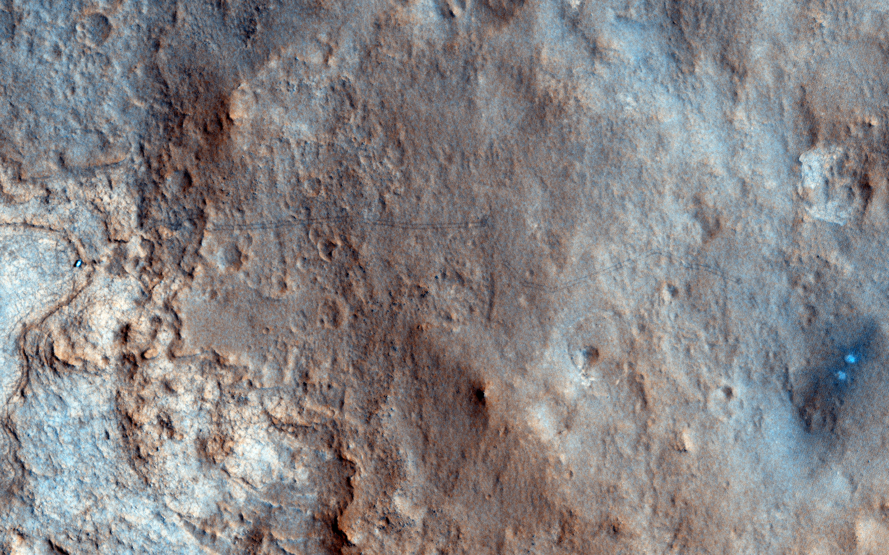
Take a look at HiRISE's birds-eye view of MSL Curiosity, taken on the 157th sol of it's mission in Gale Crater. In this image you can see the rover itself, as well as tracks left from MSL's movement across the Martian terrain (this is especially true if you click on the image). The bright white/blue dots on the right shows the the area that was directly below MSL's Sky Crane rockets. Because of wind and other factors, the earliest tracks from MSL have begun to fade, but fortunately they can still be made out in the larger high resolution version (just click the image below to see it)! 

Source: HiRISE

This image is quite significant because it is the first color image showing MSL's tracks from orbit. It is oftentimes these images that provide us perspective because they show us the impact we are having on this pristine planet. Every rover we send to Mars is breaking new ground, every image shows a never before seen world, every soil analysis enhances our understanding of the solar system and provides context for our place in the universe. 

Five Impacts, Same Time - How?

This HiRISE image shows a new impact site within a crevice in Fortuna Fossae, east of the Tharsis Quadrangle. There are five distinct craters that were created nearly simultaneously, indicating the meteorite broke up into 5 different pieces just prior to hitting the surface. This likely happened because the object was a loosely held aggregate of material that broke apart when put under pressure by the Martian atmosphere. Each of the craters has a dark distinctive ejecta pattern surrounding it. 

Scientists estimate that the impact was created sometime between September 2005 and May 2008. Click on the image to see the original high definition image. [See the original HiRISE caption]


Mars Photo of the Day - 10 Oct 2012

Today's Image of Mars shows an area at the base of Gale Crater's Mount Sharp where Mars Science Laboratory Curiosity will eventually explore. The darkest colored materials are deposits small grained, windblown sand. The blue areas represent unaltered igneous rock, whereas the lighter brownish-red colors are indicative of the same type of rock altered by what most scientists believe was water. 

MSL Curiosity's mission is to search for signs that Mars could have once supported life as we know it; examining minerals that have been altered by the presence of water will help us to determine that. Studying the chemical composition of these rocks will provide us with unparalleled insight into the past environment on Mars. 

Clicking on this image will take you to the original high resolution image. [HiRISE caption for the image]

Mars Photo of the Day - 20 Sep 2012

Today's Image of Mars shows two distinctive layers exposed in a 230m wide crater caused by a meteorite impact in the Northern Plains. The impact excavated material from both layers at different rates because the layers are different densities. If you want to conduct an experiment to see how this happens, follow these steps:
  • Fill a bowl halfway with water and freeze it. 
  • After it's frozen, place a layer of sugar (powdered or granular) over the surface.
  • (This is the messy part) Take a marble or other hard object and throw it down into the bowl. (The impact will eject a lot of sugar from the surface)
  • Carefully remove the marble.
  • Take a photo from above. You will notice that the marble made more of an impact in the sugar, but faced increased resistance when it hit the ice. 
This is a simplified version of what happened when the meteorite created this impact. The layer under the surface was denser so the meteorite faced much more resistance and excavated the material at a much lower rate, as seen below.

Click for high resolution image from HiRISE. [See their caption]
Radar images taken by SHARAD, the radar instrument aboard the Mars Reconnaissance Orbiter indicate the presence of ice below the surface, which makes this area a potential site for future exploration of Mars. If we can access ice beneath the surface of Mars then we could use it not only for sustenance, but as a source of fuel for future missions to Mars.


Studying MSL's Tracks Will Help Future Missions to Mars

Take a look at this remarkable image from HiRISE showing Mars Science Laboratory Curiosity and the tracks it made during the first few drives in Gale Crater. Scientists will be keeping a close eye on these tracks so as to track the rate of surface change on Mars. 

Click to see high resolution version from HiRISE.

Unlike Earth's Moon, Mars does have wind and other weather, so tracks will get covered up. Examining these tracks will let scientists determine the quantity and frequency of dust deposits in Gale Crater, as well the rate of erosion. Knowing how often features on the surface of Mars can change or be covered up will help current and future missions to Mars; let me explain how:

Imagine a Mars rover takes a long distance shot and sees something slightly protruding out of the surface. If we have a good idea of the rate of change on Mars then we can determine how long that feature will be there before getting covered up. If it will be covered up in a matter of days then it would become a higher priority then something that might be visible for a few weeks or months.

If you send a manned mission to Mars it is essential that they are knowledgeable about the rate of surface change. If you were going to take a walk on Mars you would make some reference points so as not to get lost. If you weren't aware of the rate of change you might use a field of hematite (blueberries) to the right of base camp as a reference point, not realizing that it might be covered up in a couple hours. You could get lost because you didn't know how fast something could get covered up!

As you can see, images like the one above are essential to our understanding of Mars and could help us save the lives of future explorers and billions in hardware!


Mars Photo of the Day - 2 Sep 2012

Today's Image of Mars shows mounds in Chryse Planitia formed by a process called diapirism, which occurs when older material of lower density than overlying layers gets dredged up to the surface. Just imagine the rock as a very viscous liquid. If you put two types of liquid together the one with the lower density will eventually float to the top. That is what happened in this image of Mars.

HiRISE images like the one below of these mounds will show us if clays or other aqueous materials are present. If they are present then scientists will be able to determine the material's age, which will tell us when water was abundant on Mars.

Clicking on this image will take you to the high resolution version from HiRISE. [See the caption from HiRISE]


Mars Photo of the Day - 19 Aug 2012

Today's Image of Mars shows Mars Science Laboratory's landing site and it's most immediate destination, Glenelg. This area was chosen because it marks the area where three different types of terrain intersect:


Credit: HiRISE with overlays from NASA. Click for high resolution version


1. In the top right you see the brighter terrain, which scientists are interested in because it may be a type of bedrock that Curiosity can eventually try and drill into. 

2. The bottom right shows terrain that scientists believe is harder and older than the surrounding terrain. Scientists know this because the terrain has many more small impact sites from meteors, which is generally an indicator of an older surface area. 

3. The next type of terrain is found at MSL's landing site and scientists are interested to see if it is duplicated at Glenelg.

But why was the name Glenelg chosen? Because MSL will be visiting the area twice, both coming and going, and the word glenelg is a palindrome, meaning it is spelled the same backward as it is forward.

Following MSL's examination of Glenelg, the rover will begin its southward drive toward the base of Mount Sharp!

Mars Photo of the Day - 15 Aug 2012

Today's Image of Mars shows Mars Science Laboratory and the surrounding terrain in color, as taken by Mars Reconnaissance Orbiter's HiRISE camera. The blue in this image would look grey to the human eye, but the color was enhanced to make differentiating terrain easier.

Mount Sharp, MSL's ultimate destination is outside of this frame to the southeast, where up is North. To give you an idea of scale, MSL is about 300m from the bottom of the image. As MSL moves south toward Mount Sharp, it will encounter much different terrain, including dune fields. In the days, weeks, and months to come MSL will study this terrain and the material that makes it up, providing us an unprecedented close up look at the clays and sulfates making up the base of Mount Sharp.


Mars Photo of the Day - 10 Aug 2012

Today's Image of Mars shows where all the hardware for Mars Science Laboratory (MSL) ended up 24 hours after landing. If you click on this image you can see the HiRISE high resolution image, in which you can spot the parachute, back shell, heat shield, sky crane, and MSL itself!

The reason you see dark patches is because the impact and/or the thrusters blew away the light surface layering of dust, revealing the darker soil underneath. 


Mars Photo of the Day - 25 Jul 2012

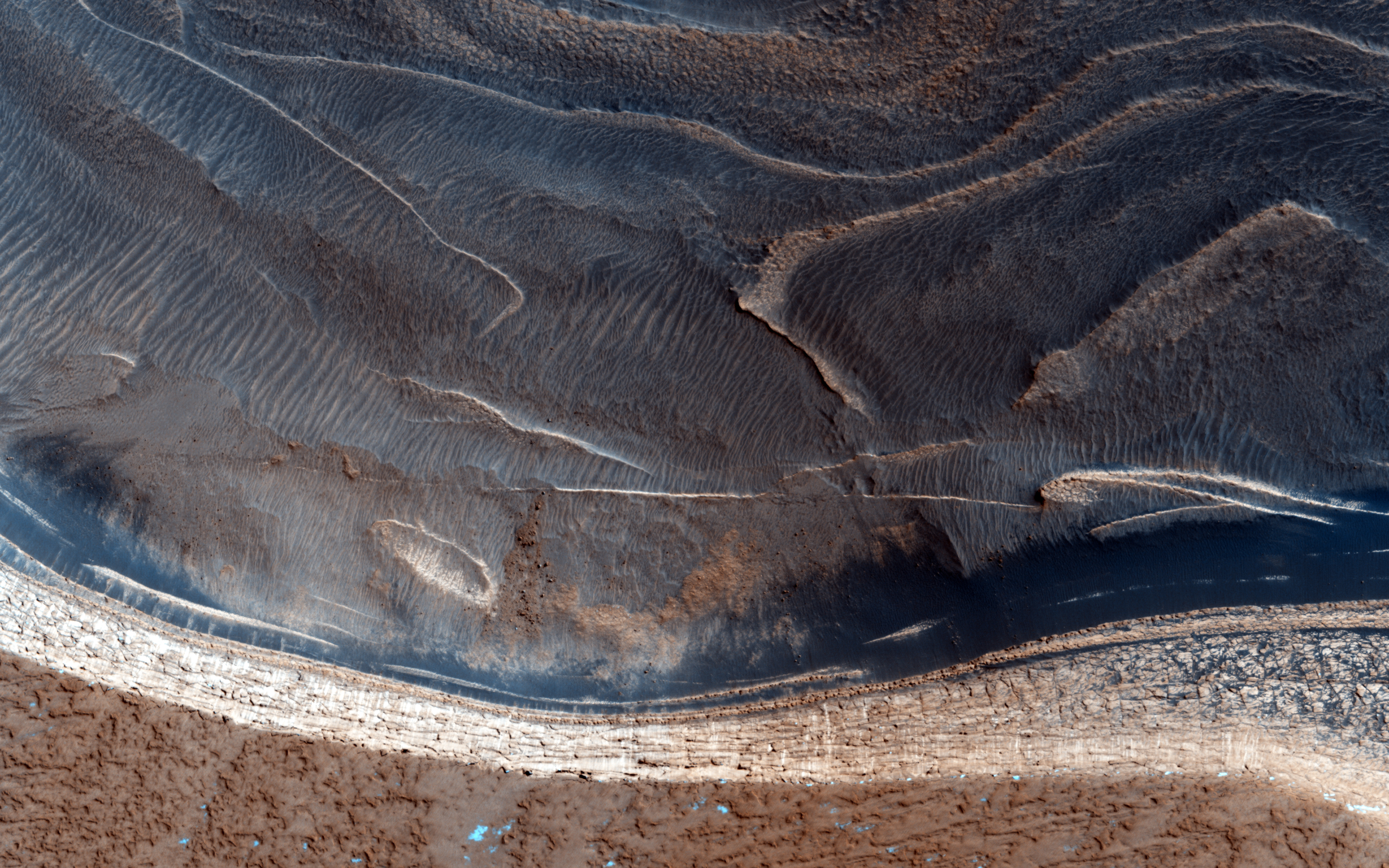
Today's image of Mars shows banded features indicative of past (and maybe present) glacial flow in Hellas Basin on Mars. The banded features we see in this HIRISE image are similar to those left on Earth where glaciers once flowed. 

Being able to understand these banded features on Mars will help scientists create a better image of what Mars looked like in the past. Being able to map out the Martian past will let scientists determine at which rate the icy glaciers moved. Understanding the Martian past will help us deal with the present and prepare for future exploration. 

Just as understanding Earth's past has helped us figure out why different continents have similar features, studying the geologic history of Mars will give us insight into the different features on Mars.

Clicking on this image will take you to the original high resolution image from HiRISE. [See the HiRISE caption]

Mars Photo of the Day - 21 Jul 2012

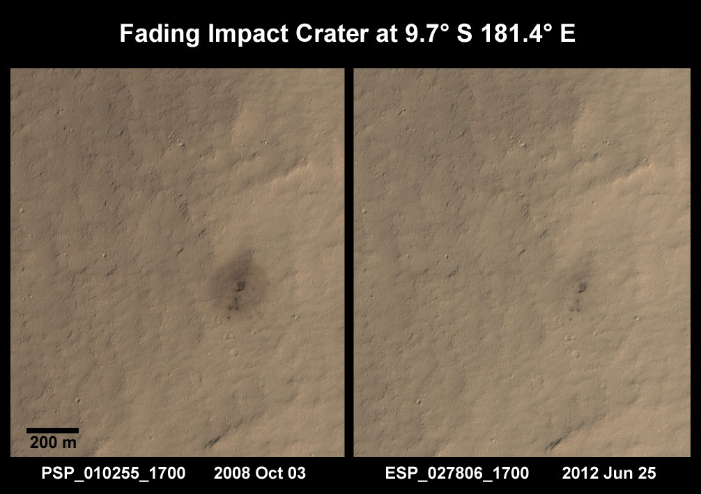
Today we'll take a look at two images of the same area taken a few years apart. Sometime between July 2005 and October 2008, a weak impactor broke up in the atmosphere of Mars and it's constituent parts hit the surface. Scientists know this because a THEMIS image from July 2005 of this area shows no indication that an impact had taken place, while a subsequent image taken by the Context Camera (CTX) aboard Mars Reconnaissance Orbiter in August 2008 showed the surface peppered with small impacts and a dark ejecta blanket. This led the HiRISE team to investigate the impact site in October 2008.
Clicking on this image will take you to the original HiRISE caption referencing this image.

In the first HiRISE image we can see the small impact sites and a dark ejecta blanket that seems to stem from the largest of the craters. In the subsequent image taken a few years later we see that the dark ejecta blanket has begun fading. This means that the wind either blew away the dark ejecta, or covered it with the surrounding lighter sediments.

Understanding this process and how long it takes is extremely important to future exploration of Mars. When we understand how fast erosion occurs on Mars we can infer how fast the wind is blowing and the amount of sediment that it picks up. Knowing this will help us to take the appropriate precautions that may end up saving lives and equipment. When we know how ferocious erosion will be we will be able to create barriers that can withstand that erosion.

Additionally, if we understand the rate at which erosion occurs we can ensure that we choose a more permanent features as navigational references once we do send a manned mission to Mars. This will ensure that people don't get lost or lose sight of their shelter because they expect to see a feature that has recently eroded away. Studying images like the two below will increase scientists understanding of the eroding elements on Mars, and help us to better prepare for the time when we do send a manned mission to Mars.

Mars Photo of the Day - 15 Jul 2012

Today's Image of Mars shows a spectacular, yet potentially dangerous feature on Mars at the North Pole. What we see here is a massive ice sheet which, at its center measures a few miles thick. The edges of the ice sheet are sharp cliffs that can sometimes drop over 800m! Scientists are extremely interested in these cliff faces because understanding how they formed helps us understand the record of climate change they hold within them!

This image truly highlights why we should continuously, thoroughly examine an area from orbit before sending manned or unmanned missions. By studying this image, and others of the area, scientists have determined that ice pieces are constantly falling from the edge, only to shatter into a million pieces at the bottom! What if we had not studied many different images of the area taken at different times and we tried to send a rover, or worse, a manned mission to Mars to study the cliff faces? People could die, or billions of dollars could be lost because we didn't take and examine more HiRISE images like the one below!

So if someday in the future you're taking a stroll on Mars, make sure to check out the HiRISE and other orbital images of the area! You wouldn't want to be walking over a cliff!

Click to see original high resolution image from HiRISE. [See their caption]

Mars Photo of the Day - 29 Jun 2012

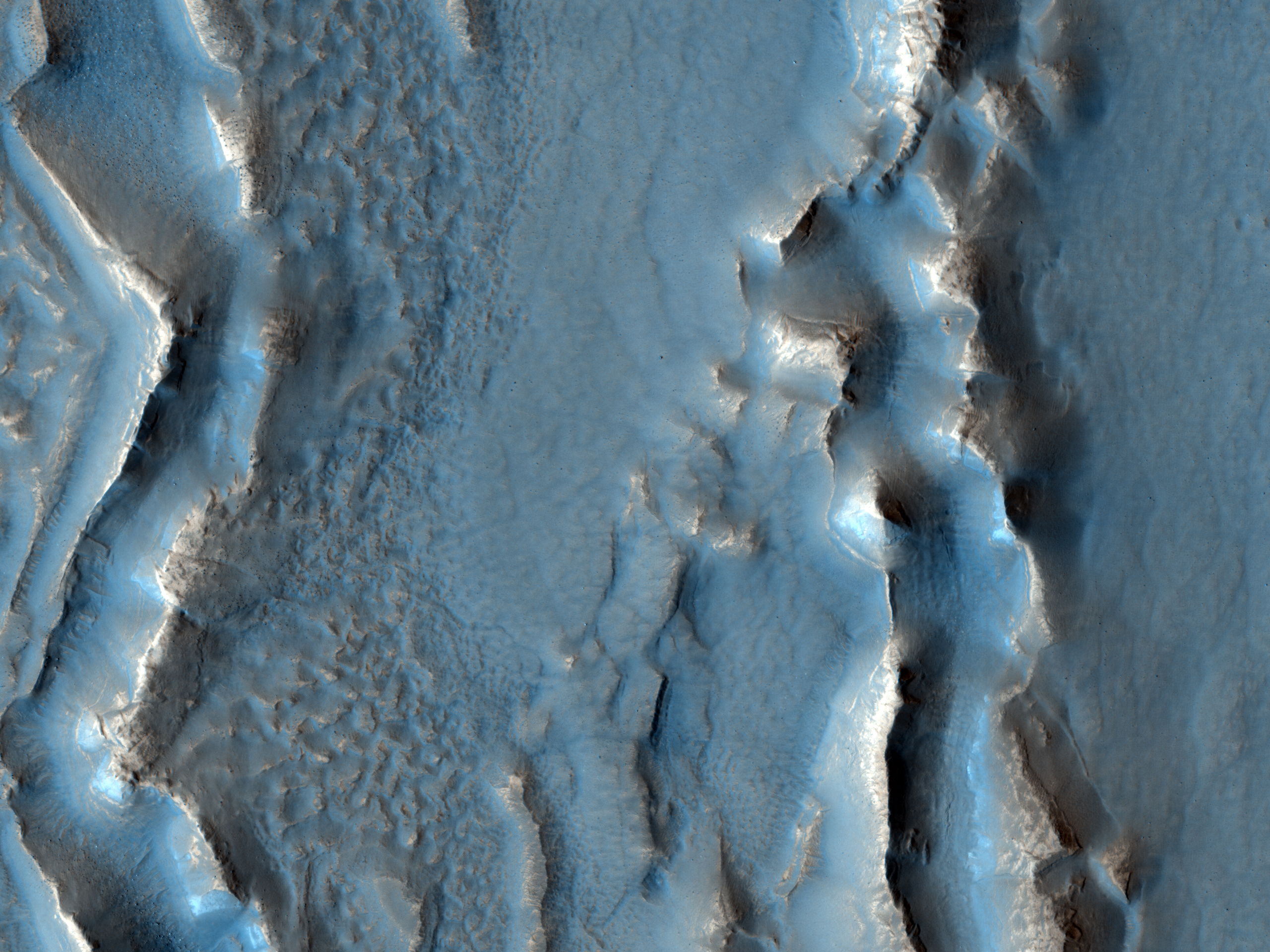
Today's Image of Mars shows colorful layers in Nili Fossae that are thought to contain carbonates. On Earth carbonates are commonly formed by marine organisms! Could it be that there was once life in the waters of Mars? Maybe!

Despite this tantalizing possibility, most scientsts are more reserved in their assessments, believing instead that there is some currently unknown reason why the carbonates formed on Mars. However, the scientists do say that water was most likely involved in the formation of the carbonates.

One day we may send a mission to this area in Nili Fossae, but for now we can only speculate and wonder about the origins of the carbonates. Clicking on this image will take you to the original high resolution image from HiRISE. [See their caption for the image]


Mars Photo of the Day - 25 June 2012

Today's Image of Mars shows what happened in Deuteronilus Mensae when ice quickly disappeared from the surface. The image below is of glaciers that once contained an abundance of ice, but when the climate changed, much of the ice on and near the surface disappeared into the atmosphere.

When the ice sublimated into the atmosphere it caused overlying terrain to collapse in on itself, creating the sharp, irregular features you see below. If we can determine when the features changed then that could tell us exactly when the climate on Mars went through a transition. If we know when the transition occurred we can make better guesses as to the reason behind the climate change. Perhaps an enormous asteroid collided with the planet, or maybe the rotational axis changed; there are unlimited possibilities, but knowing the time frame can help us narrow them down.

Clicking on this image will take you to the original high resolution HiRISE image.
[See their caption for the image]

Mars Photo of the Day - 19 June 2012

Today's Image of Mars shows bright material on the floor of a trough in Noctis Labyrinthus, which lies on the far western edge of Hellas Basin, just east of the Tharsis Volcanoes. What is this bright material, and under what circumstances did it form?

Examination of this bright material by Mars Reconnaissance Orbiter's CRISM shows that the bright material contains water. The hydrated material likely formed when ground water welled up into low lying depressions or when ice within Noctis Labyrithus was melted by volcanic activity in the nearby Tharsis region.

One day we may send a rover or even a manned mission to this area to find out exactly where the water came from, and more importantly, where it disappeared to. Until that time, further analysis from orbiting camera like those aboard the Mars Reconnaissance Orbiter will still provide valuable insight about the past and present climate on Mars. Maybe one day we will image something that will help us pinpoint the exact reason and time that water disappeared from the surface of Mars. For that answer, and many others, we will continue searching.

Clicking on this image will take you to the original high resolution image from HiRISE. [See their caption for this image]


Mars Photo of the Day - 13 June 2012

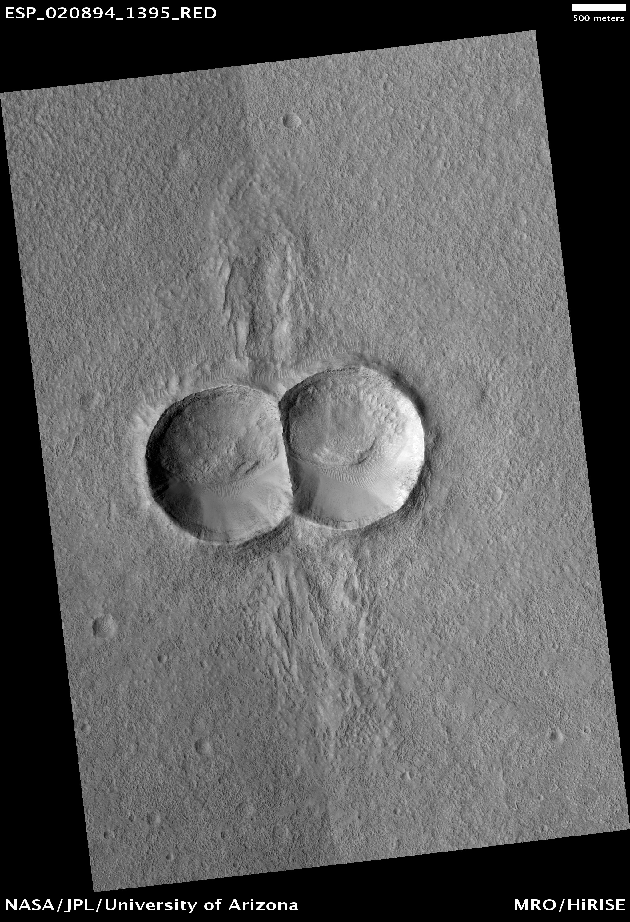
Today's Image of Mars shows a remarkable doublet crater! A doublet crater is formed when two objects impact the surface at the same time. But how does this happen?

Because the likelihood of two separate meteorites hitting the same place at the same time is so small, we assume that one loosely connected asteroid or comet split apart just before it hit the surface. The asteroid/comet would have split apart, but because of inertia, both pieces would have continued in essentially the same direction at the same velocity, separating only slightly. Thus they would impact locations nearby one another at almost the same time, thus forming the doublet imaged by HiRISE that we see below.

Clicking on this image will take you to the original high resolution image from HiRISE.