Google+ Mars Travel: Ice on Mars
Showing posts with label Ice on Mars. Show all posts

Mars Photo of the Day - 25 Jul 2012

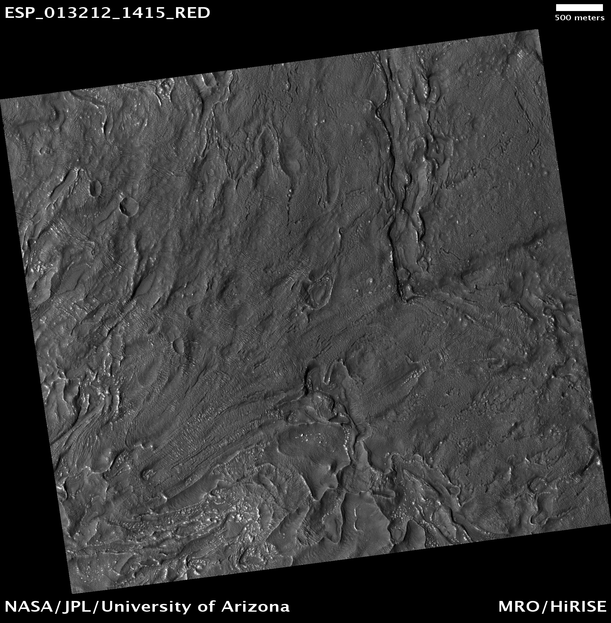
Today's image of Mars shows banded features indicative of past (and maybe present) glacial flow in Hellas Basin on Mars. The banded features we see in this HIRISE image are similar to those left on Earth where glaciers once flowed. 

Being able to understand these banded features on Mars will help scientists create a better image of what Mars looked like in the past. Being able to map out the Martian past will let scientists determine at which rate the icy glaciers moved. Understanding the Martian past will help us deal with the present and prepare for future exploration. 

Just as understanding Earth's past has helped us figure out why different continents have similar features, studying the geologic history of Mars will give us insight into the different features on Mars.

Clicking on this image will take you to the original high resolution image from HiRISE. [See the HiRISE caption]

Mars Photo of the Day - 15 Jul 2012

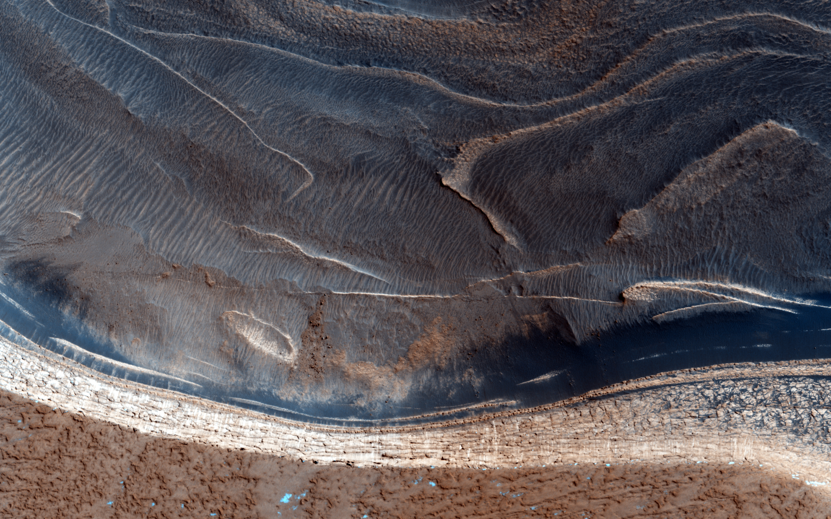
Today's Image of Mars shows a spectacular, yet potentially dangerous feature on Mars at the North Pole. What we see here is a massive ice sheet which, at its center measures a few miles thick. The edges of the ice sheet are sharp cliffs that can sometimes drop over 800m! Scientists are extremely interested in these cliff faces because understanding how they formed helps us understand the record of climate change they hold within them!

This image truly highlights why we should continuously, thoroughly examine an area from orbit before sending manned or unmanned missions. By studying this image, and others of the area, scientists have determined that ice pieces are constantly falling from the edge, only to shatter into a million pieces at the bottom! What if we had not studied many different images of the area taken at different times and we tried to send a rover, or worse, a manned mission to Mars to study the cliff faces? People could die, or billions of dollars could be lost because we didn't take and examine more HiRISE images like the one below!

So if someday in the future you're taking a stroll on Mars, make sure to check out the HiRISE and other orbital images of the area! You wouldn't want to be walking over a cliff!

Click to see original high resolution image from HiRISE. [See their caption]

Mars Photo of the Day - 25 June 2012

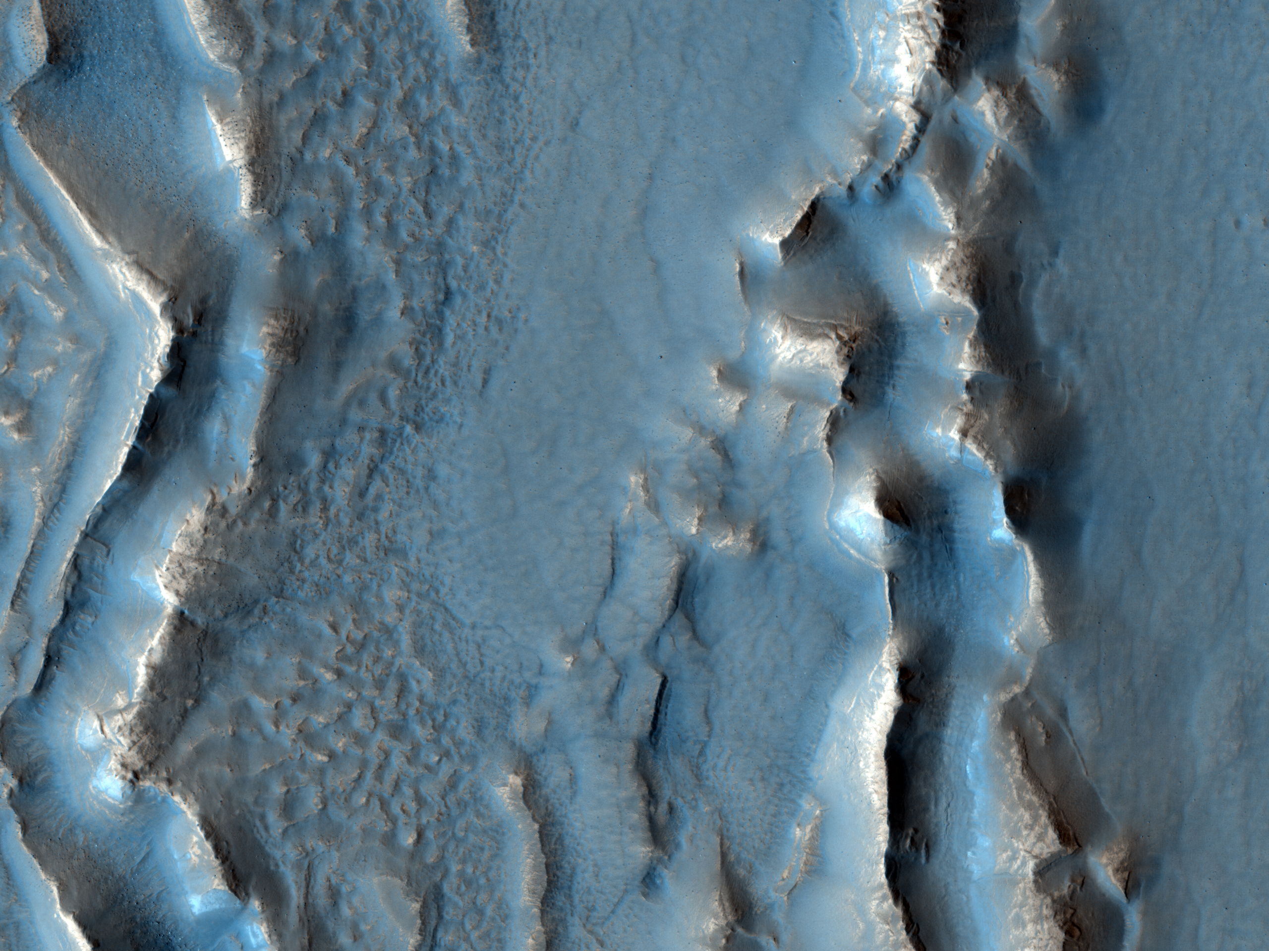
Today's Image of Mars shows what happened in Deuteronilus Mensae when ice quickly disappeared from the surface. The image below is of glaciers that once contained an abundance of ice, but when the climate changed, much of the ice on and near the surface disappeared into the atmosphere.

When the ice sublimated into the atmosphere it caused overlying terrain to collapse in on itself, creating the sharp, irregular features you see below. If we can determine when the features changed then that could tell us exactly when the climate on Mars went through a transition. If we know when the transition occurred we can make better guesses as to the reason behind the climate change. Perhaps an enormous asteroid collided with the planet, or maybe the rotational axis changed; there are unlimited possibilities, but knowing the time frame can help us narrow them down.

Clicking on this image will take you to the original high resolution HiRISE image.
[See their caption for the image]

Mars Photo of the Day - May 29 2012

Today's Image of Mars shows craters that have expanded due to the high impact temperatures sublimating the surrounding icy terrain. As you can see there are craters surrounded by wider, shallower depressions. These depressions surrounding the impact craters formed when the heat from impact made the carbon dioxide ice surrounding it turn directly into water vapor.

The depressions are elongated in the direction the meteorite struck because the impact created heated material that projected itself forward, which sublimated the ice in that direction. Imagine throwing a golf ball into a bowl of ice cream. If the ball comes in at an angle some of the ice cream will be uplifted and thrown forward, on top of other pudding. When this happens at a high enough velocity the friction between the surface of Mars and the impacting meteorite heats up the terrain it touches and launches it forward. The heat was enough that it sublimated the carbon dioxide ice and created the depression that you see oriented in the direction of the impact.

Clicking on this image will take you to the original high resolution image from HiRISE. [See their original caption for the image]


Mars Photo of the Day - Mar 25 2012

Today's Image of Mars was taken by HiRISE in an attempt to image ice covered dunes, but it turned out that area was slightly overcast!

Just like here on Earth there are clouds on Mars! These are fairly thin clouds, so we can still make out the ice covered dunes below. The clouds are likely made up of tiny carbon dioxide ice particles, but occasionally they can be made up of tiny water particles! Unfortunately that doesn't mean that it rains on Mars, but scientists have determined that it does snow! The only problem is that they have never seen the snow touch the ground, so it can't be easily used as water by future explorers!

Clicking on this image will take you to the original high resolution image from HiRISE. Check it out!


Mars Photo of the Day - Mar 6 2012

Today's Image of Mars comes from HiRISE shows one of many recent impact craters that have revealed ice just below the Martian surface. This particular crater is about 6m in diameter and located in Mars' northern hemisphere, though it doesn't lie as far north as most observed craters exposing ice. This implies that ice may lie just below the surface much further south than previously assumed. Scientists speculate that the crater formed between April 2004 and January 2010.

Ice just below the surface could be used by future manned missions to Mars as a source of water, helping to sustain the crews for a longer duration without requiring as much cargo leaving from Earth. The ice could also serve as an environment for extreme life on Mars, since most life requires some sort of water. 

Clicking on this image will take you to the Space.com article about it. 


Mars Photo of the Day - Feb 24 2012

Today's Image of Mars shows scallops (pits open on one side) and boulders in Utopia Planitia. The 3D high resolution anaglyph shows polygon features that develop as a result of temperature changes that cause ice contraction and expansion.

There are also numerous boulders that measure approximately 1 meter in diameter. Scientists know they are boulders and not ice because ice cannot remain stable on the Martian surface.

It is speculated that at least ten meters of ice has sublimated from some places in this image, which has created the pits and other features we see in this image. But how did the ice get there in the first place? Mars once had a wetter, warmer environment, but over billions of years Mars became much colder and the water that once covered the surface froze or retreated underground.

Clicking on this image will take you to the original captioned image from HiRISE.


Mars Photo of the Day - Feb 3 2012

Today's Image of Mars is from HiRISE and shows fretted terrain near Reull Vallis, a valley on Mars that appears to have been carved by water. Reull Vallis flows into Hellas Basin, which lies to the Northwest. 

Scientists have detected features in Reull Vallis that indicate glacial activity similar to that found on Earth. They even speculate that Reull Vallis actually contains large amounts of water-ice just below the surface, which is exciting because it means future explorers (man or machine) that land in Reull Vallis may be able to use the landscape as a source of water (or fuel)!

Clicking on this image will take you to the high resolution version hosted by Wikipedia.


Mars Photo of the Day - Jan 28 2012

Today's Image of Mars is shows Dodo-Goldilocks, a 22x35cm trench dug by the Mars Phoenix Lander, which, at its deepest reaches a depth between 7 and 8cm. The trench was dug using Phoenix's robotic arm on Sol 18 of its mission, which was June 12 2008, and this image was taken 6 Sol later on June 19 2008.

The white material that you see is ice. The ice lumps on the bottom left of the trench sublimated (turned from solid to gas) over the course of the next four days. [See the trench a few days later]

Clicking on this image will take you to the NASA page that shows the trench before and after the ice sublimated.
Source: NASA/JPL-Caltech/University of Arizona/Texas A&M University

Mars Photo of the Day - Dec 5 2011

Today's Image of the Day is of an unnamed crater on Mars with water ice in it. The crater is located in Vastitas Borealis, a broad plain which covers much of Mars' northern latitudes.

This crater is 35km in diameter and approximately 2km deep. The ice in this crater is present all year round because the temperatures at such high latitudes never get above freezing. The ice cannot be carbon dioxide ice because at the time this photo was taken all carbon dioxide ice had previously sublimated.

This image was taken by ESA's Mars Express' High Resolution Stereo Camera (HRSC). Clicking on this image will take you to the original high definition image. I highly recommend you check it out!


Mars Photo of the Day - Nov 13 2011

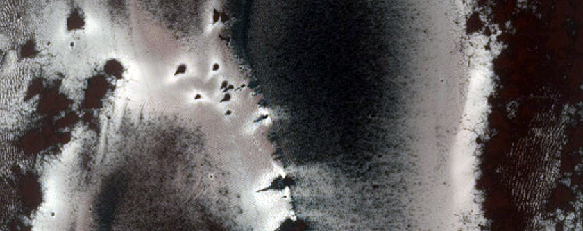
Today's Image of Mars shows a portion of the dunes in Richardson Crater, a 55km diameter crater in the south polar region of Mars. This image was taken as the dunes began to thaw and the carbon dioxide ice started to sublimate. You can see this in the dark patches where the ice has already sublimated. 

This image was taken in 2009 by HiRISE aboard the Mars Reconnaissance Orbiter. Click image to see the original captioned image.


Mars Photo of the Day - Oct 24 2011

Today's Image of Mars shows lobate flow features in the Northwest Hellas Rim. Lobate features on Mars are generally located at mid-latitudes (30-60 degreees) and are indicative of viscous flow reminiscent of glaciers on Earth. These slow flowing features has long been thought to be evidence of subsurface ice on Mars. This assertion is supported by recent ground penetrating radar images, which indicate these lobate features have cores of ice.

Clicking this image will take you to the original captioned image by HiRISE.


Mars Photo of the Day - Aug 18 2011

Today's Mars photo is of a 'skylight,' or an opening to an underground cavern, located in a crater on the Pavonis Mons volcano. The opening is 35 meters (115 feet) in diameter. These types of underground caverns often form in volcanic regions where lava flows solidify near the surface, but continue flowing underneath (the resulting structure is commonly referred to as a lava tube). When the lava ceases flowing the caverns are left empty. In this particular instance the cavern has been determined to be approximately 20 meters (65 feet) deep.

Image taken by the HiRISE camera on the Mars Reconnaissance Orbiter (Click Image for More Details)