Google+ Mars Travel: pits on Mars
Showing posts with label pits on Mars. Show all posts

Mars Photo of the Day - Apr 13 2012

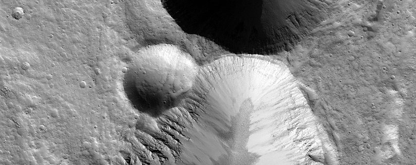
Today's Image of Mars shows a closeup of the eastern wall of a pit in Amazonis Planitia, courtesy of HiRISE. The darker streaks you see are the result of dust avalanches that removed a thin layer of light dust that covers the rest of the surface. 

You can see in the upper part of this pit near the rim that there are four distinct layers, which is indicative of at least four separate lava flows that covered the area. The terrain directly surrounding the pit is much less defined, which may be the result of a heavy dust covering that has muted the features. 

Another sign that there is a havy dust covering surrounding the pit is the bluish haze just around the rim, which the HiRISE team believes could be suspended dust. This can happen if wind lifts some of the dust covering into the air. 

Clicking on this image will take you to the original high resolution image from HiRISE. [See their caption on images of this pit]


Mars Photo of the Day - Apr 6 2012

Today's Image of Mars comes from Mars Express and shows some pit-chains near the bottom of one of the largest volcanoes in the solar system, Alba Mons. These pits are indicative of lava tubes below the surface, that form in volcanic regions where lava flows solidify near the surface, but continue flowing underneath. When the lava ceases flowing the caverns are left empty and sometimes the roof of the caverns will collapse, leaving the pits you see below. Lava pits like these are prime targets in the search for life on Mars.

One of the reasons scientists believe they have not yet detected any life on the surface is that the radiation levels are 250 times that experienced on the surface of Earth. This would be enough to kill most forms of life as we know it. What makes the lava tubes such a great target is that they are underground and shielded from much of the radiation that hits the surface. They have also been heated by the volcanic activity in the region and have likely experienced period when they were immersed in water, two key factors for life as we know it.

Clicking on this image will take you to the original high resolution image from Mars Express. [See their article on these collapse pits]


Mars Photo of the Day - Feb 24 2012

Today's Image of Mars shows scallops (pits open on one side) and boulders in Utopia Planitia. The 3D high resolution anaglyph shows polygon features that develop as a result of temperature changes that cause ice contraction and expansion.

There are also numerous boulders that measure approximately 1 meter in diameter. Scientists know they are boulders and not ice because ice cannot remain stable on the Martian surface.

It is speculated that at least ten meters of ice has sublimated from some places in this image, which has created the pits and other features we see in this image. But how did the ice get there in the first place? Mars once had a wetter, warmer environment, but over billions of years Mars became much colder and the water that once covered the surface froze or retreated underground.

Clicking on this image will take you to the original captioned image from HiRISE.


Mars Photo of the Day - Feb 11 2012

Today's Images of Mars come from the Mars Odyssey Orbiter and show seven different pits on Mars that scientists believe lead to underground caverns. These pits were found over 700km along the side of Arsia Mons, the second largest mountain on Mars, after Olympus Mons.

Cavern entrances like these ones are called skylights. They have no raised rim or ejecta, which differentiates them from impact craters. Can you see the seventh one?

In recent years scientists have suggested that underground caverns like these are likely to be much more suitable to life than the surface, which many believe is presently hostile to life as we know it.

Caverns like the ones below are likely destinations for future manned and unmanned missions to Mars! Some scientists speculate that colonies could be set up inside of caverns because they act as a natural shield to space radiation and the harsh Martian environment.

There are two skylights located in the image labeled "E", making the total number of skylights imaged below seven.

The entrances imaged below are only some of many potential cavern entrances discovered and imaged on Mars. Clicking the images will take you to other Mars Travel posts about skylights. These images were compiled by National Geographic. [See their original short caption for the images]

Images courtesy NASA/JPL/LPI


Mars Photo of the Day - Feb 4 2012

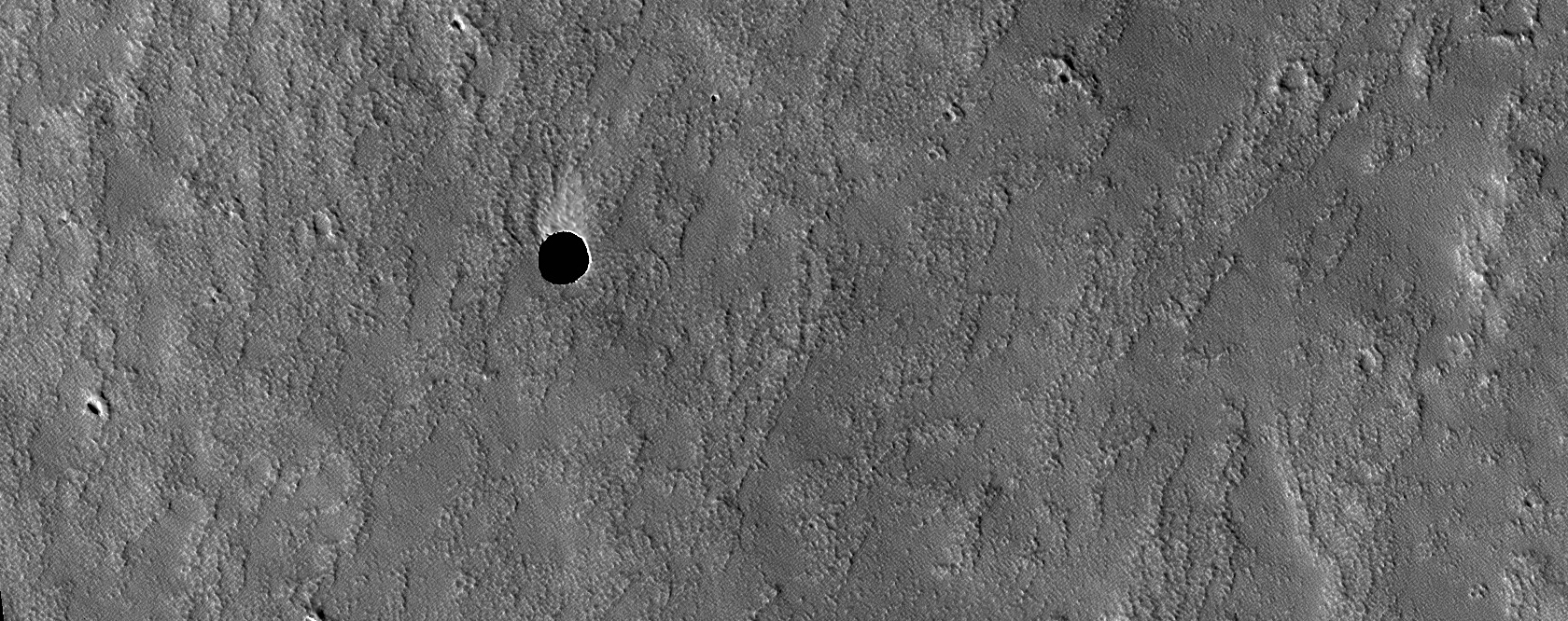
Today's Image of Mars shows what is very likely the entrance to an underground cavern on Mars. The cavern is located Northeast of Arsia Mons and can be seen at the top of this image.

Cavern entrances like this one are called skylights. They have no raised rim or ejecta, which differentiates them from impact craters. This skylight is so special because even the extremely sensitive HiRISE camera cannot detect what lies within the shadow if the skylight. In fact, HiRISE cannot see inside the shadows of this pit at all; it can't even see the walls of the pit.

Scientists speculate that this skylight must have overhanging or completely vertical walls, which brings them to the conclusion that this is a collapse pit into an underground cavern. This pit must be very deep for sunlight not to illuminate the bottom.

In recent years it has been suggested that underground caverns like this one are probably much more suitable to life than the surface, which has been irradiated and is hostile to life as we know it. Caverns like the one below are likely to be prime targets for future manned and unmanned missions to Mars! Some scientists even speculate that colonies could be set up inside of caverns because they act as a natural shield to space radiation and the harsh Martian environment.

Clicking on this image will take you to the original, captioned image from HiRISE.


Mars Photo of the Day - Dec 20 2011

Today's Image of Mars is a closeup of a pit on the Eastern flank of Pavonis Mons, a large volcano located in the Tharsis region of Mars. The pit is 180m at its widest diameter.

Even though the Western half of the pit is shrouded in shadow, HiRISE was able to peer into the shadows and determine what lies within. The boulders visible within the pit range from less than 1m to 5m in diameter. The HiRISE team reports that the boulders are covered in sediments.

Pits like the one below are called skylights and often form when the roof of an inactive lava tube collapses.

Clicking on this image will take you to the original captioned image from HiRISE.


Mars Photo of the Day - Nov 16 2011

Today's Image of Mars is of Coprates Cantena, located in the Southern part of the Valles Marineris canyon system on Mars. Coprates Cantena is a chain of collapsed structures running parallel to the main valley, Coprates Chasma. It is not as deep as the main canyon, but you can still see layered deposits on the walls of the pits.

This image was taken on May 25 2004 by Mars Express Orbiter. Clicking on the image will take you to the original, full-screen, high resolution image from the ESA. 


Mars Photo of the Day - Oct 25 2011

Today's Image of Mars shows a chain of pits along the northwestern flank of the volcano, Alba Patera. Those pits form a fracture at the volcano's southern most point. The fracture is part of a larger fracture system that is radial to the volcano and suggests that it is somehow related to the volcano's formation.

The fracture system could have formed when subsurface magma ceased flowing and the overlying ground collapsed. Another possibility is that water-ice could have formed along the fractures and the subsequent sublimation of the ice resulted in a partial collapse.

This image links to the original captioned image by HiRISE.