Google+ Mars Travel: North Polar Region of Mars
Showing posts with label North Polar Region of Mars. Show all posts

Mars Photo of the Day - 20 Sep 2012

Today's Image of Mars shows two distinctive layers exposed in a 230m wide crater caused by a meteorite impact in the Northern Plains. The impact excavated material from both layers at different rates because the layers are different densities. If you want to conduct an experiment to see how this happens, follow these steps:
  • Fill a bowl halfway with water and freeze it. 
  • After it's frozen, place a layer of sugar (powdered or granular) over the surface.
  • (This is the messy part) Take a marble or other hard object and throw it down into the bowl. (The impact will eject a lot of sugar from the surface)
  • Carefully remove the marble.
  • Take a photo from above. You will notice that the marble made more of an impact in the sugar, but faced increased resistance when it hit the ice. 
This is a simplified version of what happened when the meteorite created this impact. The layer under the surface was denser so the meteorite faced much more resistance and excavated the material at a much lower rate, as seen below.
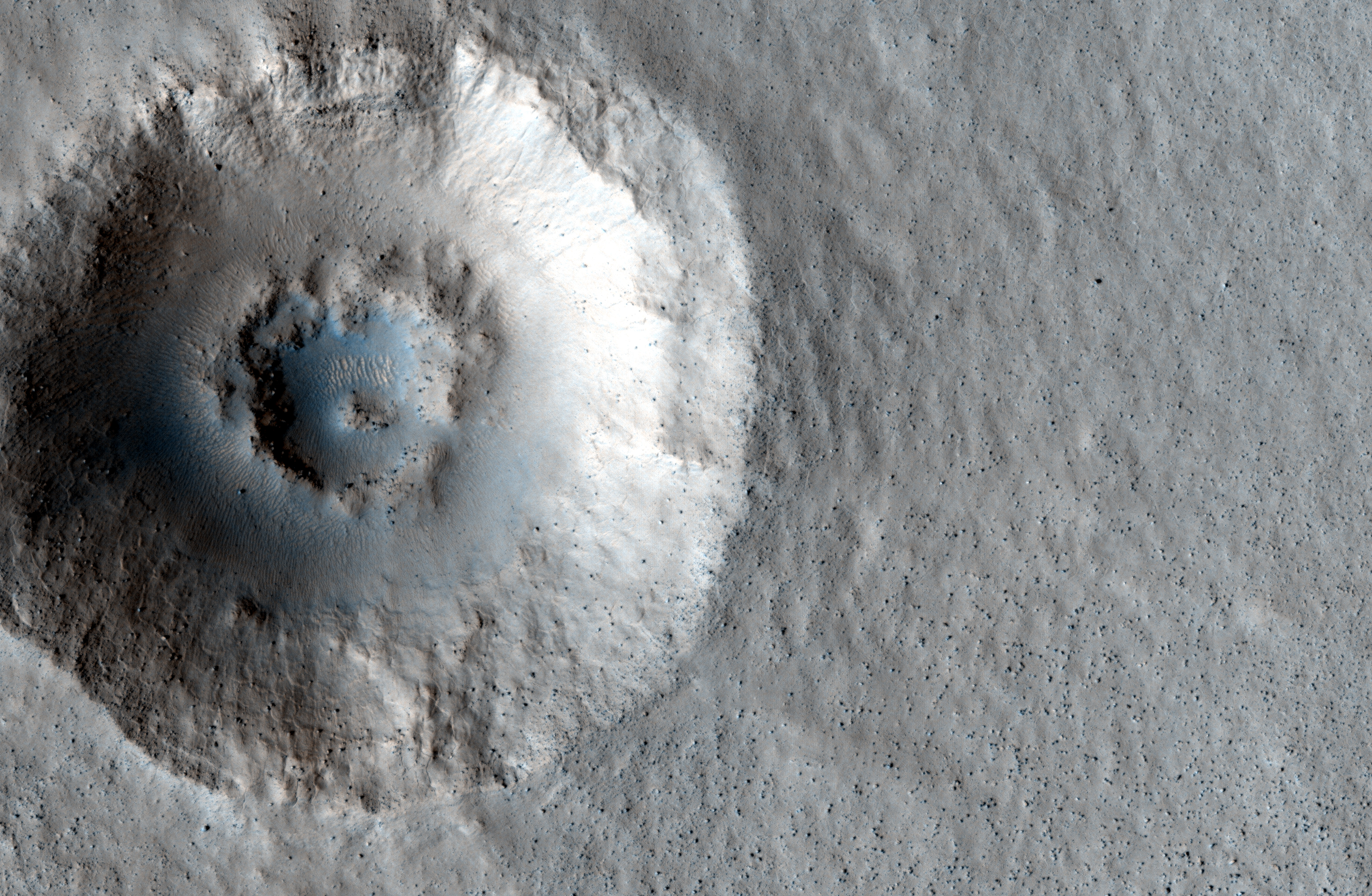
Click for high resolution image from HiRISE. [See their caption]
Radar images taken by SHARAD, the radar instrument aboard the Mars Reconnaissance Orbiter indicate the presence of ice below the surface, which makes this area a potential site for future exploration of Mars. If we can access ice beneath the surface of Mars then we could use it not only for sustenance, but as a source of fuel for future missions to Mars.

Mars Photo of the Day - 15 Jul 2012

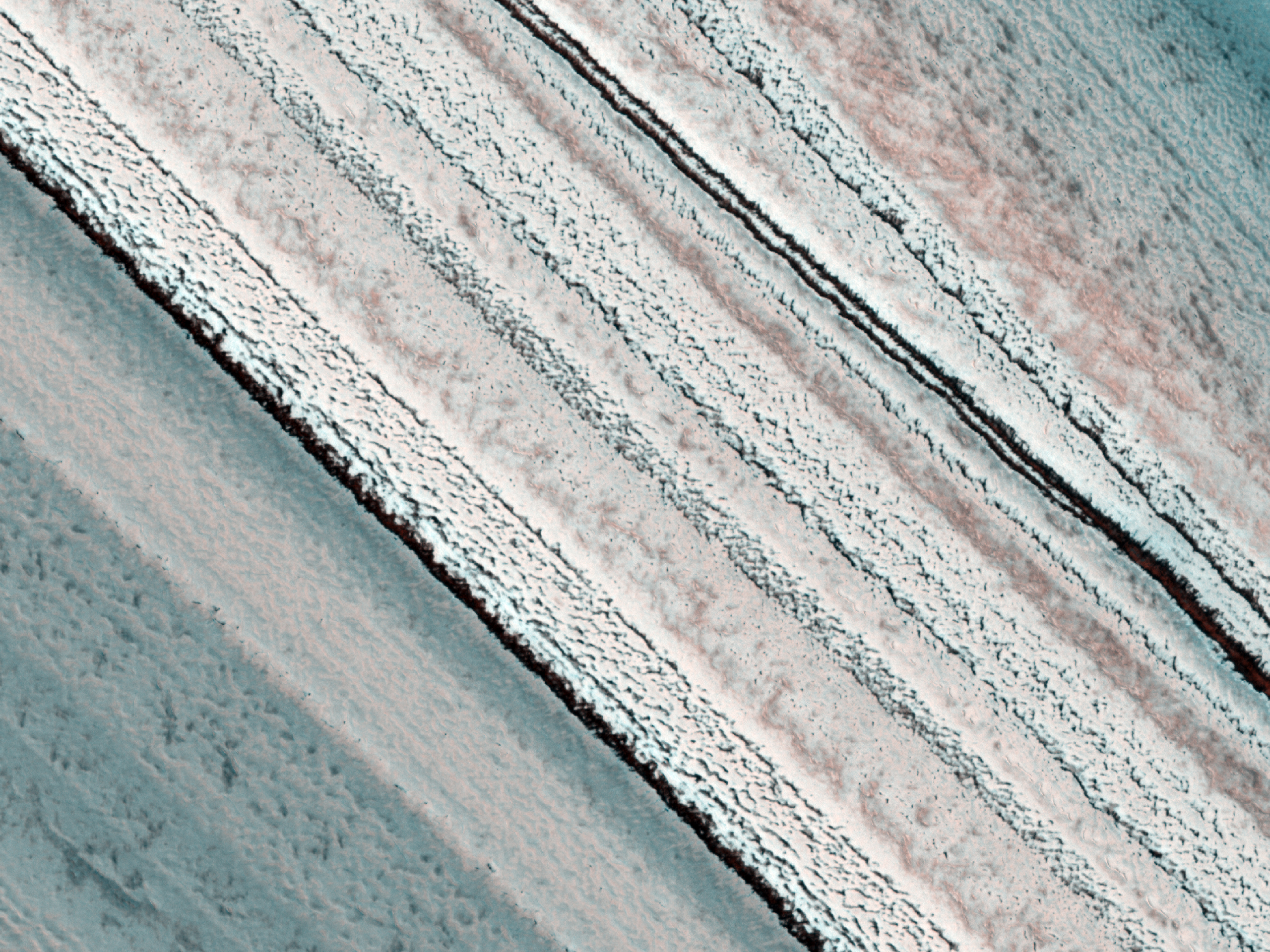
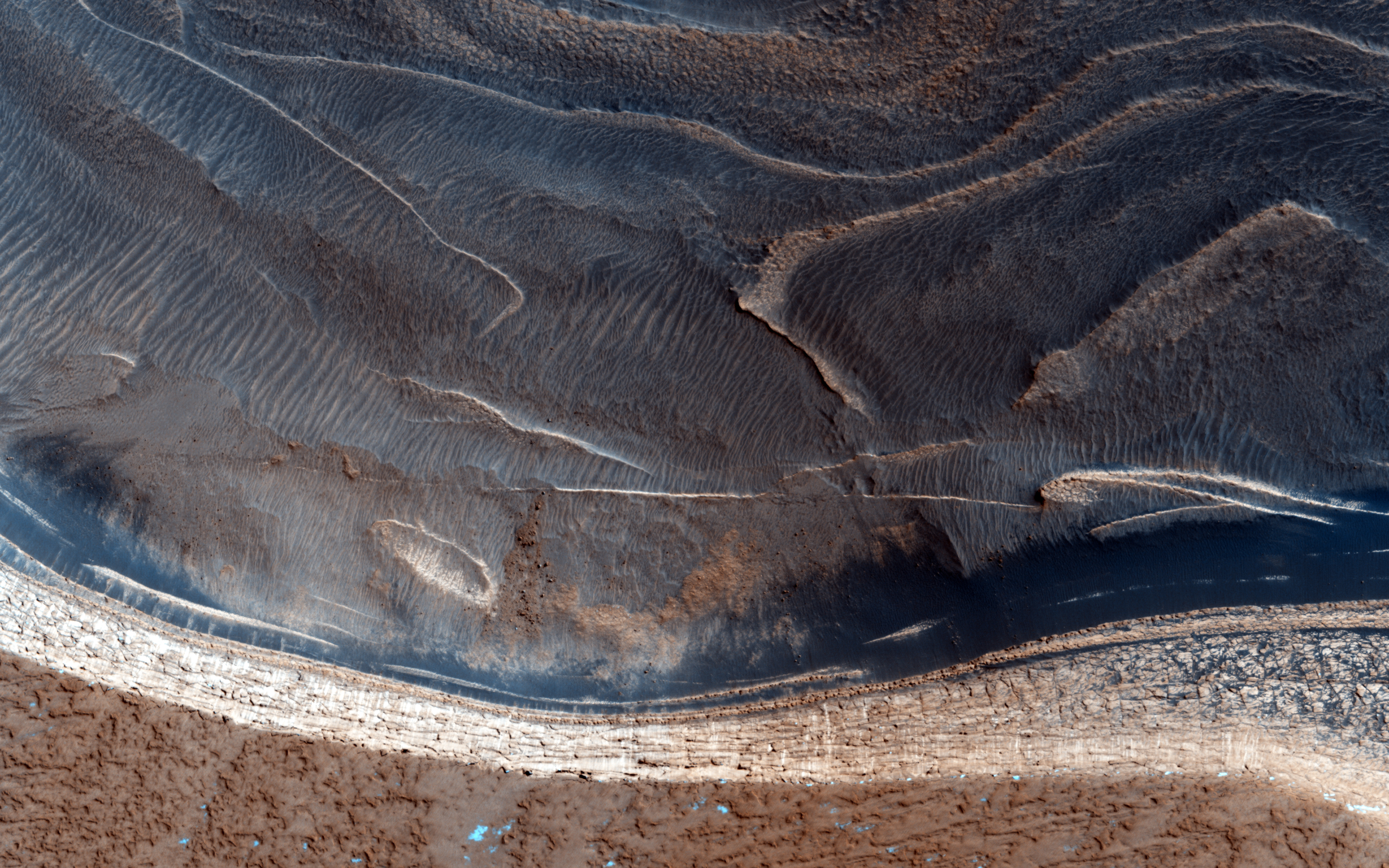
Today's Image of Mars shows a spectacular, yet potentially dangerous feature on Mars at the North Pole. What we see here is a massive ice sheet which, at its center measures a few miles thick. The edges of the ice sheet are sharp cliffs that can sometimes drop over 800m! Scientists are extremely interested in these cliff faces because understanding how they formed helps us understand the record of climate change they hold within them!

This image truly highlights why we should continuously, thoroughly examine an area from orbit before sending manned or unmanned missions. By studying this image, and others of the area, scientists have determined that ice pieces are constantly falling from the edge, only to shatter into a million pieces at the bottom! What if we had not studied many different images of the area taken at different times and we tried to send a rover, or worse, a manned mission to Mars to study the cliff faces? People could die, or billions of dollars could be lost because we didn't take and examine more HiRISE images like the one below!

So if someday in the future you're taking a stroll on Mars, make sure to check out the HiRISE and other orbital images of the area! You wouldn't want to be walking over a cliff!

Click to see original high resolution image from HiRISE. [See their caption]

Mars Photo of the Day - Apr 22 2012

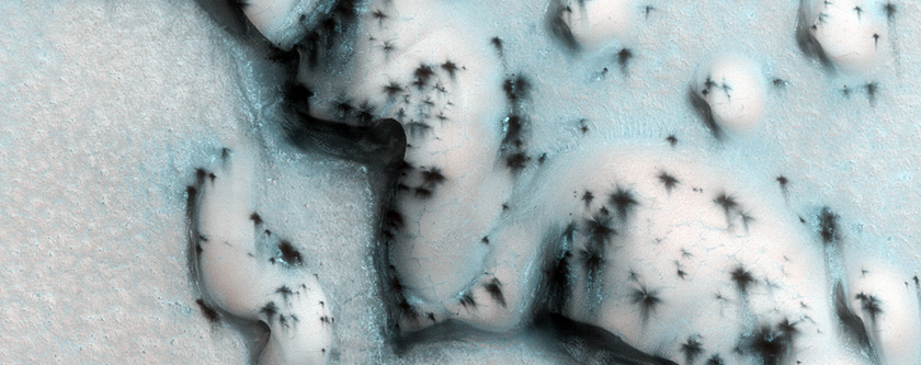
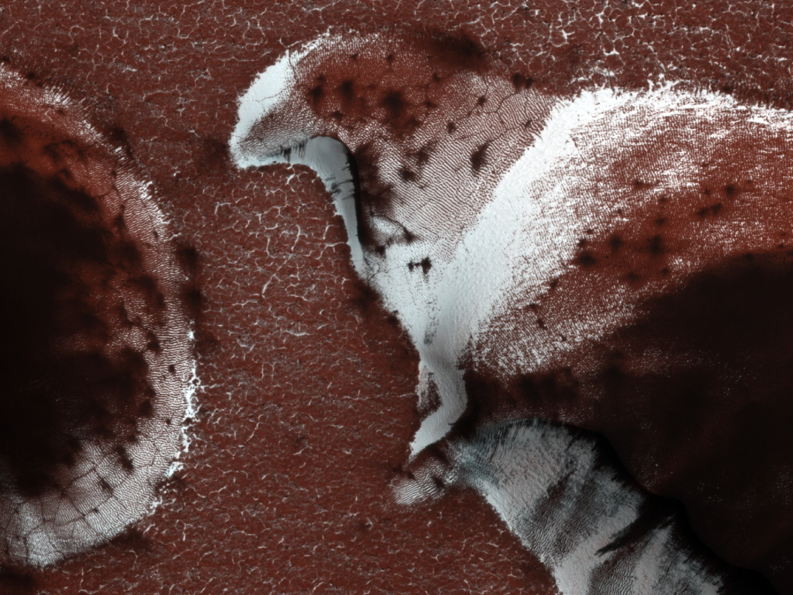
Today's Image of Mars comes from HiRISE shows defrosting dunes in the north polar region during late spring. The ice that you see is primarily carbon dioxide ice, which builds up over the winter months. During the spring the carbon dioxide ice begins to sublimate, turning directly from a solid into gas.

By the time this image was taken most of the ice had sublimated. As summer approaches more and more of the ice will sublimate, leaving only small patches, if that, but then when winter comes around the ice will begin to accumulate again! Thus is the never ending cycle in the north polar regions of Mars. 

Because there is such consistency on Mars scientists study the differences in the dunes each year to determine what processes, if any are still active on Mars. Click on this image to be taken to the original high resolution image. [See the HiRISE caption for this image]


Mars Photo of the Day - Mar 29 2012

Today's Image of Mars shows the North Polar Region in late spring, as taken by HiRISE. Earlier in the year the ground was covered in ice, but now most of it has sublimated. The ice that remains is located in areas shadowed from the sun or in places where the ice built up and will take longer to sublimate. The easiest way to imagine those is by thinking of snow drifts on Earth, which may survive for weeks after all the other snow has disappeared.

Clicking on this image will take you to the original captioned and larger image from HiRISE.


Mars Photo of the Day - Feb 29 2012

Today's Image of Mars shows clouds in The Red Planet's North Polar Region obscuring the view of Mars Odyssey's THEMIS. Some of the lower portion of this image is entirely shrouded by clouds, so much so that THEMIS can't even make out the surface.

Clouds on Mars are generally 10-15km above the surface and primarily made up ofsublimated carbon dioxide ice. Occasionally the clouds will be made up of tiny water particles. That doesn't mean it rains on Mars though! 

Mars is so cold that it couldn't rain, but scientists speculate that it does snow! Scientists have only seen snow fall in the upper atmosphere a few times and have no evidence that it ever reaches the surface, but who knows! Maybe it only happens every so often, like a leap year every four years! (See how I worked that in there? Don't worry, you can hold your applause!)

Clicking on this image will take you to the high resolution image from THEMIS. [See Universe Today's caption for a subimage of this one]


Mars Photo of the Day - Feb 17 2012

Today's Image of Mars shows colorful springtime layered deposits in the North Polar Region of Mars, as taken by HiRISE. Scientists study layered deposits because it lets them determine the past environment on Mars by studying the chemical makeup of the different layers. The oldest layers are buried beneath billions of years of sediment and dust deposits. 

When exposed, these layers tell us a lot about the past Martian climate including what the environment on Mars was when the layer was deposited, the length of time Mars experienced a certain climate, and the approximate time of environmental change. In short, studying layered deposits will help scientists determine when water was abundant on Mars and approximately when and how long it took for the planet to reach its current barren state. If we know when and how long it took for the water to disappear we can use that information to discover where the water on Mars went. 

Clicking on the image below will take you to the original high resolution image from HiRISE. [See their caption for the image]


Mars Photo of the Day - Jan 11 2012

Today's Image of Mars shows the Martian equivalent of terrestrial barchan dunes, which are usually crescent shaped and formed by winds blowing in one uniform direction. These dunes are located in the North Polar region of Mars.

Dunes like these are useful in determining the direction of the wind in this region of Mars because the side facing the wind becomes more eroded, resulting in a sheer, less rounded face. The wind also creates horn-like features oriented in the direction the wind predominantly blows. 

In this image the carbon dioxide ice on the dunes is just beginning to sublimate, revealing the dark basaltic sand underneath. The north polar Martian winter is just ending so most of the ground is still covered in the carbon dioxide ice, but by the time summer arrives it will have fully thawed, leaving the ground as dark as the patches in this image.

Clicking on this image will take you to the original, captioned HiRISE image.


Mars Photo of the Day - Dec 12 2011

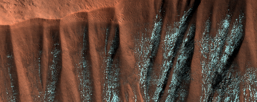
Today's Image of Mars shows frosted gullies in a North Polar region crater. This image was taken in the summer months on Mars. The frost has survived because it lies within the North facing alcoves of the gully and is constantly shrouded in shadow. There are similar gullies on the opposite side of the crater, but because they are facing south the frost inside them has melted.

The gullies depicted in this image have the large alcove at the top of the crater wall and channels that flow down into the crater. Some of these gullies show current activity, but it seems that the most activity is at the height of the winter season when the temperatures are the lowest, which leads scientists to believe that the activity is caused by falling loose material and not liquid water.

This image was taken by HiRISE. Clicking on the image will take you to the original captioned image from them.


If you like the HiRISE images showcased in the Mars Photo of the Day posts I encourage you to enter for a free 2012 HiRISE Calendar

Mars Photo of the Day - Oct 2 2011

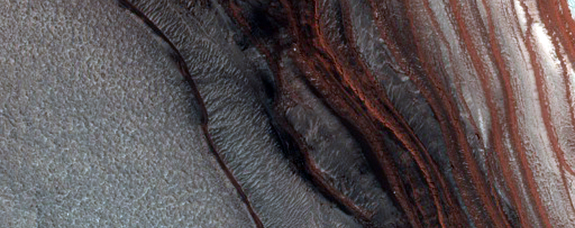
Today's Image of Mars is of layered deposits in the northern polar region of Mars. The layered deposits of dusty ice can stack up to 3 km. Differences in each layer's composition can tell a lot about the climate of the planet at the time of deposit.
These layered deposits are visible from orbit when troughs and scarps cut through the deposits. This is similar to a canyon on Earth, or a cliff, where the erosion has cut through the deposits and the layers can be seen by looking down the canyon. What is unusual about these deposits in Chasma Boreale is that not only are there layered ice deposits, but there are layered sand deposits as well. 
This photo was taken by Mar Reconnaissance Orbiter's HiRISE camera in 2008. Clicking on this image will take you to the original captioned image by HiRISE where you can find more information on layered deposits.