Google+ Mars Travel: wind erosion
Showing posts with label wind erosion. Show all posts

Examining Images of Aureum Chaos for Change

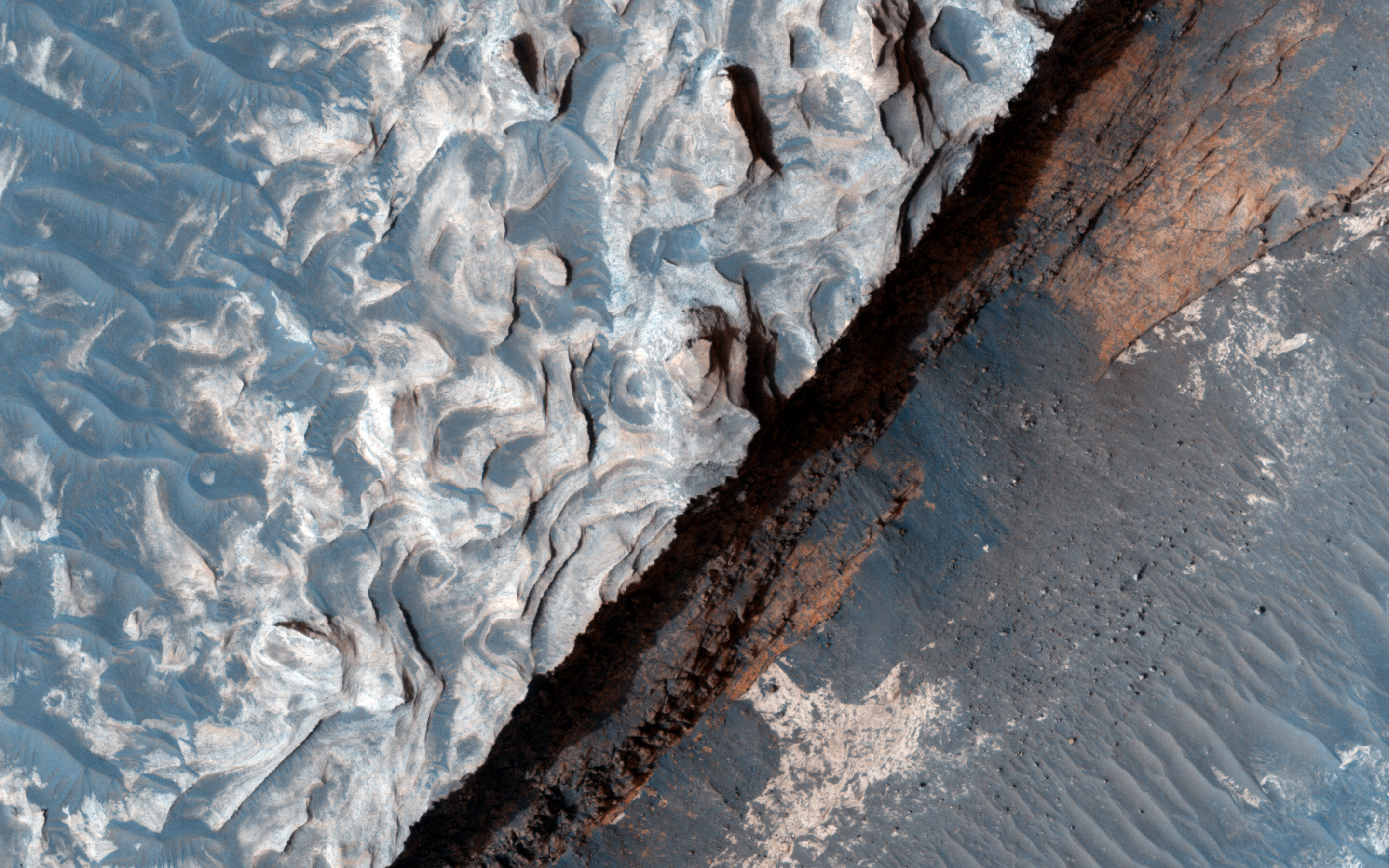
The primary source of erosion on Mars today is the wind. Scientists try to learn more about the wind and the changes it makes to the surface by studying images of Mars. To find these changes we often have to examine two pictures from a location taken at different times. This is true of the below photos taken of Aureum Chaos.

Acquired two Mars years ago. Source: HiRISE

Source: HiRISE

Although the above images are not exact overlays of one another, one can still pinpoint areas present in both images. Once done scientists can determine if there have been any changes or movements to material in the area. Although a preliminary look shows no changes in the past two years, a more fine-tuned examination will likely reveal minor changes.

Studying changes to the terrain allows scientists to assess the real affect of the wind on the environment. Knowing this will help us to know what we might see on the ground and what to watch out for on future prolonged missions to the surface. Imagine if you are living on Mars and you wake up one day to see rocks moved and sand displaced you might be disconcerted, but if you know about the wind you won't worry as much. Understanding how much effect the wind has on the surface also ensures that scientists take frequent images of landing areas because they know what might be a smooth area one week could be rocky terrain the next.

Studying images like the ones above ensures scientists learn the most they can about the wind on Mars and its effects on the environment.

Mars Photo of the Day - May 16 2012

Today's Image of Mars shows a potential landing site for future missions to Mars west of Aeolis Planum, as imaged by HiRISE. Within this potential site we see numerous ridges with a general North-South orientation, which measure about 10 meters wide and 100 meters long. These ridges appear to have formed from wind, which suggests that the soil is made of fine grained sand and rocks, easily moved and oriented by the wind.

The crater that you see on the right of this image has been filled by soil, as have many other smaller crater you can see in different subimages. This implies that the bedrock underlying the top layer of windblown soil may be easily eroded. This could be the mos likely reason why there is so much sand able to form the ridges described above.

Clicking on this image will take you to the original high resolution image form HiRISE. 


Mars Photo of the Day - Apr 19 2012

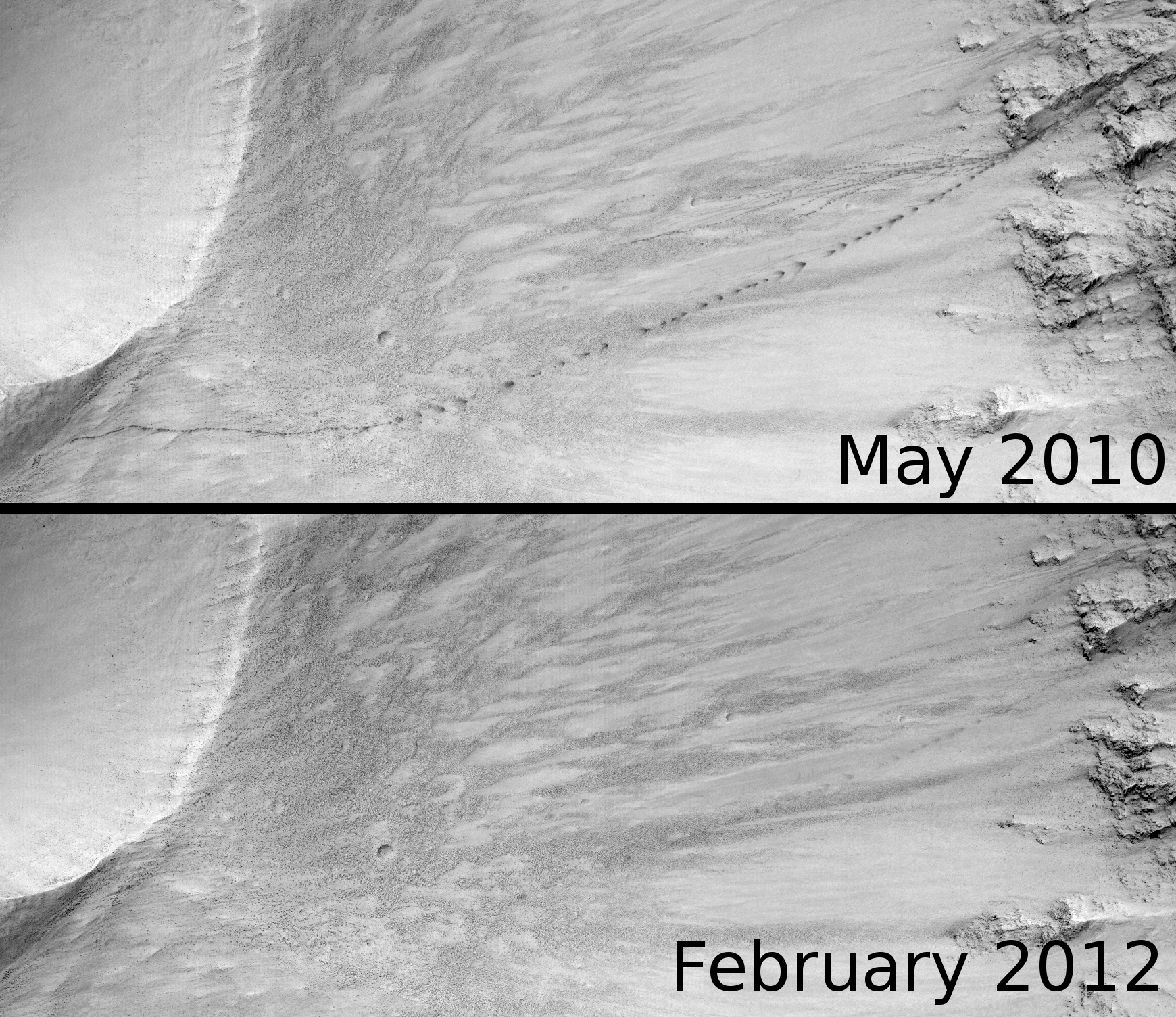
Today's Image of Mars is a reminder that features on Mars are constantly changing due to wind erosion. The image from May 2010 shows tracks left from large and small boulders as they rolled and bounced down the slope in Eastern Isidus Planitia. When you compare that with the image of the same area in February 2012 you'll notice that all but the largest trail has been completely erased from the surface, and even that has been significantly faded.

It's important that we realize that not all features on Mars are permanent. This is in direct contrast to the Moon, where even today the footprints of the Apollo astronauts can be seen. Understanding that Mars is still a changing planet is essential when sending future missions to Mars because we need to make sure that we use more permanent features for navigation while on the Red Planet. This may seem obvious, but when you look down from orbit it's easy to forget that some features can change in just a matter of months, given the right circumstances. 

Click on this image to see the original in high resolution from HiRISE. [See the original HiRISE caption for this image]


Mars Photo of the Day - Jan 31 2012

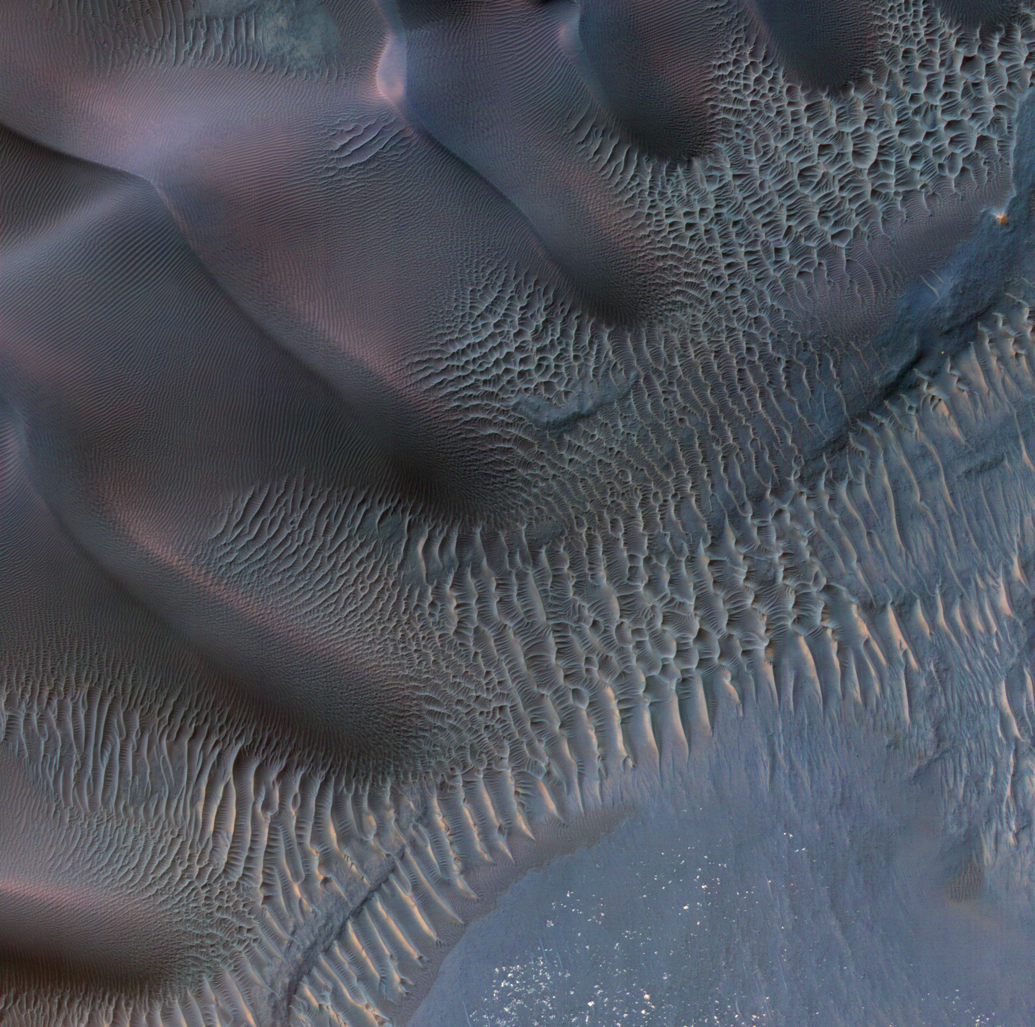
Today's Image of Mars shows dunes and sand ripples of varying sizes within an impact crater in Noachis Terra. These dunes are a perfect representation of the natural beauty on Mars. 

Because dunes are shaped by the wind, their orientation helps scientists to determine the wind's direction and strength in the imaged area. This can help scientists when they are planning future missions to Mars and need to be wary of all environmental factors. 

Clicking on this image will take you to the original high-resolution image from HiRISE. [See the captioned image]

Mars Photo of the Day - Jan 11 2012

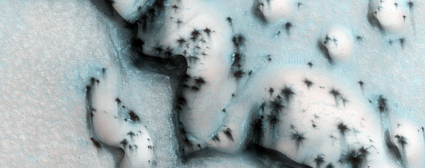
Today's Image of Mars shows the Martian equivalent of terrestrial barchan dunes, which are usually crescent shaped and formed by winds blowing in one uniform direction. These dunes are located in the North Polar region of Mars.

Dunes like these are useful in determining the direction of the wind in this region of Mars because the side facing the wind becomes more eroded, resulting in a sheer, less rounded face. The wind also creates horn-like features oriented in the direction the wind predominantly blows. 

In this image the carbon dioxide ice on the dunes is just beginning to sublimate, revealing the dark basaltic sand underneath. The north polar Martian winter is just ending so most of the ground is still covered in the carbon dioxide ice, but by the time summer arrives it will have fully thawed, leaving the ground as dark as the patches in this image.

Clicking on this image will take you to the original, captioned HiRISE image.


Mars Photo of the Day - Dec 21 2011

Today's Image of Mars shows part of a dune field found within Proctor Crater. Proctor Crater is approximately 150km in diameter and lies in the Southern Highlands of Mars.

The dark dunes seen in this image are made up of basaltic sand which has collected at the bottom of Proctor Crater. On top of these large dunes lie smaller secondary dunes consistent with terrestrial dunes of similar size.

In this image you can see that between the large, dark dunes lie smaller, brighter formations. It's been suggested that these are smaller dunes or granule ripples composed of material that is different from the larger dunes. The large, dark dunes overly the the smaller, brighter features, implying that they are a more recent addition to the crater.

Both the large and small features were formed through wind erosion. We can see in this image that the orientation of the smaller features was affected by the placement of the larger dunes.This is because wind must flow around the larger dunes.

HiRISE continues monitoring Proctor Crater to determine whether the dunes are still active today. Clicking on this image will take you to a similar, captioned HiRISE image of dunes in Proctor Crater.


Mars Photo of the Day - Dec 17 2011

Today's Image of Mars shows a partially exhumed crater in Evros Vallis.

What exactly is an 'exhumed' crater?

An exhumed crater is one that formed a long time ago, but was subsequently buried. It becomes re-exposed because the materials that originally filled and covered it start to erode. This is because oftentimes the materials that fill a crater are less wear resistant than the surrounding terrain, making them easier to erode.

In this image you can see many different dunes surrounding and even in the crater. Evros Vallis is full of these dunes. What do these dunes tell us?

Well if you look at this image you can see that not all the dunes have the same orientation. Since Martian dunes are created almost entirely from wind they are generally oriented the in the direction the wind was blowing. Because these dunes and others like them in Evros Vallis have different orientations we can tell that  different 'wind regimes' were involved in the creation of the dunes. A 'wind regime' simply refers to the a pattern in the regularly flow and direction of the wind.

This image was taken by HiRISE. If you click on it you you will be taken to the original captioned image from them.


Mars Photo of the Day - Nov 25 2011

Today's Image of Mars is of crescent shaped depressions on the surface created by strong winds.  The Earth equivalent are called blowoutsbut occurrences on Mars are much larger than those on Earth. This image is from North Azimuth on Mars, but there are many similar features in other parts of Mars. 

On Mars, wind is the currently the primary cause of erosion. [How strong are the winds on Mars?] There is evidence that water helped shape much of the Martian surface, but over billions of years Mars is now devoid of the massive seas, rivers, and lakes that once played a part in shaping the planet.

This image links to the original image page from Mars Odyssey's THEMIS.


Mars Photo of the Day - Nov 10 2011

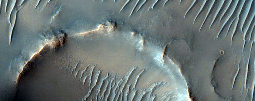
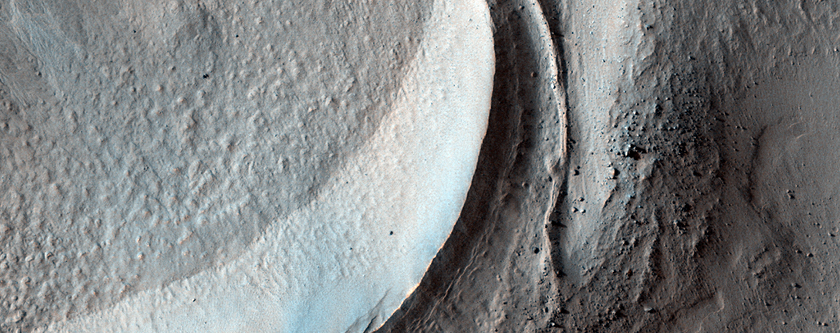
Today's Image of Mars is of gullies and lobate material in a crater in the Noreidum Montes. The area surrounding the impact site is devoid of ejecta and the crater is not as deep as one that size should be, meaning that the area was filled in.

The crater imaged below also has gullies on its northern side and extending toward the center. It also has an arc-shaped ridge inside the southern edge of the crater. This could be caused by wind erosion or accumulation of material filling the crater.

Clicking on this image will take you to the original captioned image from HiRISE.