Google+ Mars Travel

Mars Photo of the Day - Apr 3 2012

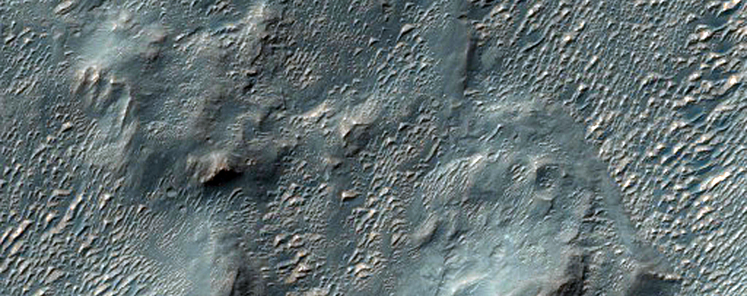
Today's Image of Mars shows a potential landing site in Holden Crater for the 2018 joint ExoMars rover, as taken by HiRISE. Holden Crater is 140km in diameter and numerous clays and sediments that could only have formed in the presence of water.

Holden Crater was one of the top four candidate landing sites for the Mars Science Laboratory, which is landing in August 2012. The crater holds some of the best exposed lake deposits yet discovered on Mars, which makes it a prime landing site for any and all future missions to Mars that hope to determine whether Mars once did, or still does support life.

NASA recently backed out of the ExoMars mission due to budgetary cuts, which forced the Russian Space Agency (Roscosmos) to take a much larger role in the mission. The joint ESA-Roscosmos mission appears to be going ahead on schedule with an orbiter expected to launch in 2016 and the rover expected to launch in 2018, but at this point anything could happen.

It remains to be determined where on Mars the ExoMars rover will be sent, but we can be sure that Holden Crater is among the top candidates! Clicking on this image will take you to all Mars Travel posts related to Holden Crater because the original HiRISE image is not yet captioned.

Mars Photo of the Day - Apr 2 2012

Today's Image of Mars comes from the High Resolution Stereo Camera (HRSC) aboard the Mars Express Orbiter and shows the Eumenides Dorsum mountains, which cover an area of 12,000 square kilometers. The mountains are to the west of the Tharsis Quadrangle and form part of the Medusa Fossae region, which scientists believe is covered by a blanket of volcanic ash. 

The region is full of features carved into layers of sedimentary rock by wind erosion. The smooth area in the center of this image is a result of that terrain being more resistant to erosion than the surrounding area. This indicates that the surface of that area is made up of volcanic rock, as opposed to more easily eroded sedimentary rock. 

Clicking on this image will take you to the original high resolution image from Mars Express. [See their article on the Eumenides Dorsum mountains]


Mars Photo of the Day - Apr 1 2012

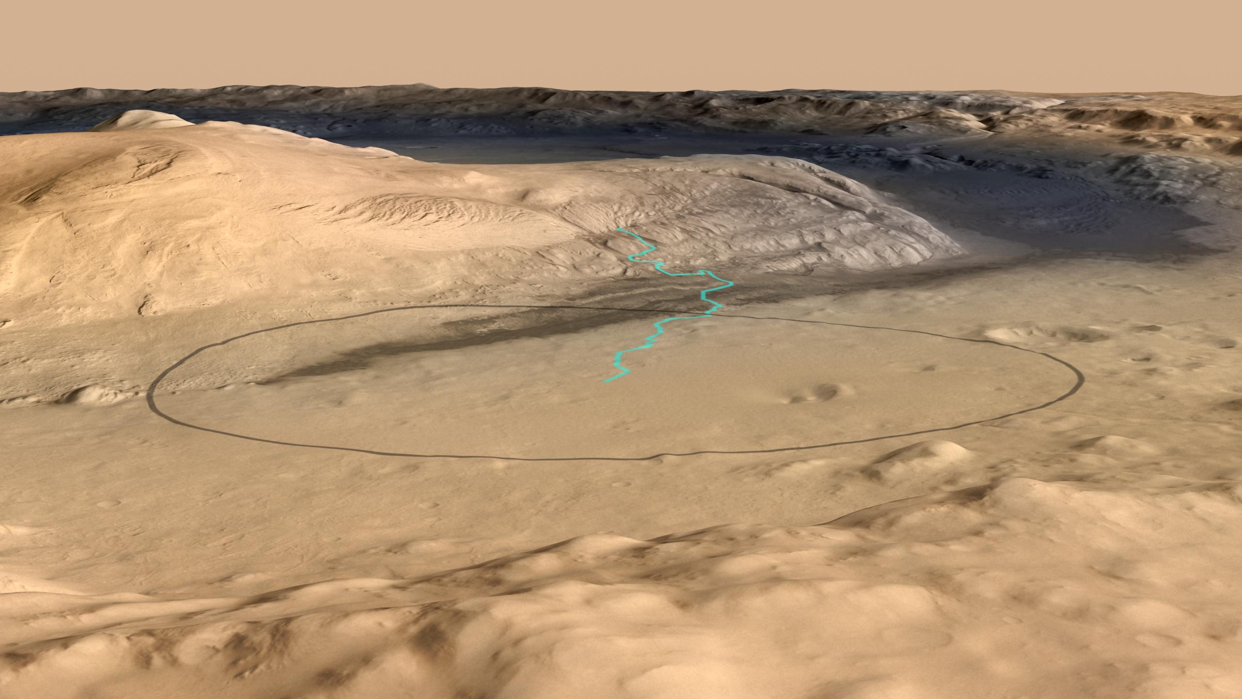
Today's Image of Mars shows the landing site for Mars Science Laboratory Curiosity at the foot of Mount Sharp, the 5km high central mound in Gale Crater. The turquoise line shows the expected path of MSL after it lands and begins navigating its way up Mount Sharp. The black oval measures about 20km by 25km and is the area in which MSL Curiosity has a 99% probability of landing.

The lowest portion of Mount Sharp is comprised of clays and sulfates, materials which are formed in the presence of water. The overlying layers contain sulfates, but very little clay, indicative of an environment in which water was evaporating and Mars was becoming drier. Scientists hope that studying Mount Sharp's layers can provide insights into the past Martian climate and give them a better idea as to whether Mars was once, or may still be habitable.

This image combines data from the High Resolution Stereo Camera on the European Space Agency's Mars Express orbiter, with data from the Context Camera on NASA's Mars Reconnaissance Orbiter, and color information from the Viking Orbiter. Clicking on this image will take you to the original higher resolution image from NASA. [See the NASA article on Mount Sharp]