Google+ Mars Travel

Mars Photo of the Day - 30 Sep 2012

Today's Image of Mars was taken by MSL Curiosity; it shows further evidence that water once existed on Mars. What you see here are remnants of an ancient riverbed on Mars, including the prominent rock outcrop Hottah, named after Hottah Lake in Canada's Northwest Territories.

Click to see full size original
Source: NASA/JPL
This rock outcrop is a sedimentary conglomerate, meaning that it is comprised of small fragments cemented together. The outcrop is tilted up due to some sort of disruption, most likely as a result of nearby impacts and their associated tremors.

We can tell that this used to be an ancient stream because of the size and rounded shape of the small rocks/gravel and the fact that small bits of the gravel and sand sized grains are cemented into the outcrop. Because some of the cemented gravel is round and too large to have been transported by the wind, scientists believe that it was transported by fast moving water, which is further evidence for this once having been a stream/river.

Mars Photo of the Day - 26 Sep 2012

Today's image of Mars is of the first rock examined in earnest by Mars Science Laboratory, Jake Matijevik. The odd, 25cm tall pyramid shaped rock is named after the late surface operations systems chief engineer, who passed away on 20 Aug 2012. He had worked on all three other rovers, Sojourner, Spirit,  and Opportunity. 

The rock Jake was used to test and calibrate some of Mars Science Laboratory's many tools, including the laser attached to the rover's ChemCam instrument, which determines the rocks chemical composition by analyzing the vaporized particles. 


On 24 Sep 2012 MSL Curiosity finished up it's examination of Jake and began its longest drive thus far on the Mars, 42 meters. Over the next few days and weeks, scientists hope to test the rest of Curiosity's instruments, including it's scooping system and drill, which scientists hope will give them unprecedented insight into the composition of surface materials on Mars, as well as material that may lie right below the surface. 

Mars Photo of the Day - 20 Sep 2012

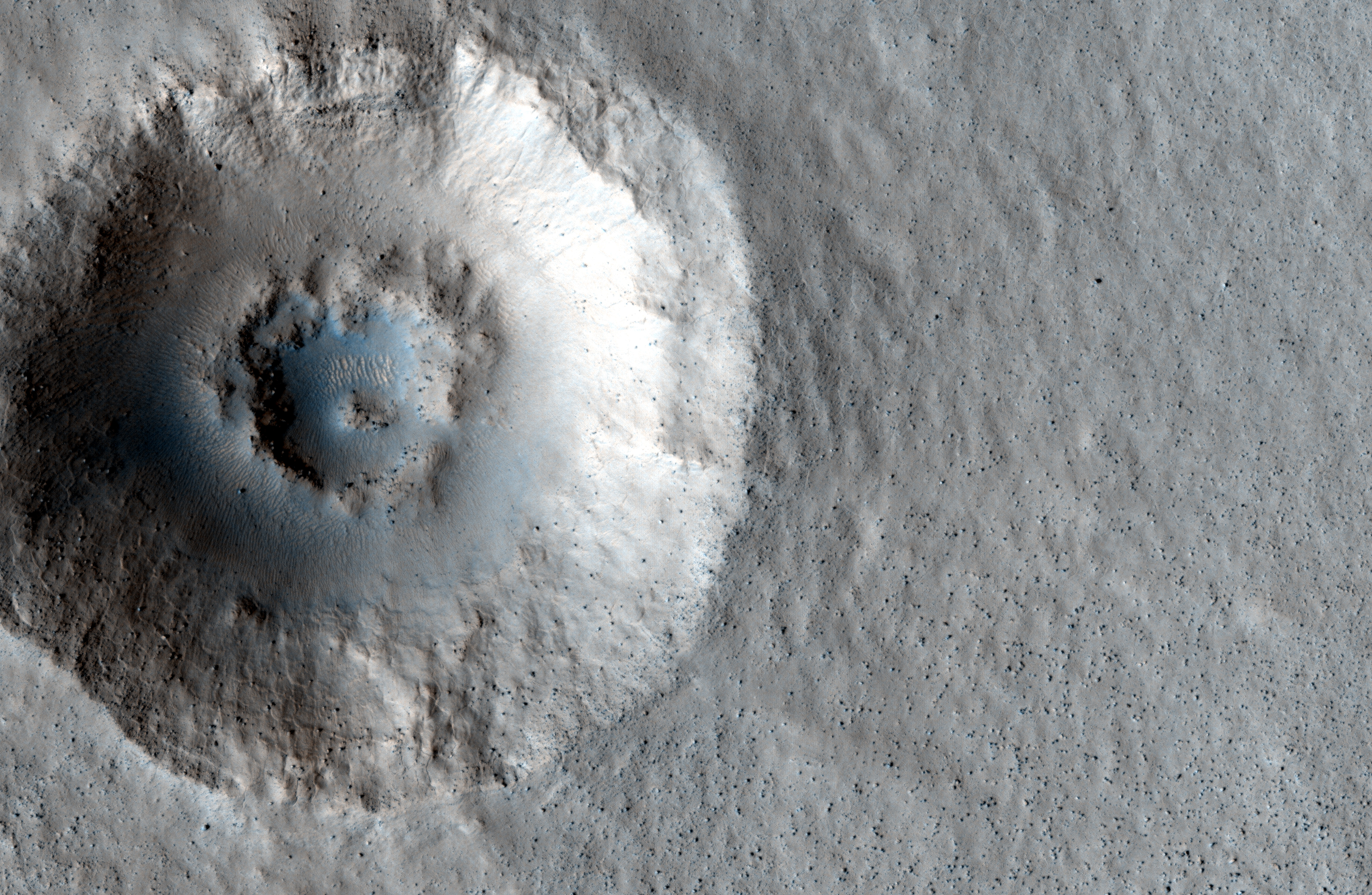
Today's Image of Mars shows two distinctive layers exposed in a 230m wide crater caused by a meteorite impact in the Northern Plains. The impact excavated material from both layers at different rates because the layers are different densities. If you want to conduct an experiment to see how this happens, follow these steps:
  • Fill a bowl halfway with water and freeze it. 
  • After it's frozen, place a layer of sugar (powdered or granular) over the surface.
  • (This is the messy part) Take a marble or other hard object and throw it down into the bowl. (The impact will eject a lot of sugar from the surface)
  • Carefully remove the marble.
  • Take a photo from above. You will notice that the marble made more of an impact in the sugar, but faced increased resistance when it hit the ice. 
This is a simplified version of what happened when the meteorite created this impact. The layer under the surface was denser so the meteorite faced much more resistance and excavated the material at a much lower rate, as seen below.

Click for high resolution image from HiRISE. [See their caption]
Radar images taken by SHARAD, the radar instrument aboard the Mars Reconnaissance Orbiter indicate the presence of ice below the surface, which makes this area a potential site for future exploration of Mars. If we can access ice beneath the surface of Mars then we could use it not only for sustenance, but as a source of fuel for future missions to Mars.