Google+ Mars Travel

Mars Photo of the Day - Dec 5 2011

Today's Image of the Day is of an unnamed crater on Mars with water ice in it. The crater is located in Vastitas Borealis, a broad plain which covers much of Mars' northern latitudes.

This crater is 35km in diameter and approximately 2km deep. The ice in this crater is present all year round because the temperatures at such high latitudes never get above freezing. The ice cannot be carbon dioxide ice because at the time this photo was taken all carbon dioxide ice had previously sublimated.

This image was taken by ESA's Mars Express' High Resolution Stereo Camera (HRSC). Clicking on this image will take you to the original high definition image. I highly recommend you check it out!

Mars Photo of the Day - Dec 4 2011

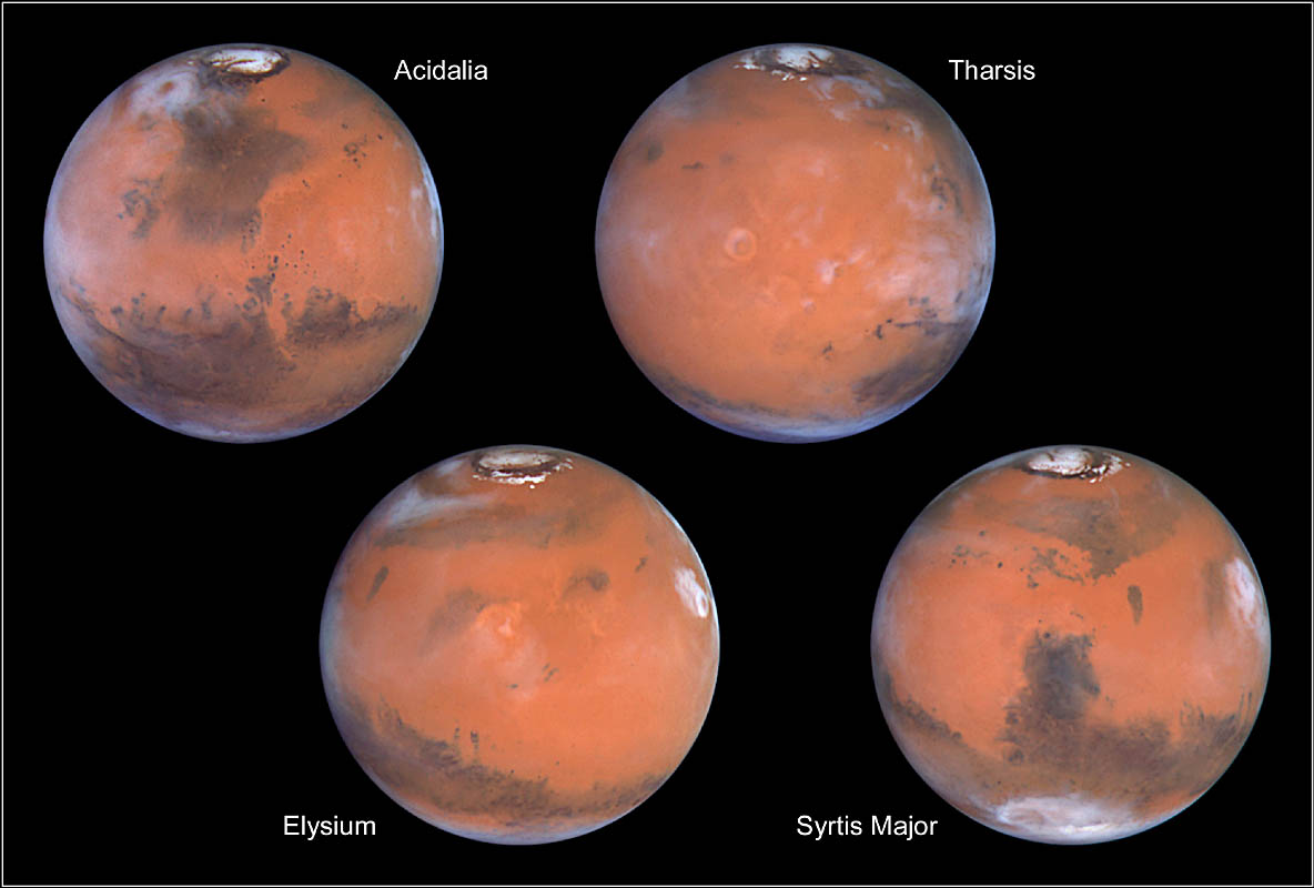
Today's Mars Photo of the Day is shows four views of Mars taken by the Hubble Space Telescope (HST) between April 27 and May 6 1999, when Mars was only 87 million kilometers from Earth. At that distance the telescope's Wide Field and Planetary Camera 2 was able to see features on Mars as small as 19km wide.

Each of the images shows Mars as it completes a quarter of its daily rotation, so together the images show Mars in its entirety. Each image is centered on a different region, all of which are labeled. Details on each of the photos can be found by clicking on the image. Doing so will direct you to the official caption from NASA.

NSSDC Photo Gallery Mars

Mars Photo of the Day - Dec 3 2011

Today's Image of Mars is actually a map of the Tharsis Quadrangle, which covers the area from 90° to 135° west longitude and 0° to 30° north latitude on Mars. Tharsis Quadrangle is home to numerous large volcanoes, including the largest in our solar system, Olympus Mons.

It is thought that at one time the volcanoes in Tharsis Quadrangle had a large impact on the Martian climate. A large amount of carbon dioxide and water vapor was released into the air from the volcanoes in the Tharsis Quadrangle. Estimates show the amount of gas emitted by the volcanoes in the Tharsis Quadrangle would have been enough to produce an atmosphere thicker than Earth's. Additionally, the water vapor released from these volcanoes would have been enough to cover all of Mars in 120 meters of water. The volcanoes in Tharsis Quadrangle lead many experts to believe that Mars once had an atmosphere thicker than Earth's and that it was once a warm and wet planet.

This Tharsis Quadrangle map is one of 30 quadrangle maps used by United States Geological Survey (USGS) Astrogeology Research Program to catalogue Mars. Clicking on this image will take you to a list of maps produced by the USGS for Mars. From there you can open many of the maps of Mars produced by the USGS.

USGS Astrogeology Research Program