Google+ Mars Travel: Cerberus Region
Showing posts with label Cerberus Region. Show all posts

Mars Photo of the Day - Jan 4 2012

Today's Image of Mars shows a small floral-shaped volcano in Cerberus Fossae.You can see the flows because they are darker than the surrounding terrain and radiate away from the opening, forming a flower shape. The volcano lies at the flank of a larger one of the Cerberus Tholi.

To the right you can see this volcanoes only vent. You will also notice that there are a few small crater superimposed over the lava flows, which indicates that this feature is "not entirely young." (HiRISE)

Cerberus Fossae is a series of roughly parallel fissures created by faults which pulled the Martian crust apart in the Cerberus region, which is located at around 9°N, 197°W. These faults are the result of the formation of the Elysium Volcanic Field. They pass through preexisting features, like hills, which indicates that the faults are relatively recent.

Clicking on this image will take you to a captioned sub-image of this from HiRISE.


Mars Photo of the Day - Dec 27 2011

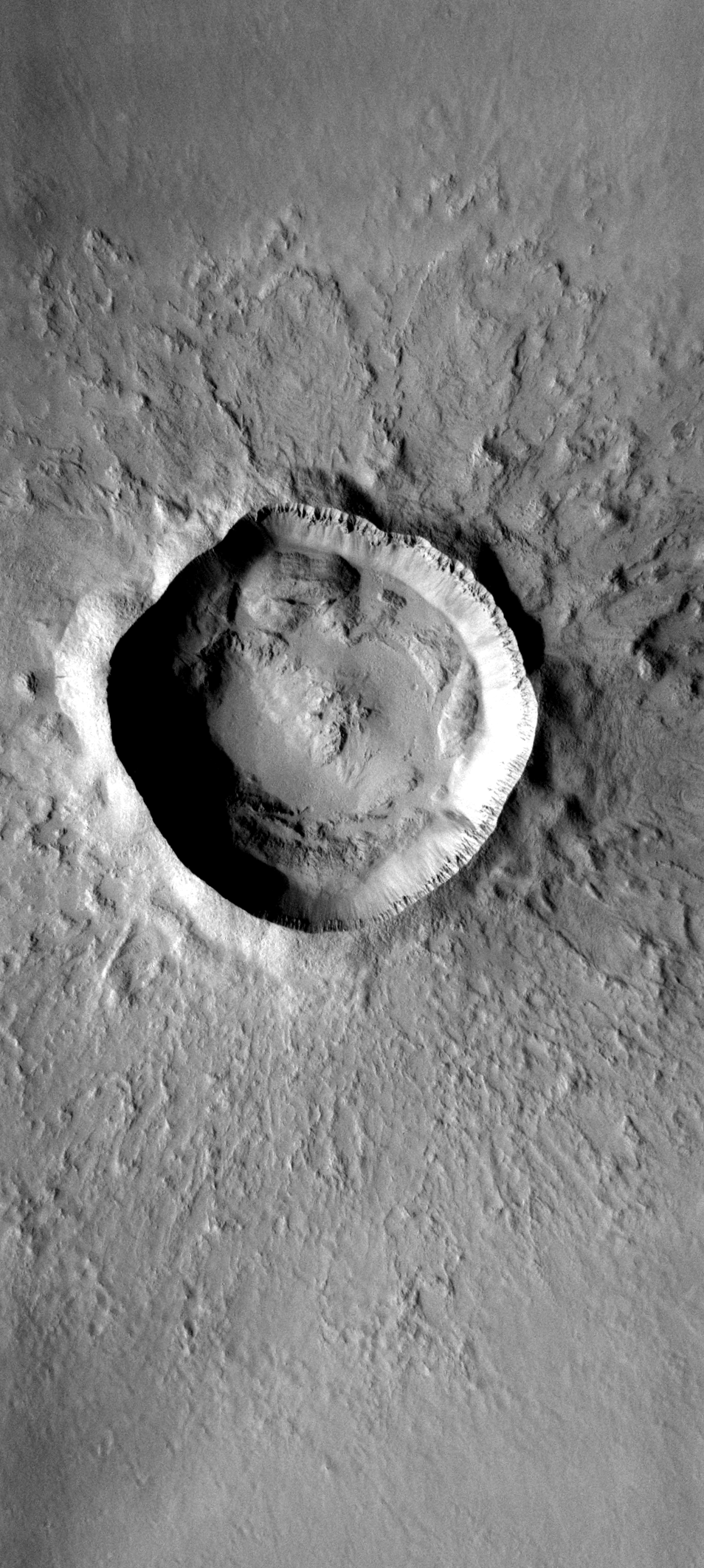
Today's Image of Mars shows Zunil Crater, located in Mars' Cerberus Plains, the youngest (least cratered) large lava plain on Mars. This 10km in diameter crater was created just a few million years ago. The impact is thought to have created 10 million secondary craters measuring 10m in diameter or larger. These secondary craters reach as far as 1600km.

It is thought that the Zunil impact crater could be the source of many shergottites, or meteorites from Mars that fall to Earth. Shergottites from two different periods (1.5 and 2.7 million years ago) are known to exist.

This image was taken by Mars Odyssey Orbiter's THEMIS camera. Clicking on the image will take you to the original THEMIS page.


Mars Photo of the Day - Oct 14 2011

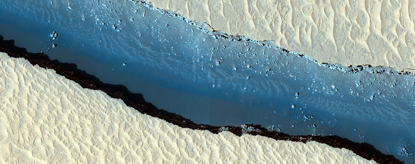
Today's Image of Mars shows what is possibly the newest part of Cerberus Fossae. And what exactly is Cerberus Fossae? 

Cerberus Fossae is a series of roughly parallel fissures created by faults which pulled the Martian crust apart in the Cerberus region, which is located at around 9°N, 197°W. These faults are the result of the formation of the Elysium Volcanic Field. They pass through preexisting features, like hills, which indicates that the faults are relatively recent.

Research suggests that the formation of these fossae released massive amounts of pressurized underground water, which led to the creation of Athabasca Valles, a large outflow channel on Mars.

Clicking on this photo of Mars will take you to the original HiRISE image, but they have yet to provide a caption.