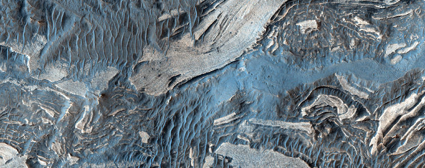
Today's Image of Mars is of faults in Ius Chasma, one of many deep depressions in Valles Marineris, the solar system's largest known canyon. Ius Chasma is about 900km long and 8-10km deep. The chasma is divided by an east-west ridge called Geryon Montes.
The floor of Ius Chasma is comprised of layered deposits, but due to excessive faulting the deposits have become jumbled. The dark spots you see in this image are the result of ejecta from impacts. They have exposed a layer underlying the lighter surface area. Scientists speculate that the darker layer being exposed is basalt.
If you look closely you can also see many linear dunes, which are prominent all throughout Ius Chasma. These dunes have a north-south orientation, which is indicative of prevailing westerly winds through the canyon.
Clicking on this image will take you to the original captioned image from HiRISE.

If you like the HiRISE images showcased in the Mars Photo of the Day posts I encourage you to enter for a free 2012 HiRISE Calendar